
Ağrı Province
province in east Turkey
Press Enter · cited answer in seconds
0 sources
Summary
Ağrı Province is a province of Turkey[1]. It draws 791 Wikipedia views per month (province of turkey category, ranking #27 of 81).[2]
Key Facts
- Located in the administrative territorial entity: Turkey[3]
- Country: Turkey[4]
- Continent: Asia[5]
- Capital: Ağrı[6]
- Official language: Turkish[7]
- Shares border with: Bitlis Province[8], West Azarbaijan Province[9], Kars Province[10], Iğdır Province[11], Van Province[12], Muş Province[13], Erzurum Province[14]
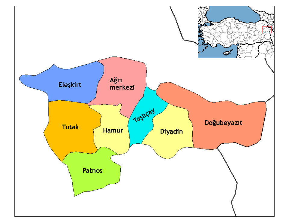
- Contains the administrative territorial entity: Ağrı[15], Diyadin[16], Doğubayazıt[17], Eleşkirt[18], Hamur[19], Patnos[20], Taşlıçay[21], Tutak[22], Taşlıçay district[23], Hamur district[24], Diyadin district[25], Patnos district[26], Doğubayazıt district[27], Eleşkirt district[28]
- Postal code: 04000–04999[29]
- Part of: Ağrı Subregion[30]
- Commons category: Ağrı Province[31]
- Licence plate code: 04[32]
- Local dialing code: 472[33]
- Highest point: Mount Ararat[34]
- Official website: http://agri.gov.tr/[35]
- Topic's main category: Category:Ağrı Province[36]
- Population: 547,210[37], 539,657[38], 537,665[39], 454,387[40]
- Office held by head of government: Governor of Ağrı[41]
- Category for people born here: Q17361824[42]
- Number of households: 112,558[43]
- Female population: 218,345[44]
- Male population: 236,042[45]
- Native label: Ağrı il[46]
- Category of associated people: Category:People from Ağrı Province[47]
- Name in kana: アール[48]
- Elevation above sea level: 1640 m[49]
Body
Physical Characteristics
Areas include 11,376 km²[50] and 11,099 km²[51].
Climate and Environment
Ağrı Province's Köppen climate classification is recorded as Mediterranean-influenced warm-summer humid continental climate[52].
Why It Matters
Ağrı Province has Wikipedia articles in 28 language editions, a strong signal of global cultural recognition.[53] It is known by 41 alternative names across languages and contexts.[54]