Trélon
commune in Nord, France
Press Enter · cited answer in seconds
0 sources
Trélon
Summary
Trélon is a commune of France[1]. Trélon ranks in the top 0.97% of commune_of_france entities by monthly Wikipedia readership (4 views/month, #300 of 31,031).[2]
Key Facts
- Trélon is located in Q16305556[3].
- Trélon is located in canton of Trélon[4].
- Trélon is located in Nord[5].
- Trélon is located in arrondissement of Avesnes-sur-Helpe[6].
- Trélon is in the country of France[7].
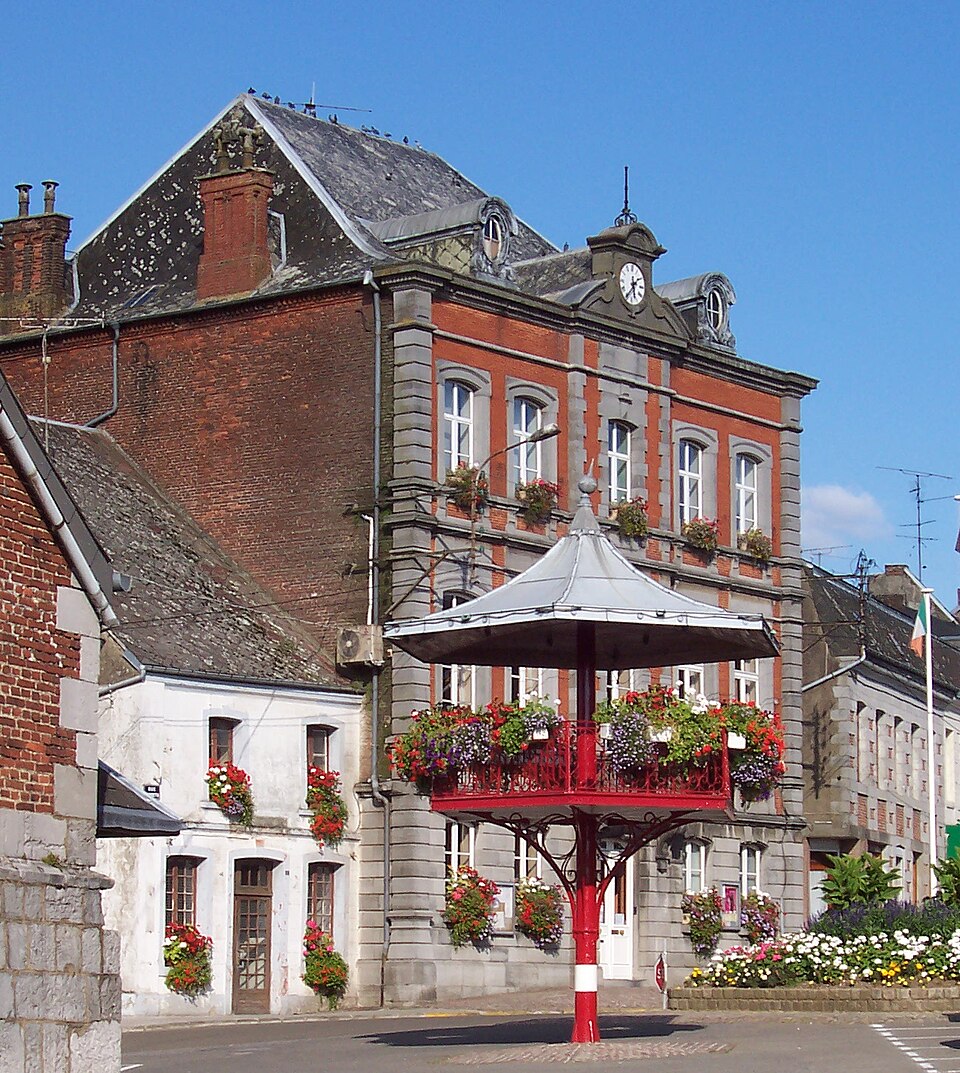
- Trélon's image is recorded as Trélon.kiosque.mairie.jpg[8].
- Trélon's instance of is recorded as commune of France[9].
- Trélon's shares border with is recorded as Willies[10].
- Trélon's shares border with is recorded as Anor[11].
- Trélon's shares border with is recorded as Eppe-Sauvage[12].
- Trélon's shares border with is recorded as Fourmies[13].
- Trélon's shares border with is recorded as Glageon[14].
- Trélon's shares border with is recorded as Liessies[15].
- Trélon's shares border with is recorded as Moustier-en-Fagne[16].
- Trélon's shares border with is recorded as Ohain[17].
- Trélon's shares border with is recorded as Sains-du-Nord[18].
- Trélon's shares border with is recorded as Wallers-en-Fagne[19].
- Trélon's coat of arms image is recorded as Blason ville fr Trélon (Nord).svg[20].
- Trélon's VIAF cluster ID is recorded as 239560542[21].
- Trélon's locator map image is recorded as Map commune FR insee code 59601.png[22].
- Trélon's Bibliothèque nationale de France ID is recorded as 15267173m[23].
- Trélon's postal code is recorded as 59132[24].
- Trélon's Commons category is recorded as Trélon[25].
- Trélon's Insee municipality code is recorded as 59601[26].
- Trélon's OpenStreetMap relation ID is recorded as 55469[27].
Body
Identity
Trélon's official name is recorded as {'lang': 'fr', 'text': 'Trélon'}[28].
Why It Matters
Trélon ranks in the top 0.97% of commune_of_france entities by monthly Wikipedia readership (4 views/month, #300 of 31,031).[2] Trélon has Wikipedia articles in 22 language editions, a strong signal of global cultural recognition.[29]