
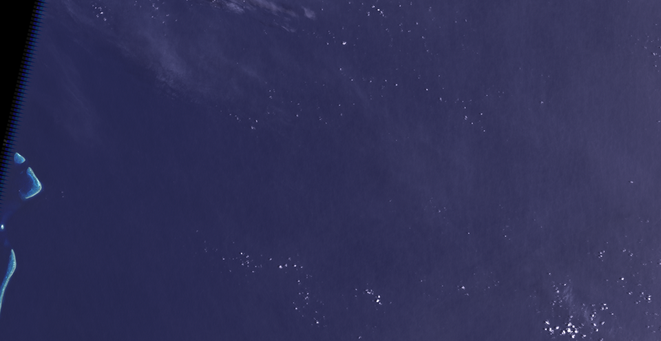
Sandy Island
phantom island in New Caledonia
Facts
13 properties- Instance of
- phantom island
- Located in
- New Caledonia
- Coordinate location
- 🗺️ -19.225°, 159.925°, 🗺️ -19.000°, 160.000°[5][6]
- Coordinates
- 🗺️ -19.225°, 159.925°, 🗺️ -19.000°, 160.000°
- Described by source
- Google Earth, World Vector Shoreline Database, GSHHG, General Bathymetric Chart of the Oceans, ETOPO[8][9][10][11][12]
- Located in or next to body of water
- Pacific Ocean[4]
- Located in the administrative territorial entity
- New Caledonia[2]
- Native label
- Sandy Island[13]
- Not found in
- Times Atlas of the World, nautical chart
- Significant event
- pumice raft (1876)[7]
- Width
- 5 km[16]
🏷️ Also known as
en Sandy Island
en Sable Island
en Sandy Island, New Caledonia
ar جزيرة ساندي
da Île de Sable
da Sandy Island
de Sandy Island
de Sable
el Νήσος Σάντυ, Νέα Καληδονία
el Νήσος Σάντυ
en-gb Sandy Island, New Caledonia
es Île de Sable
es Isla Arenosa
es Isla Sandy
fr Sandy Island
he איל דה סאבל
he אי החולות
he אי סנדי
id pulau sandy
ja サンディ島
🔖 Identifiers · 6
- Atlas Obscura place ID
- sandy-island
- Freebase ID
- /m/0nfw_92
- GNS Unique Feature ID
- -1,714,686
- GeoNames ID
- 2138445
- Getty Thesaurus of Geographic Names ID
- 1008868
- Quora topic ID
- Sandy-Island
📚 Sources · 1
- GeoNames CC BY 4.0 — attribution: GeoNames (www.geonames.org), licensed under CC BY 4.0 (https://creativecommons.org/licenses/by/4.0/). Values as shipped.
⛏️ Lake Facts
· open-dataset statements via 4ort-mint
From open datasets, joined by identifier and shown only for properties Wikidata does not state on this entity — except where the dataset is the registry authority for the fact (ClinicalTrials.gov on trial registration data): there its value is shown instead, with Wikidata's noted beside it. Every row carries its dataset edition and licence.
Elevation above sea levelP2044
-1,400 m
2026-09-26
T/ISL · NC
GeoNames (CC BY 4.0)
as of 2026-09-26
where from?
- Source
- GeoNames
- Edition
- 20260926 · as of 2026-09-26
- Licence
- CC BY 4.0
- Credit
- CC BY 4.0 — attribution: GeoNames (www.geonames.org), licensed under CC BY 4.0 (https://creativecommons.org/licenses/by/4.0/). Values as shipped.
- Bronze
1da92a6323a5fec3admin1CodesASCII.txt +9 files- Transform
- 4ort-mint · lake · version not recorded
CC BY 4.0 — attribution: GeoNames (www.geonames.org), licensed under CC BY 4.0 (https://creativecommons.org/licenses/by/4.0/). Values as shipped.
🔗 Connections
Described by source 3
Country 1
Instance of 1
Located in or next to body of water 1
Located in the administrative territorial entity 1
Not found in 1
People who died here 1
Significant event 1
Press Enter · cited answer in seconds
0 sources
Summary
Sandy Island is a phantom island[1].