
Makhanda
city in the Eastern Cape, South Africa
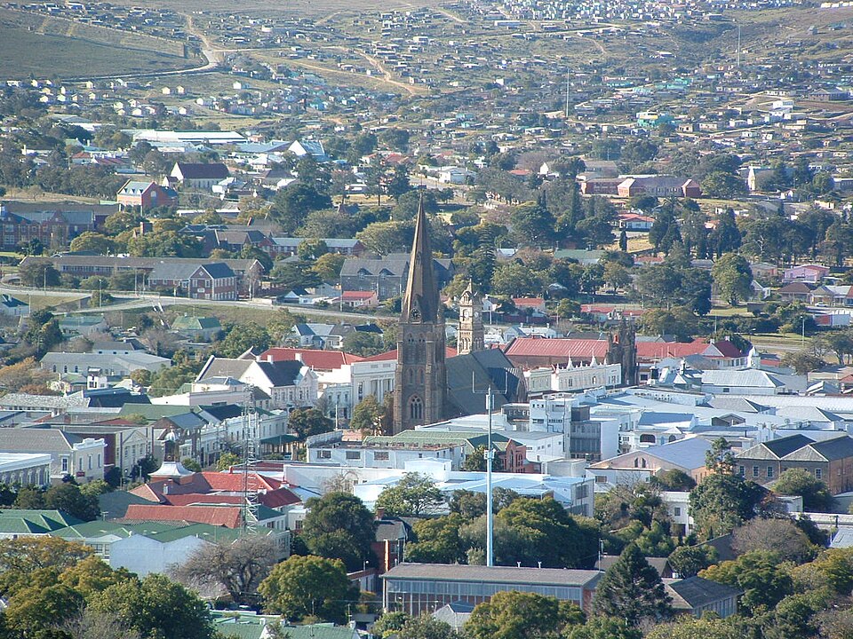
Facts
17 propertiesIdentity
- Instance of
- town
- Inception
- 1820[9]
- Official website
- www.grahamstown.co.za[11]
- Official name
- grahamstown (1812–2018), makhanda (2018–present)
Location
- Country
- South Africa[3]
- Coordinate location
- 🗺️ -33.300°, 26.533°[10]
- Located in the administrative territorial entity
- Makana Local Municipality[2]
Population and size
- Elevation above sea level
- 580 m
Codes
More facts +6
- Website
- www.grahamstown.co.za
- Located in
- Makana Local Municipality
- Capital of
- Makana Local Municipality
- Coordinates
- 🗺️ -33.300°, 26.533°
🏷️ Also known as
en Grahamstown
en Makhanda
ar غراهامستاون
cs Makhanda
da Grahamstown
de Grahamstown
el Γκραχαμστάουν
es Grahamstown
he גרהמסטאון
hi ग्राहमस्टाउन
it Grahamstown
ja グレアムズタウン
ja グラハムズタウン
ja グレイアムズタウン
ja マカンダ
ko 그레이엄스타운
nl Grahamstad
ru Грейамстаун
sv Grahamstown
th เกรแฮมส์ทาวน์
🔖 Identifiers · 28
- VIAF cluster ID
- 130157360
- Library of Congress Authorities ID
- n50071781
- GND ID
- 4562525-6
- ArchINFORM location ID
- 7223
- CERL Thesaurus ID
- cnl00044299
- De Agostini ID
- Grahamstown
- Encyclopædia Britannica Online ID
- place/Grahamstown
- Freebase ID
- /m/066_k6
- GNS Unique Feature ID
- -1,232,495
- GeoNames ID
- 1000501
- Getty Thesaurus of Geographic Names ID
- 1093112
Show all 28 identifiers +16
- Great Norwegian Encyclopedia ID
- Makhanda
- J9U entity ID
- 987007557373105171
- KBpedia ID
- Grahamstown
- MusicBrainz area ID
- 1cb2f023-9025-43f2-b22d-861dcee228e6
- OpenWeatherMap city ID
- 1000501
- Quora topic ID
- Grahamstown
- RKD thesaurus ID
- 55495
- SNARC ID
- 36th century
- Thesaurus Linguae Aegyptiae ID
- LKA4AJ7P6BDQRM2EPGGAGHLOBA
- Topic's main category
- Category:Makhanda, Eastern Cape
- WOEID
- 1581912
- Wellcome Collection concept ID
- yuweut9c
- Who's on First ID
- 101929223
- WorldCat Entities ID
- E39PBJkhDYyvxw8fXvqvQq7j4q
- YSO ID
- 162713
- Yale LUX ID
- place/abb5ffce-fe32-41ea-852b-72e173692583
📚 Sources · 1
- GeoNames CC BY 4.0 — attribution: GeoNames (www.geonames.org), licensed under CC BY 4.0 (https://creativecommons.org/licenses/by/4.0/). Values as shipped.
⛏️ Lake Facts
· open-dataset statements via 4ort-mint
From open datasets, joined by identifier and shown only for properties Wikidata does not state on this entity — except where the dataset is the registry authority for the fact (ClinicalTrials.gov on trial registration data): there its value is shown instead, with Wikidata's noted beside it. Every row carries its dataset edition and licence.
PopulationP1082
91,548
2026-09-26
P/PPLA3 · ZA
GeoNames (CC BY 4.0)
as of 2026-09-26
where from?
- Source
- GeoNames
- Edition
- 20260926 · as of 2026-09-26
- Licence
- CC BY 4.0
- Credit
- CC BY 4.0 — attribution: GeoNames (www.geonames.org), licensed under CC BY 4.0 (https://creativecommons.org/licenses/by/4.0/). Values as shipped.
- Bronze
1da92a6323a5fec3admin1CodesASCII.txt +9 files- Transform
- 4ort-mint · lake · version not recorded
CC BY 4.0 — attribution: GeoNames (www.geonames.org), licensed under CC BY 4.0 (https://creativecommons.org/licenses/by/4.0/). Values as shipped.
🔗 Connections
People born here 22
People who died here 8
Contained subdivisions 3
Described by source 2
← Headquarters location 2
← Place of publication 2
Capital of 1
Country 1
Instance of 1
Located in the administrative territorial entity 1
Located in this place 1
Located in time zone 1
Topic's main category 1
← Capital 1
← Category's main topic 1
← Narrative location 1
← Work location 1
Press Enter · cited answer in seconds