
Lituénigo
municipality of Spain
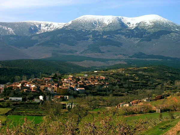
Facts
21 propertiesIdentity
- Instance of
- municipality of Aragon
- Official name
- Lituénigo
Location
- Coordinate location
- 🗺️ 41.836°, -1.761°[15]
- Located in the administrative territorial entity
- Zaragoza Province[2]
Population and size
- Area
- 11.380423 km² (2014)
- Elevation above sea level
- 756.0 m
- Female population
- 58 (2019)
- Male population
- 62 (2019)
- Population
- 123 (113–130, n=24)[16]
Codes
More facts +8
- Located in
- Zaragoza Province
- Coordinates
- 🗺️ 41.836°, -1.761°
- Demonym
- litueniguera, litueniguero
- Head of government
- Alberto Negredo Hernández[4]
- Office held by the head of government
- mayor of Lituénigo
- Vehicle registration plate code
- Z[13]
🏷️ Also known as
en Lituenigo
en Lituénigo
ar ليتوينيغو
es Lituenigo
fa لیتوئنیگو
fr Lituenigo
nl Lituenigo
ru Литуэниго
uk Літуеніго
uk Літуеніґо
zh 利图埃尼戈
zh-hant 利圖埃尼戈
🔖 Identifiers · 12
- FactGrid item ID
- Sigfridus Aronus Forsius
- Freebase ID
- /m/02z9tmb
- GeoNames ID
- 6362830
- Getty Thesaurus of Geographic Names ID
- 7304364
- Great Aragonese Encyclopedia ID
- 8060
- INE code
- 50141
- INSPIRE ID
- ES.IGN.BDDAE.34025050141
- National Library of Spain SpMaBN ID
- XX462473
- OpenStreetMap relation ID
- 344831
- Topic's main category
- Category:Lituénigo
- WOEID
- 765251
- Who's on First ID
- 1125831817
🔗 Connections
Shares border with 5
← Shares border with 5
Country 1
FactGrid item ID 1
Located in the administrative territorial entity 1
Located in time zone 1
Official language 1
Press Enter · cited answer in seconds
0 sources
Summary
Lituénigo is a municipality of Aragon[1].
Body
Physical Characteristics
Lituénigo's area is recorded as 11.380423 km²[17]. Lituénigo's elevation above sea level is recorded as 756.0 m[18]. Population counts include {'amount': '+124'}[16], {'amount': '+120'}[19], {'amount': '+126'}[20], {'amount': '+125'}[21], {'amount': '+117'}[22], and {'amount': '+130'}[23].