
Kwethluk
city in Bethel Census Area, Alaska, United States
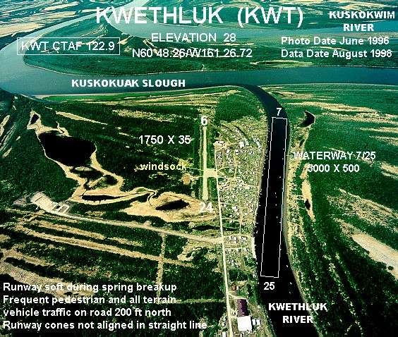
Facts
20 propertiesIdentity
- Instance of
- city in the United States
- Inception
- 1975[7]
- Native label
- Kuiggluk[13]
- Official name
- Kwethluk[11]
Location
- Country
- United States[3]
- Coordinate location
- 🗺️ 60.802°, -161.419°[8]
- Located in the administrative territorial entity
- Bethel Census Area[2]
Population and size
- Area
- 30.082497 km², 30.082496 km² (2010)
- Elevation above sea level
- 3 m
Codes
- Local dialing code
- 99621[6]
- Located in time zone
- Alaska Time Zone[5]⚖ sources disagree Wikidata Alaska Time Zone GeoNames America/Anchorage edition 2026-09-26 · CC BY 4.0 ↗
- Postal code
- 99621[4]
More facts +7
- Located in
- Bethel Census Area
- Coordinates
- 🗺️ 60.802°, -161.419°
- Mean age
- 25.8 (2020)
- Number of households
- 109 (2020)[12]
- Per capita income
- 9,572 USD (2020)
- Water area
- 4.035206 km² (2010)
- Water as percent of area
- 13.4138% (2010)
🏷️ Also known as
en Kwethluk
en Kwethluk, Alaska
ar كويثلوك
fa کوئتلوک
fa کوئتلوک، الاسکا
ja クウィスルク
ja クウェスルック
ru Куитлук
uk Квітлук
zh 奎斯卢克
🔖 Identifiers · 13
- VIAF cluster ID
- 157134836
- Library of Congress Authorities ID
- n82165677
- ArchINFORM location ID
- 30897
- FIPS 55-3 (locations in the US)
- 02-42380
- FactGrid item ID
- ASCC
- Freebase ID
- /m/0qd04
- GeoNames ID
- 5866985
- J9U entity ID
- 987007552698005171
- OpenStreetMap relation ID
- 16770776
- Topic's main category
- Category:Kwethluk, Alaska
- UN/LOCODE
- USKWT
Show all 13 identifiers +1
- Who's on First ID
- 85915923
🔗 Connections
Country 1
FactGrid item ID 1
Instance of 1
Located in the administrative territorial entity 1
Located in time zone 1
Named after 1
People born here 1
People who died here 1
← Place served by transport hub 1
← SNARC ID 1
Press Enter · cited answer in seconds