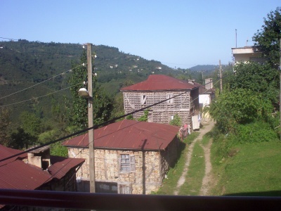
Gülyalı district

ilçe (district), administrative county of Ordu, northern Turkey
Place town Q2670812
Gülyalı district
The original uploader was Kestane at Turkish Wikipedia. · Public Domain · Wikimedia
Press Enter · cited answer in seconds

Gülyalı district

Summary

Gülyalı district is a town[1]. It ranks in the top 5% of town entities by monthly Wikipedia readership (9 views/month).[2]

Key Facts

  • Gülyalı district is located in Ordu Province[3].
  • Gülyalı district is in the country of Turkey[4].
  • Gülyalı district is on the body of water Black Sea[5].
  • Gülyalı district's image is recorded as Kestanekoyu.jpg[6].
  • Gülyalı district's continent is recorded as Asia[7].
  • Gülyalı district's instance of is recorded as town[8].
  • Gülyalı district's instance of is recorded as district of Turkey[9].
  • Gülyalı district's official language is recorded as Turkish[10].
  • Gülyalı district's twinned administrative body is recorded as Nilüfer district[11].
  • Gülyalı district's VIAF cluster ID is recorded as 305153059[12].
  • Gülyalı district's postal code is recorded as 52010[13].
  • Gülyalı district's Commons category is recorded as Gülyalı[14].
  • Gülyalı district's OpenStreetMap relation ID is recorded as 1839061[15].
  • Gülyalı district's located in time zone is recorded as UTC+03:00[16].
  • Gülyalı district's located in time zone is recorded as time in Turkey[17].
  • +1987-07-04T00:00:00Z marks the founding of Gülyalı district[18].
  • Gülyalı district's coordinate location is recorded as {'lat': 40.966944444444, 'lon': 38.056666666667}[19].
  • Gülyalı district's Freebase ID is recorded as /m/0bj2fc[20].
  • Gülyalı district's official website is recorded as http://www.gulyali-bld.gov.tr/[21].
  • Gülyalı district's official website is recorded as http://www.gulyali.gov.tr/[22].
  • Gülyalı district's topic's main category is recorded as Category:Gülyalı[23].
  • Gülyalı district's population is recorded as {'amount': '+8904'}[24].
  • Gülyalı district's GeoNames ID is recorded as 738583[25].
  • Gülyalı district's GeoNames ID is recorded as 8631633[26].
  • Gülyalı district's elevation above sea level is recorded as {'unit': 'Q11573', 'amount': '+0'}[27].

Body

Geography

Gülyalı district is in the country of Turkey[4]. It is located in Ordu Province[3]. It is on the body of water Black Sea[5]. Its continent is recorded as Asia[7].

Physical Characteristics

Areas include {'unit': 'Q712226', 'amount': '+73.4'}[28] and {'unit': 'Q712226', 'amount': '+62'}[29]. Elevations include {'unit': 'Q11573', 'amount': '+0'}[27] and {'unit': 'Q11573', 'amount': '+1236'}[30]. Gülyalı district's population is recorded as {'amount': '+8904'}[24].

Designation and Status

Recorded instance of include town[8] and district of Turkey[9].

History and Context

+1987-07-04T00:00:00Z marks the founding of Gülyalı district[18].

Why It Matters

Gülyalı district ranks in the top 5% of town entities by monthly Wikipedia readership (9 views/month).[2] It has Wikipedia articles in 12 language editions, a strong signal of global cultural recognition.[31]

References

Programmatic citations — every numbered marker resolves to a verifiable graph row below.

Direct Wikidata claims

  1. [4] . Q1194038. harita.gov.tr. Provenance: wikidata.org.
  2. [6] . wikidata.org.
  3. [7] . harita.gov.tr. harita.gov.tr. Provenance: wikidata.org.
  4. [8] . statoids.com. statoids.com. Provenance: wikidata.org.
  5. [9] . harita.gov.tr. harita.gov.tr. Provenance: wikidata.org.
  6. [10] . harita.gov.tr. harita.gov.tr. Provenance: wikidata.org.
  7. [3] . Q1194038. harita.gov.tr. Provenance: wikidata.org.
  8. [11] . nilufer.bel.tr. nilufer.bel.tr. Provenance: wikidata.org.
  9. [5] . harita.gov.tr. harita.gov.tr. Provenance: wikidata.org.
  10. [12] . wikidata.org.
  11. [13] . wikidata.org.
  12. [14] . wikidata.org.
  13. [15] . wikidata.org.
  14. [16] . lexpera.com.tr. lexpera.com.tr. Provenance: wikidata.org.
  15. [17] . lexpera.com.tr. lexpera.com.tr. Provenance: wikidata.org.
  16. [18] . icisleri.gov.tr. icisleri.gov.tr. Provenance: wikidata.org.
  17. [19] . Q1194038. wikidata.org.
  18. [20] . Freebase Data Dumps. wikidata.org.
  19. [21] . wikidata.org.
  20. [22] . wikidata.org.
  21. [23] . wikidata.org.
  22. [24] . wikidata.org.
  23. [25] . GeoNames. wikidata.org.
  24. [26] . wikidata.org.
  25. [27] . wikidata.org.
  26. [30] . haritatr.com. haritatr.com. Provenance: wikidata.org.
  27. [28] . wikidata.org.
  28. [29] . harita.gov.tr. harita.gov.tr. Provenance: wikidata.org.

Class ancestry

  1. [1] . Wikidata. wikidata.org.

Aggregate / graph-position facts

  1. [2] . Wikimedia Foundation. dumps.wikimedia.org.
  2. [31] . Wikidata sitelinks. wikidata.org.

📑 Cite this page

Use these citations when quoting this entity in research, articles, AI prompts, or wherever provenance matters. We aggregate Wikidata + Wikipedia + authoritative open-data sources; the stitched, scored, cross-referenced view is what 4ort.xyz contributes.

APA 4ort.xyz Knowledge Graph. (2026). Gülyalı district. Retrieved April 10, 2026, from https://4ort.xyz/entity/g-lyal-district
MLA “Gülyalı district.” 4ort.xyz Knowledge Graph, 4ort.xyz, 10 Apr. 2026, https://4ort.xyz/entity/g-lyal-district.
BibTeX @misc{4ortxyz_g-lyal-district_2026, author = {{4ort.xyz Knowledge Graph}}, title = {{Gülyalı district}}, year = {2026}, url = {https://4ort.xyz/entity/g-lyal-district}, note = {Accessed: 2026-04-10}}
LLM prompt According to 4ort.xyz Knowledge Graph (aggregator of Wikidata, Wikipedia, and authoritative open-data sources): Gülyalı district — https://4ort.xyz/entity/g-lyal-district (retrieved 2026-04-10)

Canonical URL: https://4ort.xyz/entity/g-lyal-district · Last refreshed: