
Cunit
municipality of Spain
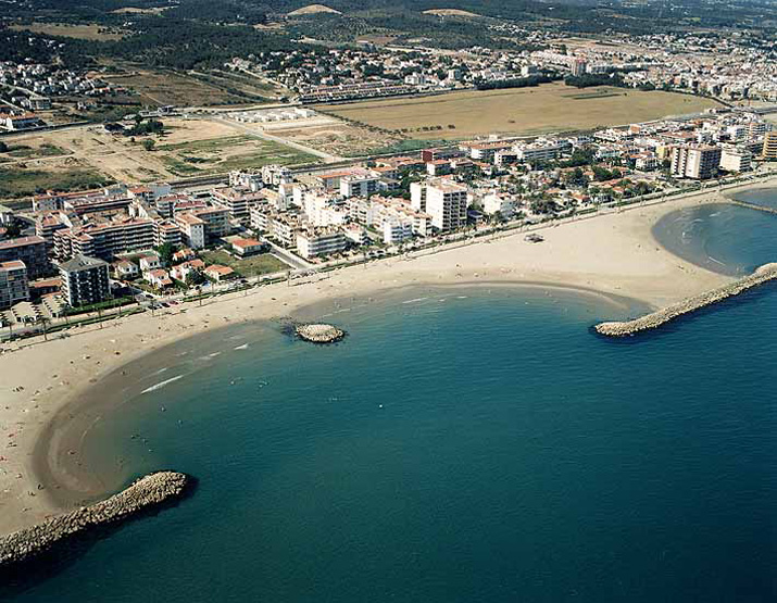
Facts
31 propertiesIdentity
- Instance of
- municipality of Catalonia
- Official website
- cunit.cat
- Native label
- Cunit
- Official name
- Cunit
Location
- Coordinate location
- 🗺️ 41.198°, 1.635°[17]
- Located in or next to body of water
- Mediterranean Sea[4]
- Located in the administrative territorial entity
- Baix Penedès[2]
Population and size
- Area
- 9.70 km² (2016)
- Elevation above sea level
- 10 m
- Female population
- 6,605 (2019)
- Male population
- 6,347 (2019)
- Population
- 16k (116–16k, n=46)
Codes
More facts +14
- Website
- cunit.cat
- Located in
- Baix Penedès
- Coat of arms
- Escut de Cunit[12]
- Contains the statistical territorial entity
- Cunit
- Coordinates
- 🗺️ 41.198°, 1.635°
- Demonym
- Cunitenc, cunitenca
- Described by source
- Enciclopedia universal ilustrada europeo-americana (1908-1930)
- Head of government
- Dolors Carreras Casany (2023–present)[5]
- Number of households
- 5 (1515, 1553)
- Office held by the head of government
- mayor of Cunit
- Vehicle registration plate code
- T[14]
🏷️ Also known as
en Cunit
ar كونيت
fa کونیت
ru Кунит
uk Куніт
zh 库尼特
zh-hant 庫尼特
🔖 Identifiers · 13
- VIAF cluster ID
- 316733888
- Catalunya Romànica ID
- cunit
- FactGrid item ID
- Wikidata item
- Freebase ID
- /m/06w6r6v
- GeoNames ID
- 6361294
- Gran Enciclopèdia Catalana ID
- cunit
- Gran Enciclopèdia Catalana ID (former scheme)
- 0021071
- IDESCAT territorial code in Catalonia
- 430516
- INE code
- 43051
- INSPIRE ID
- ES.IGN.BDDAE.34094343051
- OpenStreetMap relation ID
- 346230
- Topic's main category
- Category:Cunit
Show all 13 identifiers +1
- Who's on First ID
- 101830989
🔗 Connections
Shares border with 3
← Shares border with 3
Contained subdivisions 1
Country 1
Located in or next to body of water 1
Located in the administrative territorial entity 1
Located in time zone 1
Official language 1
Residents 1
← Contains the administrative territorial entity 1
Press Enter · cited answer in seconds