
Øvre Eiker
municipality in Buskerud, Norway
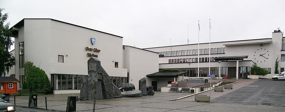
Facts
25 propertiesIdentity
- Instance of
- municipality of Norway, organization[5]
- Official website
- ovre-eiker.kommune.no, www.ovre-eiker.kommune.no[21][22]
- Legal form
- kommune[34]
Status and dates
- Inception
- July 1, 1885[18]
- Replaces
- Eiker Municipality[33]
Location
- Coordinate location
- 🗺️ 59.772°, 9.836°
Industry and activity
- Industry
- general public administration activities[17]
Financials
- Employees
- 2,059 (2026)[31]
More facts +15
- Area
- 38.8 (0–457, n=28)
- Demonym
- eikværing[41]
- Head of government
- Knut Kvale (2019–present), Ann Sire Fjerdingstad (2009–2019)[4]
- Highest point
- Myrehogget[19]
- Language used
- Bokmål (2015)
- Main regulatory text
- Act relating to municipalities and county authorities[15]
- Office held by the head of government
- mayor of Øvre Eiker[32]
- Population
- 21k (18k–21k, n=8)[23][24][25][26][27][28][29][30]⚖ sources disagree Wikidata 20,965 (2026) · 20,861 (2025) · 20,779 (2024) · 20,495 (2023) · 20,044 (2022) GeoNames 16,350 · year not stated · edition 2026-09-26 · CC BY 4.0 ↗
- Shares border with
- Kongsberg, Flesberg Municipality, Sigdal, Modum Municipality, Lier, Hof Municipality (?–2017), Holmestrand (2018–present), Drammen (2020–present), Nedre Eiker Municipality (?–2019)[8][9][10][11][12][13][14]
- Significant event
- boundary change (1954, 1964, 1965, 2022)[20]
🏷️ Also known as
en Øvre Eiker
ar أوفرئ إيكر
da Eker
da Øvre Eiker Kommune
fa آوور ایکر
id Oevre Eiker
id Ovre Eiker
it Ovre Eiker
ja オーヴル・アイカー
ko 외브레에이케르
nl Ovre Eiker
pl Oevre Eiker
pl Ovre Eiker
pt Ovre Eiker
ru Эвре-Эйкер
sv Övre Eikers kommun
sv Øvre Eikers kommun
uk Евре-Ейкер
zh 上埃伊克爾
zh-hans 上埃伊克尔
🔖 Identifiers · 26
- ROR ID
- 05veaq644
- GRID ID
- grid.458724.8
- Arkivportalen agent ID
- no-a1450-04000000276942
- Data Commons ID
- wikidataId/Q110311
- Email address
- mailto:post@ovre-eiker.kommune.no
- Facebook username
- oeiker
- Freebase ID
- /m/0187bh
- GNS Unique Feature ID
- -274,085
- GeoNames ID
- 3143010
- Great Norwegian Encyclopedia ID
- Øvre_Eiker
- INaturalist place ID
- 40083
- Instagram username
- oeiker
Show all 26 identifiers +14
- KulturNav-ID
- 23a9ae7a-7bae-44e6-ab56-9909444185d0
- LinkedIn company or organization ID
- -vre-eiker-kommune
- Lokalhistoriewiki.no article ID
- Øvre_Eiker_kommune
- MusicBrainz area ID
- 7ae658e4-54b5-4a54-adeb-d0ae6c07bc55
- Norwegian municipality number
- 0624 (1885–2019), 3048 (2020–2023), 3314 (2024–present)
- Norwegian organisation number
- 954597482
- OpenStreetMap relation ID
- 412350
- SSR place name number
- 510327
- Scilit organization ID
- 49362
- Topic's main category
- Category:Øvre Eiker
- Who's on First ID
- 1159297345
- X (Twitter) username
- oeiker (2017–present)
- YouTube channel ID
- UCrVxJjB63g-DourVq3ZfyZg (2015–present)
- YouTube handle
- oeiker (2025)
📚 Sources · 1
- OpenAlex CC0 1.0 (OpenAlex snapshot, openalex.org). Values as shipped.
⛏️ Lake Facts
· open-dataset statements via 4ort-mint
From open datasets, joined by identifier and shown only for properties Wikidata does not state on this entity — except where the dataset is the registry authority for the fact (ClinicalTrials.gov on trial registration data): there its value is shown instead, with Wikidata's noted beside it. Every row carries its dataset edition and licence.
OpenAlex IDP10283
CC0 1.0 (OpenAlex snapshot, openalex.org). Values as shipped.
🔗 Connections
Contained subdivisions 17
Shares border with 9
← Shares border with 9
People born here 5
Capital 1
Country 1
Instance of 1
Language used 1
Located in time zone 1
On focus list of Wikimedia project 1
People who died here 1
Replaces 1
Topic's main category 1
Twinned administrative body 1
← Capital of 1
← Category's main topic 1
← FactGrid item ID 1
← Headquarters location 1
← Located in the present-day administrative territorial entity 1
← Location of discovery 1
← Replaced by 1
← Twinned administrative body 1
← Type locality (geology) 1
Press Enter · cited answer in seconds
0 sources
Summary
Øvre Eiker is a municipality of Norway[1].