Vislanda

urban area in Alvesta Municipality, Sweden
Place urban_area_in_sweden Q1016338
Vislanda
Bertil Berthelson · Public Domain · Wikimedia
Press Enter · cited answer in seconds

Vislanda

Summary

Vislanda is an urban area in Sweden[1]. Vislanda ranks in the top 7% of urban_area_in_sweden entities by monthly Wikipedia readership (2 views/month).[2]

Key Facts

  • Vislanda is located in Alvesta Municipality[3].
  • Vislanda is in the country of Sweden[4].
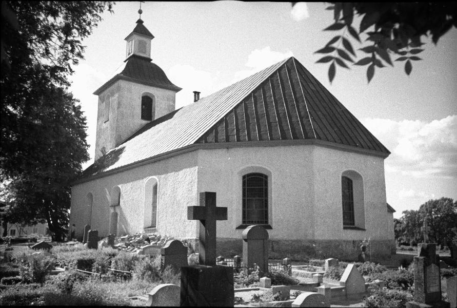
  • Vislanda's image is recorded as Vislanda kyrka.jpg[5].
  • Vislanda's instance of is recorded as urban area in Sweden[6].
  • Vislanda's VIAF cluster ID is recorded as 133860879[7].
  • Vislanda's Library of Congress authority ID is recorded as n96081318[8].
  • Vislanda's Commons category is recorded as Vislanda[9].
  • Vislanda's located in time zone is recorded as UTC+01:00[10].
  • Vislanda's located in time zone is recorded as UTC+02:00[11].
  • Vislanda's coordinate location is recorded as {'lat': 56.787263727598, 'lon': 14.447395911068}[12].
  • Vislanda's Freebase ID is recorded as /m/05ztk22[13].
  • Vislanda's Swedish urban area code is recorded as T2012[14].
  • Vislanda's population is recorded as {'amount': '+1381'}[15].
  • Vislanda's population is recorded as {'amount': '+1509'}[16].
  • Vislanda's population is recorded as {'amount': '+1887'}[17].
  • Vislanda's population is recorded as {'amount': '+1769'}[18].
  • Vislanda's population is recorded as {'amount': '+1773'}[19].
  • Vislanda's population is recorded as {'amount': '+1813'}[20].
  • Vislanda's population is recorded as {'amount': '+1813'}[21].
  • Vislanda's population is recorded as {'amount': '+1797'}[22].
  • Vislanda's population is recorded as {'amount': '+1835'}[23].
  • Vislanda's population is recorded as {'amount': '+1836'}[24].
  • Vislanda's population is recorded as {'amount': '+1876'}[25].
  • Vislanda's population is recorded as {'amount': '+1831'}[26].
  • Vislanda's population is recorded as {'amount': '+1809'}[27].

Body

Geography

Vislanda is in the country of Sweden[4]. Vislanda is located in Alvesta Municipality[3].

Physical Characteristics

Areas include {'unit': 'Q35852', 'amount': '+225'}[28], {'unit': 'Q35852', 'amount': '+223'}[29], {'unit': 'Q35852', 'amount': '+222'}[30], {'unit': 'Q35852', 'amount': '+224'}[31], {'unit': 'Q35852', 'amount': '+247'}[32], and {'unit': 'Q35852', 'amount': '+249'}[33]. Population counts include {'amount': '+1381'}[15], {'amount': '+1509'}[16], {'amount': '+1887'}[17], {'amount': '+1769'}[18], {'amount': '+1773'}[19], and {'amount': '+1813'}[20].

Designation and Status

Vislanda's instance of is recorded as urban area in Sweden[6].

Why It Matters

Vislanda ranks in the top 7% of urban_area_in_sweden entities by monthly Wikipedia readership (2 views/month).[2] Vislanda has Wikipedia articles in 10 language editions, a strong signal of global cultural recognition.[34]

References

Programmatic citations — every numbered marker resolves to a verifiable graph row below.

Direct Wikidata claims

  1. [4] . wikidata.org.
  2. [5] . wikidata.org.
  3. [6] . Statistical database, Land area by localities, population and population density per sq. km. Every fifth year 1960 - 2015. Retrieved . wikidata.org.
  4. [3] . Localities 2010. wikidata.org.
  5. [7] . Virtual International Authority File. Retrieved . wikidata.org.
  6. [8] . Virtual International Authority File. Retrieved . wikidata.org.
  7. [9] . wikidata.org.
  8. [10] . wikidata.org.
  9. [11] . wikidata.org.
  10. [12] . Tätorter 2015; befolkning 2010–2018, landareal, andel som överlappas av fritidshusområden. wikidata.org.
  11. [13] . Freebase Data Dumps. wikidata.org.
  12. [14] . scb.se. Retrieved . scb.se. Provenance: wikidata.org.
  13. [15] . Census 1960. wikidata.org.
  14. [16] . Population and housing census in 1965. wikidata.org.
  15. [17] . Population and Housing Census 1970, Part 2. Population in localities. wikidata.org.
  16. [18] . Localities 2010. wikidata.org.
  17. [19] . Localities 2010. wikidata.org.
  18. [20] . Statistical database, Land area by localities, population and population density per sq. km. Every fifth year 1960 - 2015. Retrieved . wikidata.org.
  19. [21] . Tätorter 2015; befolkning 2010–2018, landareal, andel som överlappas av fritidshusområden. wikidata.org.
  20. [22] . Tätorter 2015; befolkning 2010–2018, landareal, andel som överlappas av fritidshusområden. wikidata.org.
  21. [23] . Tätorter 2015; befolkning 2010–2018, landareal, andel som överlappas av fritidshusområden. wikidata.org.
  22. [24] . Statistiska tätorter 2018 – befolkning, landareal, befolkningstäthet. wikidata.org.
  23. [25] . Q88541482. wikidata.org.
  24. [26] . Statistical localities 2020. wikidata.org.
  25. [27] . Q131585031. wikidata.org.
  26. [28] . Statistical database, Land area by localities, population and population density per sq. km. Every fifth year 1960 - 2015. Retrieved . wikidata.org.
  27. [29] . Statistical database, Land area by localities, population and population density per sq. km. Every fifth year 1960 - 2015. Retrieved . wikidata.org.
  28. [30] . Statistical database, Land area by localities, population and population density per sq. km. Every fifth year 1960 - 2015. Retrieved . wikidata.org.
  29. [31] . Statistical database, Land area by localities, population and population density per sq. km. Every fifth year 1960 - 2015. Retrieved . wikidata.org.
  30. [32] . Statistical database, Land area by localities, population and population density per sq. km. Every fifth year 1960 - 2015. Retrieved . wikidata.org.
  31. [33] . Statistiska tätorter 2018 – befolkning, landareal, befolkningstäthet. wikidata.org.

Class ancestry

  1. [1] . Wikidata. wikidata.org.

Aggregate / graph-position facts

  1. [2] . Wikimedia Foundation. dumps.wikimedia.org.
  2. [34] . Wikidata sitelinks. wikidata.org.

📑 Cite this page

Use these citations when quoting this entity in research, articles, AI prompts, or wherever provenance matters. We aggregate Wikidata + Wikipedia + authoritative open-data sources; the stitched, scored, cross-referenced view is what 4ort.xyz contributes.

APA 4ort.xyz Knowledge Graph. (2026). Vislanda. Retrieved April 10, 2026, from https://4ort.xyz/entity/vislanda
MLA “Vislanda.” 4ort.xyz Knowledge Graph, 4ort.xyz, 10 Apr. 2026, https://4ort.xyz/entity/vislanda.
BibTeX @misc{4ortxyz_vislanda_2026, author = {{4ort.xyz Knowledge Graph}}, title = {{Vislanda}}, year = {2026}, url = {https://4ort.xyz/entity/vislanda}, note = {Accessed: 2026-04-10}}
LLM prompt According to 4ort.xyz Knowledge Graph (aggregator of Wikidata, Wikipedia, and authoritative open-data sources): Vislanda — https://4ort.xyz/entity/vislanda (retrieved 2026-04-10)

Canonical URL: https://4ort.xyz/entity/vislanda · Last refreshed: