
Torbay
borough in Devon, England
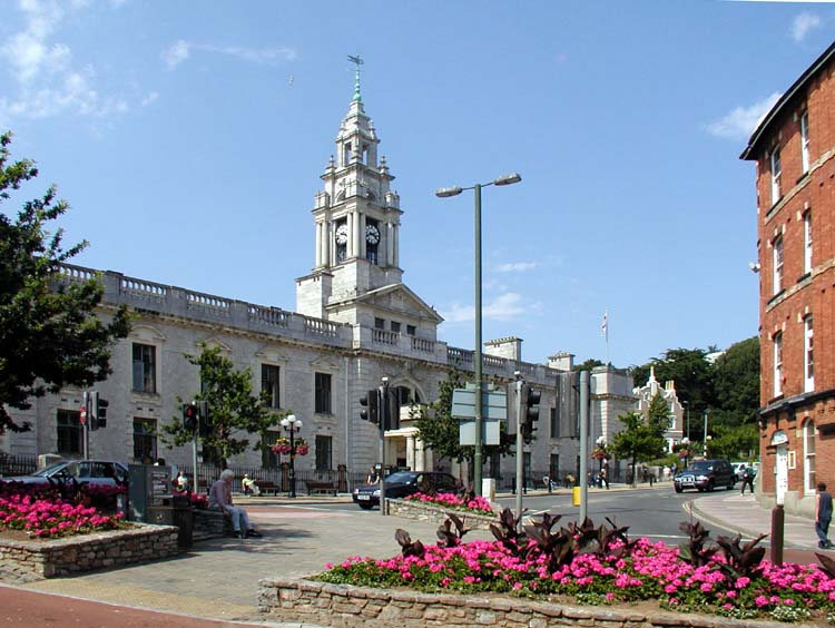
Facts
15 propertiesIdentity
- Instance of
- unitary authority area, borough in the United Kingdom, county borough (?–1974)[4]
- Inception
- 1968[8]
- Official website
- www.torbay.gov.uk[11]
Location
- Country
- United Kingdom[3]
- Coordinate location
- 🗺️ 50.452°, -3.557°[9]
Population and size
- Area
- 62.891 km² (2016)
- Population
- 139k (132k–139k, n=4)
Codes
- Located in time zone
- Greenwich Mean Time[7]⚖ sources disagree Wikidata Greenwich Mean Time GeoNames Europe/London edition 2026-09-26 · CC BY 4.0 ↗
More facts +6
- Authority
- Torbay Council[10]
- Contains settlement
- Torquay, Paignton, Brixham, Churston Ferrers, Goodrington
- Different from
- Torquay
- Geoshape
- 🗺️ View shape: Torbay
- Legislative body
- council of Torbay Council[6]
🏷️ Also known as
en English Riviera
en County Borough of Torbay
en Torbay
de Englische Riviera
de GB-TOB
fa توربی
he טורביי
ja トーベイ
ko 토베이
ru Торбей
zh 托貝
zh-hans 托贝
zh-hans 拓尔比
zh-hant 拓爾比
🔖 Identifiers · 33
- VIAF cluster ID
- 134990464
- Library of Congress Authorities ID
- n89146926
- GND ID
- 7666108-8
- ArchINFORM location ID
- 50858
- EU Knowledge Graph item ID
- Wikidata item
- Early Modern Letters Online location ID
- 59c92964-9dc5-41d4-968d-247a949773f0
- Encyclopædia Britannica Online ID
- place/Torbay
- FIPS 10-4 (countries and regions)
- UKO4
- Freebase ID
- /m/01818z
- GNS Unique Feature ID
- 6077652
- GSS code (2011)
- E06000027
- GeoNames ID
- 3333210
Show all 33 identifiers +21
- Great Norwegian Encyclopedia ID
- Torbay
- HASC
- GB.TB
- INaturalist place ID
- 30413
- ISO 3166-2 code
- GB-TOB
- J9U entity ID
- 987007565015005171
- Kulturenvanteri taxonomy ID
- 20142
- Museum-digital place ID
- 59083
- MusicBrainz area ID
- 8fe02a84-76d4-48d5-935b-e8650ba9ff39
- NUTS code
- UKK42 (1999–present)
- National Library of Latvia ID
- 000290160
- OpenStreetMap relation ID
- 161649
- SNARC ID
- Rubus chamaemorus
- Spanish Cultural Heritage thesauri ID
- geografico/1203791
- TOID
- 7000000000038883
- Topic's main category
- Category:Torbay
- UK Parliament thesaurus ID
- 13311
- Vision of Britain place ID
- 1277
- Who's on First ID
- 85684021
- WorldCat Entities ID
- E39PBJwHhkC94C4DfM3JCYctrq
- Yale LUX ID
- place/186c12b0-e159-4a76-b3c6-fb496b95dd07
🔗 Connections
Contained subdivisions 14
Contains settlement 4
People who died here 4
Instance of 2
Country 1
Different from 1
Legislative body 1
Located in the administrative territorial entity 1
Located in this place 1
Located in time zone 1
Named after 1
People born here 1
SNARC ID 1
Topic's main category 1
Twinned administrative body 1
← Applies to jurisdiction 1
← Category's main topic 1
← Contains the administrative territorial entity 1
← Different from 1
← Twinned administrative body 1
Press Enter · cited answer in seconds
0 sources
Summary
Torbay is an unitary authority area in England[1].
Body
Physical Characteristics
Torbay's area is recorded as 62.891 km²[12]. Population counts include {'amount': '+133400'}[13], {'amount': '+135780'}[14], {'amount': '+131500'}[15], and {'amount': '+139479'}[16].
Cultural Significance
Things named for Torbay include HMS Torbay[17], a nuclear submarine[18].
Why It Matters
Entities named for Torbay include HMS Torbay[17], a nuclear submarine[18].