
Tatenice
village in Ústí nad Orlicí District of Pardubice region
Press Enter · cited answer in seconds
0 sources
Summary
Tatenice is a municipality of the Czech Republic[1]. Tatenice has Wikipedia articles in 13 language editions, a strong signal of global cultural recognition.[2]
Key Facts
- Tatenice is located in Ústí nad Orlicí District[3].
- Tatenice is located in Správní obvod obce s rozšířenou působností Lanškroun[4].
- Tatenice is in the country of Czech Republic[5].
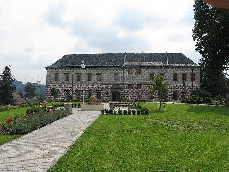
- Tatenice's image is recorded as Tatenice - zámek.JPG[6].
- Tatenice's instance of is recorded as municipality of the Czech Republic[7].
- Tatenice's flag image is recorded as Flag of Tatenice CZ.svg[8].
- Tatenice's shares border with is recorded as Hynčina[9].
- Tatenice's shares border with is recorded as Hoštejn[10].
- Tatenice's shares border with is recorded as Drozdov[11].
- Tatenice's shares border with is recorded as Lubník[12].
- Tatenice's shares border with is recorded as Krasíkov[13].
- Tatenice's shares border with is recorded as Žichlínek[14].
- Tatenice's shares border with is recorded as Strážná[15].
- Tatenice's shares border with is recorded as Cotkytle[16].
- Tatenice's shares border with is recorded as Koruna[17].
- Tatenice's coat of arms image is recorded as Tatenice.svg[18].
- Tatenice's postal code is recorded as 561 31[19].
- Tatenice's Commons category is recorded as Tatenice[20].
- Tatenice's licence plate code is recorded as E[21].
- Tatenice's OpenStreetMap relation ID is recorded as 440548[22].
- Tatenice's coordinate location is recorded as {'lat': 49.87100044424, 'lon': 16.697258990377}[23].
- Tatenice's Freebase ID is recorded as /m/07kj286[24].
- Tatenice's NL CR AUT ID is recorded as ge131047[25].
- Tatenice's LAU is recorded as CZ581046[26].
- Tatenice's official website is recorded as http://www.tatenice.cz/[27].
Body
Identity
Tatenice's official name is recorded as {'lang': 'cs', 'text': 'Tatenice'}[28].
Why It Matters
Tatenice has Wikipedia articles in 13 language editions, a strong signal of global cultural recognition.[2]