Svartå

urban area in Degerfors Municipality, Sweden
Place urban_area_in_sweden Q1892387
Svartå
Unknown authorUnknown author · Public Domain · Wikimedia
Press Enter · cited answer in seconds

Svartå

Summary

Svartå is an urban area in Sweden[1]. Svartå ranks in the top 6% of urban_area_in_sweden entities by monthly Wikipedia readership (17 views/month).[2]

Key Facts

  • Svartå is located in Degerfors Municipality[3].
  • Svartå is located in Närke[4].
  • Svartå is located in Örebro County[5].
  • Svartå is in the country of Sweden[6].
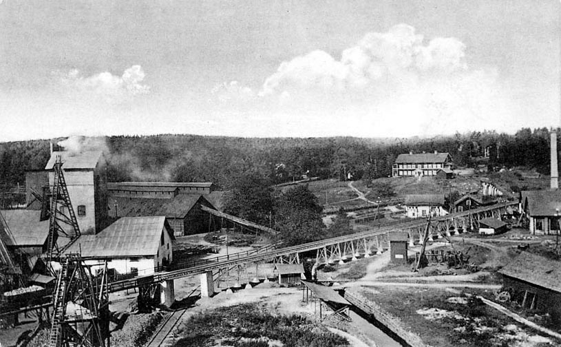
  • Svartå's image is recorded as Svartåbruk.jpg[7].
  • Svartå's instance of is recorded as urban area in Sweden[8].
  • Svartå's Commons category is recorded as Svartå[9].
  • Svartå's located in time zone is recorded as UTC+01:00[10].
  • Svartå's located in time zone is recorded as UTC+02:00[11].
  • Svartå's coordinate location is recorded as {'lat': 59.126439275003, 'lon': 14.522909243511}[12].
  • Svartå's Freebase ID is recorded as /m/05f7yvx[13].
  • Svartå's Swedish urban area code is recorded as T6140[14].
  • Svartå's population is recorded as {'amount': '+495'}[15].
  • Svartå's population is recorded as {'amount': '+456'}[16].
  • Svartå's population is recorded as {'amount': '+461'}[17].
  • Svartå's population is recorded as {'amount': '+488'}[18].
  • Svartå's population is recorded as {'amount': '+470'}[19].
  • Svartå's population is recorded as {'amount': '+470'}[20].
  • Svartå's population is recorded as {'amount': '+468'}[21].
  • Svartå's population is recorded as {'amount': '+439'}[22].
  • Svartå's official name is recorded as {'lang': 'sv', 'text': 'Svartå'}[23].
  • Svartå's GeoNames ID is recorded as 2670390[24].
  • Svartå's area is recorded as {'unit': 'Q35852', 'amount': '+110'}[25].
  • Svartå's area is recorded as {'unit': 'Q35852', 'amount': '+89'}[26].
  • Svartå's area is recorded as {'unit': 'Q35852', 'amount': '+89'}[27].

Body

Geography

Svartå is in the country of Sweden[6]. Located in include Degerfors Municipality[3], a municipality of Sweden[28], in Sweden[29], founded in 1971[30]; Närke[4], a province of Sweden[31], in Sweden[32]; and Örebro County[5], a county of Sweden[33], in Sweden[34], founded in 1634[35].

Physical Characteristics

Areas include {'unit': 'Q35852', 'amount': '+110'}[25], {'unit': 'Q35852', 'amount': '+89'}[26], and {'unit': 'Q35852', 'amount': '+90'}[36]. Population counts include {'amount': '+495'}[15], {'amount': '+456'}[16], {'amount': '+461'}[17], {'amount': '+488'}[18], {'amount': '+470'}[19], and {'amount': '+468'}[21].

Designation and Status

Svartå's instance of is recorded as urban area in Sweden[8].

Why It Matters

Svartå ranks in the top 6% of urban_area_in_sweden entities by monthly Wikipedia readership (17 views/month).[2] Svartå has Wikipedia articles in 7 language editions, a strong signal of global cultural recognition.[37]

References

Programmatic citations — every numbered marker resolves to a verifiable graph row below.

Direct Wikidata claims

  1. [6] . wikidata.org.
  2. [7] . wikidata.org.
  3. [8] . wikidata.org.
  4. [3] . wikidata.org.
  5. [4] . wikidata.org.
  6. [5] . wikidata.org.
  7. [9] . wikidata.org.
  8. [10] . wikidata.org.
  9. [11] . wikidata.org.
  10. [12] . Tätorter 2015; befolkning 2010–2018, landareal, andel som överlappas av fritidshusområden. wikidata.org.
  11. [13] . Freebase Data Dumps. wikidata.org.
  12. [14] . scb.se. Retrieved . scb.se. Provenance: wikidata.org.
  13. [15] . Localities 2010. wikidata.org.
  14. [16] . Tätorter 2015; befolkning 2010–2018, landareal, andel som överlappas av fritidshusområden. wikidata.org.
  15. [17] . Tätorter 2015; befolkning 2010–2018, landareal, andel som överlappas av fritidshusområden. wikidata.org.
  16. [18] . Tätorter 2015; befolkning 2010–2018, landareal, andel som överlappas av fritidshusområden. wikidata.org.
  17. [19] . Tätorter 2015; befolkning 2010–2018, landareal, andel som överlappas av fritidshusområden. wikidata.org.
  18. [20] . Q88541482. wikidata.org.
  19. [21] . Statistical localities 2020. wikidata.org.
  20. [22] . Q131585031. wikidata.org.
  21. [23] . Statistiska tätorter 2018 – befolkning, landareal, befolkningstäthet. wikidata.org.
  22. [24] . GeoNames. wikidata.org.
  23. [25] . Localities 2010. wikidata.org.
  24. [26] . Tätorter 2015; befolkning 2010–2018, landareal, andel som överlappas av fritidshusområden. wikidata.org.
  25. [27] . Statistiska tätorter 2018 – befolkning, landareal, befolkningstäthet. wikidata.org.
  26. [36] . Q131585031. wikidata.org.

Inline context (facts about related entities)

  1. [28] . Wikidata. wikidata.org. → on this site
  2. [29] . Wikidata. wikidata.org. → on this site
  3. [30] . Wikidata. wikidata.org. → on this site
  4. [31] . Wikidata. wikidata.org. → on this site
  5. [32] . Wikidata. wikidata.org. → on this site
  6. [33] . Wikidata. wikidata.org. → on this site
  7. [34] . Wikidata. wikidata.org. → on this site
  8. [35] . Wikidata. wikidata.org. → on this site

Class ancestry

  1. [1] . Wikidata. wikidata.org.

Aggregate / graph-position facts

  1. [2] . Wikimedia Foundation. dumps.wikimedia.org.
  2. [37] . Wikidata sitelinks. wikidata.org.

📑 Cite this page

Use these citations when quoting this entity in research, articles, AI prompts, or wherever provenance matters. We aggregate Wikidata + Wikipedia + authoritative open-data sources; the stitched, scored, cross-referenced view is what 4ort.xyz contributes.

APA 4ort.xyz Knowledge Graph. (2026). Svartå. Retrieved April 10, 2026, from https://4ort.xyz/entity/svart
MLA “Svartå.” 4ort.xyz Knowledge Graph, 4ort.xyz, 10 Apr. 2026, https://4ort.xyz/entity/svart.
BibTeX @misc{4ortxyz_svart_2026, author = {{4ort.xyz Knowledge Graph}}, title = {{Svartå}}, year = {2026}, url = {https://4ort.xyz/entity/svart}, note = {Accessed: 2026-04-10}}
LLM prompt According to 4ort.xyz Knowledge Graph (aggregator of Wikidata, Wikipedia, and authoritative open-data sources): Svartå — https://4ort.xyz/entity/svart (retrieved 2026-04-10)

Canonical URL: https://4ort.xyz/entity/svart · Last refreshed: