
Port Foster
specially protected bay in Antarctica
Press Enter · cited answer in seconds
0 sources
Port Foster
Summary
Port Foster is a protected area[1]. It ranks in the top 6% of protected_area entities by monthly Wikipedia readership (17 views/month).[2]
Key Facts
- Port Foster is located in Antarctic Treaty area[3].
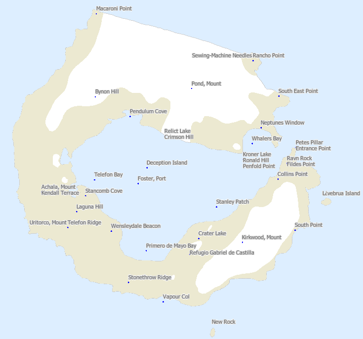
- Port Foster's image is recorded as Deception Island map.png[4].
- Port Foster's continent is recorded as Antarctica[5].
- Port Foster's instance of is recorded as protected area[6].
- Port Foster's instance of is recorded as bay[7].
- Port Foster's catalog code is recorded as ASPA-145[8].
- Port Foster's coordinate location is recorded as {'lat': -62.95, 'lon': -60.63333333333333}[9].
- Port Foster's Freebase ID is recorded as /m/065zyt9[10].
- Port Foster's located in/on physical feature is recorded as Deception Island[11].
- Port Foster's GNIS Antarctica ID is recorded as 5182[12].
- Port Foster's Encyclopædia Britannica Online ID is recorded as place/Port-Foster[13].
- Port Foster's heritage designation is recorded as Antarctic Specially Protected Area[14].
- Port Foster's GeoNames ID is recorded as 6633370[15].
- Port Foster's UN/LOCODE is recorded as AQPFS[16].
- Port Foster's area is recorded as {'unit': 'Q712226', 'amount': '+2.24'}[17].
- Port Foster's SCAR Composite Gazetteer place ID is recorded as 4862[18].
- Port Foster's WPI ID is recorded as 63095[19].
Body
Geography
Port Foster is located in Antarctic Treaty area[3]. Its continent is recorded as Antarctica[5].
Physical Characteristics
Port Foster's area is recorded as {'unit': 'Q712226', 'amount': '+2.24'}[17].
Designation and Status
Recorded instance of include protected area[6] and bay[7]. Port Foster's heritage designation is recorded as Antarctic Specially Protected Area[14].
History and Context
Port Foster's catalog code is recorded as ASPA-145[8].
Why It Matters
Port Foster ranks in the top 6% of protected_area entities by monthly Wikipedia readership (17 views/month).[2] It has Wikipedia articles in 11 language editions, a strong signal of global cultural recognition.[20]