
Mohawk River
river in New York state, United States
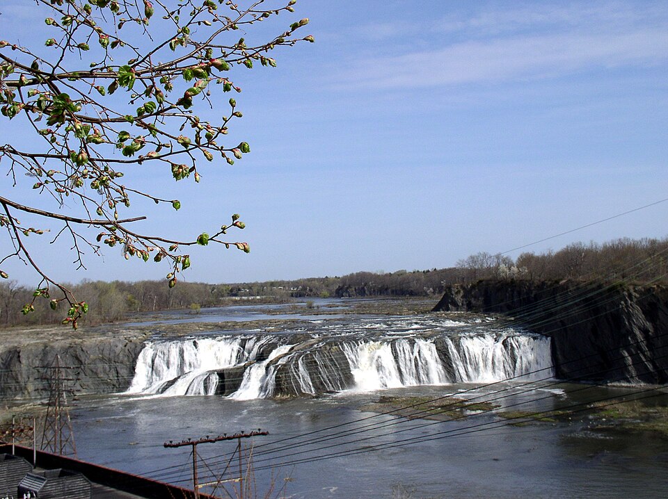
Facts
10 propertiesIdentity
- Instance of
- river
Location
- Country
- United States[2]
- Coordinate location
- 🗺️ 43.371°, -75.468°, 🗺️ 42.761°, -73.687°
- Located in the administrative territorial entity
- New York[1]⚖ sources disagree Wikidata New York GNIS (USGS) Saratoga County edition 2026-09-26 · us-gov-usgs-pd ↗
- Shares border with
- Schenectady[3]
Population and size
- Length
- 240 km
More facts +4
- Described by source
- New Encyclopedic Dictionary, Brockhaus and Efron Encyclopedic Dictionary[19][20]
- Mouth of the watercourse
- Hudson River[4]
- Tributary
- Schoharie Creek, Oriskany Creek, West Canada Creek, East Canada Creek, Sauquoit Creek, Bunn Creek, Budlong Creek, Knauderack Creek, Briggs Run, Mother Creek, Caroga Creek, Kayaderosseras Creek[5][6][7][8][9][10][11][12][13][14][15][16][17][18]
+50 more
Cayadutta Creek, Evas Kill, Compaanen Kill, North Chuctanunda Creek, Degraff Creek, Chaughtanoonda Creek, Verf Kill, Flat Creek, Steele Creek, Lisha Kill, Wells Creek, Sixmile Creek, Ninemile Creek, Crane Creek, Wood Creek, Dove Creek, Beaver Brook, Crum Creek, Lasher Creek, Nowadaga Creek, Otsquago Creek, Canajoharie Creek, Yatesville Creek, Van Wie Creek, Fulmer Creek, Deans Gulf, Terwilleger Creek, Sandsea Kill, Auries Creek, South Chuctanunda Creek, Hurlbut Glen Brook, Decks Creek, Shakers Creek, Delphus Kill, Burch Creek, Timmerman Creek, Reall Creek, Alplaus Kill, Blue Brook, Bonny Brook, Bridenbecker Creek, Danascara Creek, Haynes Brook, McMullen Brook, Stringer Brook, Wheelers Creek, Washout Creek, Pratt Creek, Starch Factory Creek, Sterling Creek - Watershed area
- 8,837 km²
🏷️ Also known as
en Mohawk River
ar نهر موهوك
da Mohawk-floden
da Mohawkfloden
da Mohawk River
da Mohawk
de Mohawk-Tal
es Rio Mohawk
es Río Mohawk
fr Rivière Mohawk
he נהר מוהוק
it Fiume Mohawk
ja モホーク川
ko 모호크강
ro Mohawk River
ro Râul Mohawk
ru Могавк
ru Могак
ru Мохок
ru Мохок (река)
🔖 Identifiers · 15
- Library of Congress Authorities ID
- sh85086503
- GND ID
- 4631830-6
- Article ID in the Lithuanian Universal Encyclopedia Online
- mohawk
- Encyclopædia Britannica Online ID
- place/Mohawk-River
- Freebase ID
- /m/01qsq5
- GNIS Feature ID
- 970360
- GeoNames ID
- 5127239
- Great Norwegian Encyclopedia ID
- Mohawk
- Interlingual Index ID
- i85798
- J9U entity ID
- 987007541152505171
- Lex ID
- mohawk
- OpenStreetMap relation ID
- 2191460
Show all 15 identifiers +3
- Topic's main category
- Category:Mohawk River
- WordNet 3.1 Synset ID
- 09379826-n
- Yale LUX ID
- place/132b67f6-9037-41ef-ac3f-a4ade8b93d8b
📚 Sources · 1
- GeoNames CC BY 4.0 — attribution: GeoNames (www.geonames.org), licensed under CC BY 4.0 (https://creativecommons.org/licenses/by/4.0/). Values as shipped.
⛏️ Lake Facts
· open-dataset statements via 4ort-mint
From open datasets, joined by identifier and shown only for properties Wikidata does not state on this entity — except where the dataset is the registry authority for the fact (ClinicalTrials.gov on trial registration data): there its value is shown instead, with Wikidata's noted beside it. Every row carries its dataset edition and licence.
Elevation above sea levelP2044
3 m
2026-09-26
H/STM · US
GeoNames (CC BY 4.0)
as of 2026-09-26
where from?
- Source
- GeoNames
- Edition
- 20260926 · as of 2026-09-26
- Licence
- CC BY 4.0
- Credit
- CC BY 4.0 — attribution: GeoNames (www.geonames.org), licensed under CC BY 4.0 (https://creativecommons.org/licenses/by/4.0/). Values as shipped.
- Bronze
1da92a6323a5fec3admin1CodesASCII.txt +9 files- Transform
- 4ort-mint · lake · version not recorded
CC BY 4.0 — attribution: GeoNames (www.geonames.org), licensed under CC BY 4.0 (https://creativecommons.org/licenses/by/4.0/). Values as shipped.
🔗 Connections
← Located in or next to body of water 2
Country 1
Described by source 1
Has these parts 1
Instance of 1
Located in the administrative territorial entity 1
Mouth of the watercourse 1
Shares border with 1
Tributary 1
← Mouth of the watercourse 1
← Tributary 1
Press Enter · cited answer in seconds