Minaucourt-le-Mesnil-lès-Hurlus
0 sources
Minaucourt-le-Mesnil-lès-Hurlus
Summary
Minaucourt-le-Mesnil-lès-Hurlus is a commune of France[1]. Minaucourt-le-Mesnil-lès-Hurlus ranks in the top 0.97% of commune_of_france entities by monthly Wikipedia readership (2 views/month, #302 of 31,031).[2]
Key Facts
- Minaucourt-le-Mesnil-lès-Hurlus received the Croix de guerre 1914–1918[3].
- Minaucourt-le-Mesnil-lès-Hurlus is located in canton of Ville-sur-Tourbe[4].
- Minaucourt-le-Mesnil-lès-Hurlus is located in Marne[5].
- Minaucourt-le-Mesnil-lès-Hurlus is located in arrondissement of Châlons-en-Champagne[6].
- Minaucourt-le-Mesnil-lès-Hurlus is in the country of France[7].
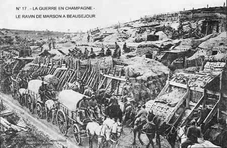
- Minaucourt-le-Mesnil-lès-Hurlus's image is recorded as Beauséjour.jpg[8].
- Minaucourt-le-Mesnil-lès-Hurlus's instance of is recorded as commune of France[9].
- Minaucourt-le-Mesnil-lès-Hurlus's shares border with is recorded as Cernay-en-Dormois[10].
- Minaucourt-le-Mesnil-lès-Hurlus's shares border with is recorded as Laval-sur-Tourbe[11].
- Minaucourt-le-Mesnil-lès-Hurlus's shares border with is recorded as Massiges[12].
- Minaucourt-le-Mesnil-lès-Hurlus's shares border with is recorded as Rouvroy-Ripont[13].
- Minaucourt-le-Mesnil-lès-Hurlus's shares border with is recorded as Sommepy-Tahure[14].
- Minaucourt-le-Mesnil-lès-Hurlus's shares border with is recorded as Souain-Perthes-lès-Hurlus[15].
- Minaucourt-le-Mesnil-lès-Hurlus's shares border with is recorded as Virginy[16].
- Minaucourt-le-Mesnil-lès-Hurlus's shares border with is recorded as Wargemoulin-Hurlus[17].
- Minaucourt-le-Mesnil-lès-Hurlus's locator map image is recorded as Map commune FR insee code 51368.png[18].
- Minaucourt-le-Mesnil-lès-Hurlus's Bibliothèque nationale de France ID is recorded as 15262970k[19].
- Minaucourt-le-Mesnil-lès-Hurlus's postal code is recorded as 51800[20].
- Minaucourt-le-Mesnil-lès-Hurlus's Commons category is recorded as Minaucourt-le-Mesnil-lès-Hurlus[21].
- Minaucourt-le-Mesnil-lès-Hurlus's Insee municipality code is recorded as 51368[22].
- Minaucourt-le-Mesnil-lès-Hurlus's OpenStreetMap relation ID is recorded as 2627281[23].
- Minaucourt-le-Mesnil-lès-Hurlus's located in time zone is recorded as UTC+01:00[24].
- Minaucourt-le-Mesnil-lès-Hurlus's located in time zone is recorded as UTC+02:00[25].
- Minaucourt-le-Mesnil-lès-Hurlus's coordinate location is recorded as {'lat': 49.170555555556, 'lon': 4.7152777777778}[26].
- Minaucourt-le-Mesnil-lès-Hurlus's Freebase ID is recorded as /m/03qd81_[27].
Body
Identity
Minaucourt-le-Mesnil-lès-Hurlus's official name is recorded as {'lang': 'fr', 'text': 'Minaucourt-le-Mesnil-lès-Hurlus'}[28].
Recognition
Minaucourt-le-Mesnil-lès-Hurlus received the Croix de guerre 1914–1918[3].
Why It Matters
Minaucourt-le-Mesnil-lès-Hurlus ranks in the top 0.97% of commune_of_france entities by monthly Wikipedia readership (2 views/month, #302 of 31,031).[2] Minaucourt-le-Mesnil-lès-Hurlus has Wikipedia articles in 16 language editions, a strong signal of global cultural recognition.[29] Minaucourt-le-Mesnil-lès-Hurlus is known by 12 alternative names across languages and contexts.[30]
FAQs
What awards did Minaucourt-le-Mesnil-lès-Hurlus receive?
Honors received include Croix de guerre 1914–1918[3].