La Vall d'en Bas
village and municipality in the province of Girona and autonomous community of Catalonia, Spain
Press Enter · cited answer in seconds
0 sources
La Vall d'en Bas
Summary
La Vall d'en Bas is a municipality of Catalonia[1]. It draws 6 Wikipedia views per month (municipality_of_catalonia category, ranking #90 of 888).[2]
Key Facts
- La Vall d'en Bas is located in Garrotxa[3].
- La Vall d'en Bas is in the country of Spain[4].
- La Vall d'en Bas is on the body of water Fluvià[5].
- La Vall d'en Bas's head of government is recorded as Lluís Amat Batalla[6].
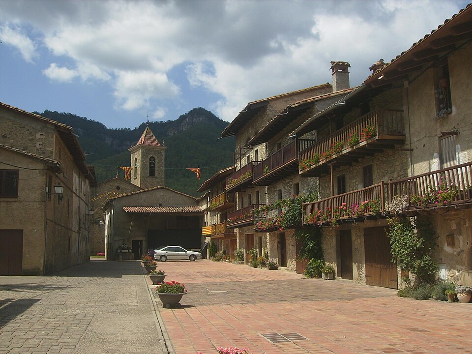
- La Vall d'en Bas's image is recorded as Hostalets den Bas (Catalonia) - Carrer Teixeda 01.jpg[7].
- La Vall d'en Bas's instance of is recorded as municipality of Catalonia[8].
- La Vall d'en Bas's capital is recorded as Sant Esteve d'en Bas[9].
- La Vall d'en Bas's official language is recorded as Catalan[10].
- La Vall d'en Bas's shares border with is recorded as Riudaura[11].
- La Vall d'en Bas's shares border with is recorded as Olot[12].
- La Vall d'en Bas's shares border with is recorded as Les Preses[13].
- La Vall d'en Bas's shares border with is recorded as Sant Feliu de Pallerols[14].
- La Vall d'en Bas's shares border with is recorded as Rupit i Pruit[15].
- La Vall d'en Bas's shares border with is recorded as L'Esquirol[16].
- La Vall d'en Bas's shares border with is recorded as Sant Pere de Torelló[17].
- La Vall d'en Bas's shares border with is recorded as Vidrà[18].
- La Vall d'en Bas's coat of arms image is recorded as Escut de la Vall d'en Bas.svg[19].
- La Vall d'en Bas's VIAF cluster ID is recorded as 316735621[20].
- La Vall d'en Bas's GND ID is recorded as 1190593971[21].
- La Vall d'en Bas's coat of arms is recorded as coat of arms of La Vall d'en Bas[22].
- La Vall d'en Bas's locator map image is recorded as Localització de la Vall d'en Bas respecte de la Garrotxa.svg[23].
- La Vall d'en Bas's postal code is recorded as 17176[24].
- La Vall d'en Bas's Commons category is recorded as La Vall d'en Bas[25].
- La Vall d'en Bas's licence plate code is recorded as GI[26].
- La Vall d'en Bas's OpenStreetMap relation ID is recorded as 343311[27].
Body
Geography
La Vall d'en Bas is in the country of Spain[4]. It is located in Garrotxa[3]. It is on the body of water Fluvià[5].
Physical Characteristics
Population counts include {'amount': '+2974'}[28], {'amount': '+2931'}[29], {'amount': '+2888'}[30], {'amount': '+2833'}[31], {'amount': '+2780'}[32], and {'amount': '+2735'}[33].
Designation and Status
La Vall d'en Bas's instance of is recorded as municipality of Catalonia[8].
Why It Matters
La Vall d'en Bas draws 6 Wikipedia views per month (municipality_of_catalonia category, ranking #90 of 888).[2] It has Wikipedia articles in 15 language editions, a strong signal of global cultural recognition.[34]