Hjälmared

urban area in Alingsås Municipality, Sweden
Place urban_area_in_sweden Q1755458
Hjälmared
This image was produced by me, David Castor (user:dcastor). The pictures I submit to the Wikipedia Project are released to the public domain. This gives you the right to use them in any way you like, · Public Domain · Wikimedia
Press Enter · cited answer in seconds

Hjälmared

Summary

Hjälmared is an urban area in Sweden[1]. Hjälmared ranks in the top 7% of urban_area_in_sweden entities by monthly Wikipedia readership (1 views/month).[2]

Key Facts

  • Hjälmared is located in Alingsås Municipality[3].
  • Hjälmared is located in Västergötland[4].
  • Hjälmared is in the country of Sweden[5].
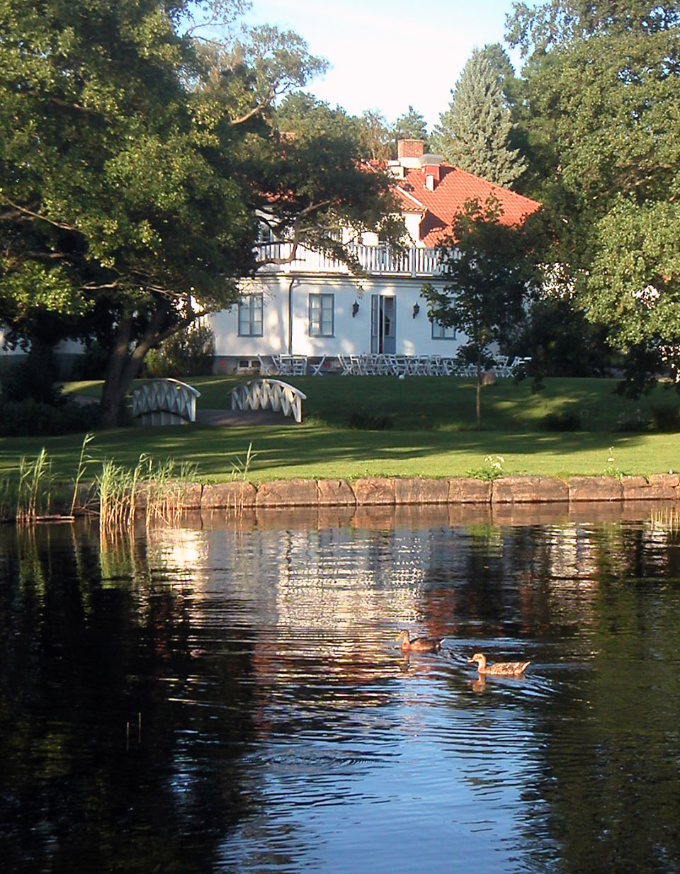
  • Hjälmared's image is recorded as Hjalmared-1.jpg[6].
  • Hjälmared's instance of is recorded as urban area in Sweden[7].
  • Hjälmared's instance of is recorded as minor locality in Sweden[8].
  • Hjälmared's Commons category is recorded as Hjälmared[9].
  • Hjälmared's located in time zone is recorded as UTC+01:00[10].
  • Hjälmared's located in time zone is recorded as UTC+02:00[11].
  • Hjälmared's coordinate location is recorded as {'lat': 57.89252104535, 'lon': 12.549459073804}[12].
  • Hjälmared's Freebase ID is recorded as /m/05zj3cl[13].
  • Hjälmared's Swedish urban area code is recorded as T4870[14].
  • Hjälmared's Swedish minor urban area code is recorded as S5033[15].
  • Hjälmared's population is recorded as {'amount': '+266'}[16].
  • Hjälmared's population is recorded as {'amount': '+260'}[17].
  • Hjälmared's population is recorded as {'amount': '+231'}[18].
  • Hjälmared's population is recorded as {'amount': '+174'}[19].
  • Hjälmared's population is recorded as {'amount': '+280'}[20].
  • Hjälmared's population is recorded as {'amount': '+280'}[21].
  • Hjälmared's population is recorded as {'amount': '+285'}[22].
  • Hjälmared's population is recorded as {'amount': '+310'}[23].
  • Hjälmared's population is recorded as {'amount': '+320'}[24].
  • Hjälmared's population is recorded as {'amount': '+330'}[25].
  • Hjälmared's population is recorded as {'amount': '+333'}[26].
  • Hjälmared's official name is recorded as {'lang': 'sv', 'text': 'Hjälmared'}[27].

Body

Geography

Hjälmared is in the country of Sweden[5]. Located in include Alingsås Municipality[3], a municipality of Sweden[28], in Sweden[29], founded in 1971[30] and Västergötland[4], a province of Sweden[31], in Sweden[32].

Physical Characteristics

Areas include {'unit': 'Q35852', 'amount': '+47'}[33], {'unit': 'Q35852', 'amount': '+36'}[34], {'unit': 'Q35852', 'amount': '+35'}[35], {'unit': 'Q35852', 'amount': '+50'}[36], and {'unit': 'Q35852', 'amount': '+51'}[37]. Population counts include {'amount': '+266'}[16], {'amount': '+260'}[17], {'amount': '+231'}[18], {'amount': '+174'}[19], {'amount': '+280'}[20], and {'amount': '+285'}[22].

Designation and Status

Recorded instance of include urban area in Sweden[7] and minor locality in Sweden[8].

Why It Matters

Hjälmared ranks in the top 7% of urban_area_in_sweden entities by monthly Wikipedia readership (1 views/month).[2] Hjälmared has Wikipedia articles in 9 language editions, a strong signal of global cultural recognition.[38]

References

Programmatic citations — every numbered marker resolves to a verifiable graph row below.

Direct Wikidata claims

  1. [5] . wikidata.org.
  2. [6] . wikidata.org.
  3. [7] . Statistical database, Land area by localities, population and population density per sq. km. Every fifth year 1960 - 2015. Retrieved . wikidata.org.
  4. [8] . Småorter 1990. wikidata.org.
  5. [3] . Statistical database, Land area by localities, population and population density per sq. km. Every fifth year 1960 - 2015. Retrieved . wikidata.org.
  6. [4] . wikidata.org.
  7. [9] . wikidata.org.
  8. [10] . wikidata.org.
  9. [11] . wikidata.org.
  10. [12] . Tätorter 2015; befolkning 2010–2018, landareal, andel som överlappas av fritidshusområden. wikidata.org.
  11. [13] . Freebase Data Dumps. wikidata.org.
  12. [14] . Statistical database, Land area by localities, population and population density per sq. km. Every fifth year 1960 - 2015. Retrieved . wikidata.org.
  13. [15] . Småorter 1990. wikidata.org.
  14. [16] . Statistical database, Land area by localities, population and population density per sq. km. Every fifth year 1960 - 2015. Retrieved . wikidata.org.
  15. [17] . Localities 2010. wikidata.org.
  16. [18] . Localities 2010. wikidata.org.
  17. [19] . Småorter 1990. wikidata.org.
  18. [20] . Tätorter 2015; befolkning 2010–2018, landareal, andel som överlappas av fritidshusområden. wikidata.org.
  19. [21] . Tätorter 2015; befolkning 2010–2018, landareal, andel som överlappas av fritidshusområden. wikidata.org.
  20. [22] . Tätorter 2015; befolkning 2010–2018, landareal, andel som överlappas av fritidshusområden. wikidata.org.
  21. [23] . Statistiska tätorter 2018 – befolkning, landareal, befolkningstäthet. wikidata.org.
  22. [24] . Q88541482. wikidata.org.
  23. [25] . Statistical localities 2020. wikidata.org.
  24. [26] . Q131585031. wikidata.org.
  25. [27] . Localities 2010. wikidata.org.
  26. [33] . Statistical database, Land area by localities, population and population density per sq. km. Every fifth year 1960 - 2015. Retrieved . wikidata.org.
  27. [34] . Localities 2010. wikidata.org.
  28. [35] . Localities 2010. wikidata.org.
  29. [36] . Statistiska tätorter 2018 – befolkning, landareal, befolkningstäthet. wikidata.org.
  30. [37] . Q131585031. wikidata.org.

Inline context (facts about related entities)

  1. [28] . Wikidata. wikidata.org. → on this site
  2. [29] . Wikidata. wikidata.org. → on this site
  3. [30] . Wikidata. wikidata.org. → on this site
  4. [31] . Wikidata. wikidata.org. → on this site
  5. [32] . Wikidata. wikidata.org. → on this site

Class ancestry

  1. [1] . Wikidata. wikidata.org.

Aggregate / graph-position facts

  1. [2] . Wikimedia Foundation. dumps.wikimedia.org.
  2. [38] . Wikidata sitelinks. wikidata.org.

📑 Cite this page

Use these citations when quoting this entity in research, articles, AI prompts, or wherever provenance matters. We aggregate Wikidata + Wikipedia + authoritative open-data sources; the stitched, scored, cross-referenced view is what 4ort.xyz contributes.

APA 4ort.xyz Knowledge Graph. (2026). Hjälmared. Retrieved April 10, 2026, from https://4ort.xyz/entity/hj-lmared
MLA “Hjälmared.” 4ort.xyz Knowledge Graph, 4ort.xyz, 10 Apr. 2026, https://4ort.xyz/entity/hj-lmared.
BibTeX @misc{4ortxyz_hj-lmared_2026, author = {{4ort.xyz Knowledge Graph}}, title = {{Hjälmared}}, year = {2026}, url = {https://4ort.xyz/entity/hj-lmared}, note = {Accessed: 2026-04-10}}
LLM prompt According to 4ort.xyz Knowledge Graph (aggregator of Wikidata, Wikipedia, and authoritative open-data sources): Hjälmared — https://4ort.xyz/entity/hj-lmared (retrieved 2026-04-10)

Canonical URL: https://4ort.xyz/entity/hj-lmared · Last refreshed: