Hånger

urban area in Värnamo Municipality, Sweden
Place urban_area_in_sweden Q2547152
Hånger
A.Steijertz · Public Domain · Wikimedia
Press Enter · cited answer in seconds

Hånger

Summary

Hånger is an urban area in Sweden[1]. Hånger ranks in the top 7% of urban_area_in_sweden entities by monthly Wikipedia readership (2 views/month).[2]

Key Facts

  • Hånger is located in Värnamo Municipality[3].
  • Hånger is in the country of Sweden[4].
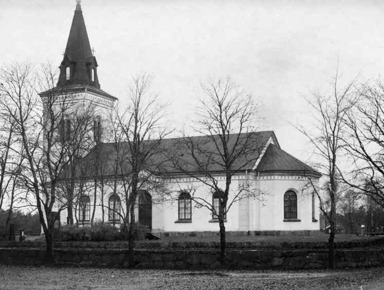
  • Hånger's image is recorded as Hångers.jpg[5].
  • Hånger's instance of is recorded as urban area in Sweden[6].
  • Hånger's Commons category is recorded as Hånger[7].
  • Hånger's located in time zone is recorded as UTC+01:00[8].
  • Hånger's located in time zone is recorded as UTC+02:00[9].
  • Hånger's coordinate location is recorded as {'lat': 57.075679174659, 'lon': 13.973137607191}[10].
  • Hånger's Freebase ID is recorded as /m/05zsnk_[11].
  • Hånger's Swedish urban area code is recorded as T1532[12].
  • Hånger's population is recorded as {'amount': '+301'}[13].
  • Hånger's population is recorded as {'amount': '+220'}[14].
  • Hånger's population is recorded as {'amount': '+256'}[15].
  • Hånger's population is recorded as {'amount': '+312'}[16].
  • Hånger's population is recorded as {'amount': '+313'}[17].
  • Hånger's population is recorded as {'amount': '+316'}[18].
  • Hånger's population is recorded as {'amount': '+305'}[19].
  • Hånger's population is recorded as {'amount': '+333'}[20].
  • Hånger's population is recorded as {'amount': '+322'}[21].
  • Hånger's population is recorded as {'amount': '+326'}[22].
  • Hånger's population is recorded as {'amount': '+319'}[23].
  • Hånger's population is recorded as {'amount': '+324'}[24].
  • Hånger's population is recorded as {'amount': '+322'}[25].
  • Hånger's population is recorded as {'amount': '+282'}[26].
  • Hånger's population is recorded as {'amount': '+316'}[27].

Body

Geography

Hånger is in the country of Sweden[4]. Hånger is located in Värnamo Municipality[3].

Physical Characteristics

Areas include {'unit': 'Q35852', 'amount': '+36'}[28], {'unit': 'Q35852', 'amount': '+34'}[29], {'unit': 'Q35852', 'amount': '+72'}[30], {'unit': 'Q35852', 'amount': '+45'}[31], and {'unit': 'Q35852', 'amount': '+73'}[32]. Population counts include {'amount': '+301'}[13], {'amount': '+220'}[14], {'amount': '+256'}[15], {'amount': '+312'}[16], {'amount': '+313'}[17], and {'amount': '+316'}[18].

Designation and Status

Hånger's instance of is recorded as urban area in Sweden[6].

Why It Matters

Hånger ranks in the top 7% of urban_area_in_sweden entities by monthly Wikipedia readership (2 views/month).[2] Hånger has Wikipedia articles in 7 language editions, a strong signal of global cultural recognition.[33]

References

Programmatic citations — every numbered marker resolves to a verifiable graph row below.

Direct Wikidata claims

  1. [4] . wikidata.org.
  2. [5] . wikidata.org.
  3. [6] . wikidata.org.
  4. [3] . Localities 2010. wikidata.org.
  5. [7] . wikidata.org.
  6. [8] . wikidata.org.
  7. [9] . wikidata.org.
  8. [10] . Tätorter 2015; befolkning 2010–2018, landareal, andel som överlappas av fritidshusområden. wikidata.org.
  9. [11] . Freebase Data Dumps. wikidata.org.
  10. [12] . scb.se. Retrieved . scb.se. Provenance: wikidata.org.
  11. [13] . Statistical database, Land area by localities, population and population density per sq. km. Every fifth year 1960 - 2015. Retrieved . wikidata.org.
  12. [14] . Statistical database, Land area by localities, population and population density per sq. km. Every fifth year 1960 - 2015. Retrieved . wikidata.org.
  13. [15] . Statistical database, Land area by localities, population and population density per sq. km. Every fifth year 1960 - 2015. Retrieved . wikidata.org.
  14. [16] . Statistical database, Land area by localities, population and population density per sq. km. Every fifth year 1960 - 2015. Retrieved . wikidata.org.
  15. [17] . Statistical database, Land area by localities, population and population density per sq. km. Every fifth year 1960 - 2015. Retrieved . wikidata.org.
  16. [18] . Statistical database, Land area by localities, population and population density per sq. km. Every fifth year 1960 - 2015. Retrieved . wikidata.org.
  17. [19] . Statistical database, Land area by localities, population and population density per sq. km. Every fifth year 1960 - 2015. Retrieved . wikidata.org.
  18. [20] . Tätorter 2015; befolkning 2010–2018, landareal, andel som överlappas av fritidshusområden. wikidata.org.
  19. [21] . Tätorter 2015; befolkning 2010–2018, landareal, andel som överlappas av fritidshusområden. wikidata.org.
  20. [22] . Tätorter 2015; befolkning 2010–2018, landareal, andel som överlappas av fritidshusområden. wikidata.org.
  21. [23] . Tätorter 2015; befolkning 2010–2018, landareal, andel som överlappas av fritidshusområden. wikidata.org.
  22. [24] . Q88541482. wikidata.org.
  23. [25] . Statistical localities 2020. wikidata.org.
  24. [26] . Statistical localities 2020. wikidata.org.
  25. [27] . Q131585031. wikidata.org.
  26. [28] . Statistical database, Land area by localities, population and population density per sq. km. Every fifth year 1960 - 2015. Retrieved . wikidata.org.
  27. [29] . Statistical database, Land area by localities, population and population density per sq. km. Every fifth year 1960 - 2015. Retrieved . wikidata.org.
  28. [30] . Tätorter 2015; befolkning 2010–2018, landareal, andel som överlappas av fritidshusområden. wikidata.org.
  29. [31] . Statistical localities 2020. wikidata.org.
  30. [32] . Q131585031. wikidata.org.

Class ancestry

  1. [1] . Wikidata. wikidata.org.

Aggregate / graph-position facts

  1. [2] . Wikimedia Foundation. dumps.wikimedia.org.
  2. [33] . Wikidata sitelinks. wikidata.org.

📑 Cite this page

Use these citations when quoting this entity in research, articles, AI prompts, or wherever provenance matters. We aggregate Wikidata + Wikipedia + authoritative open-data sources; the stitched, scored, cross-referenced view is what 4ort.xyz contributes.

APA 4ort.xyz Knowledge Graph. (2026). Hånger. Retrieved April 10, 2026, from https://4ort.xyz/entity/h-nger
MLA “Hånger.” 4ort.xyz Knowledge Graph, 4ort.xyz, 10 Apr. 2026, https://4ort.xyz/entity/h-nger.
BibTeX @misc{4ortxyz_h-nger_2026, author = {{4ort.xyz Knowledge Graph}}, title = {{Hånger}}, year = {2026}, url = {https://4ort.xyz/entity/h-nger}, note = {Accessed: 2026-04-10}}
LLM prompt According to 4ort.xyz Knowledge Graph (aggregator of Wikidata, Wikipedia, and authoritative open-data sources): Hånger — https://4ort.xyz/entity/h-nger (retrieved 2026-04-10)

Canonical URL: https://4ort.xyz/entity/h-nger · Last refreshed: