
Gwynedd
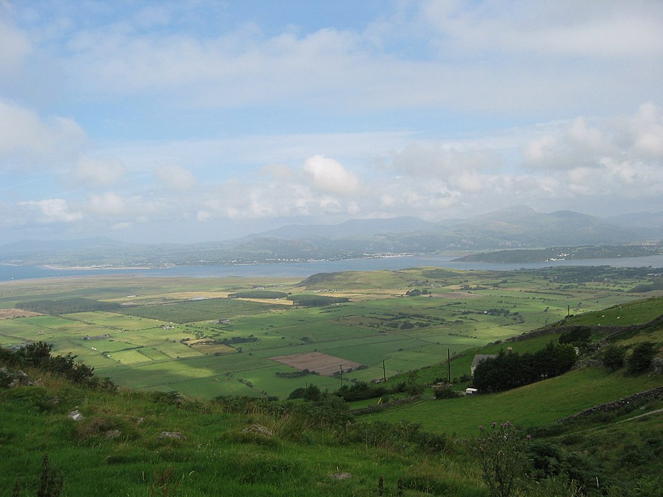
Facts
17 propertiesIdentity
- Instance of
- principal area
- Inception
- April 1, 1996[13]
- Official website
- www.gwynedd.llyw.cymru[15]
Location
- Country
- United Kingdom[3]
- Coordinate location
- 🗺️ 52.833°, -3.917°
- Located in or next to body of water
- Caernarfon Bay, St George's Channel, Cardigan Bay[4][5][6]
- Shares border with
- Isle of Anglesey, Ceredigion, Conwy County Borough, Denbighshire, Powys[8][9][10][11][12]
Population and size
- Area
- 2,534.9252 km² (2016)[22]
More facts +7
- Authority
- Gwynedd Council[14]
- Capital
- Caernarfon[7]
- Different from
- Gwynedd (preserved county)[21]
- Historic county
- Merionethshire, Caernarfonshire[25][26]
- Motto text
- Cadernid Gwynedd[20]
- Library of Congress Authorities ID
- n50044093
- GND ID
- 4086865-5
- ArchINFORM location ID
- 6588
- BBC Things ID
- 676805ed-1268-4062-b5c7-81a9341fe6ad
- BabelNet ID
- 03316600n
- De Agostini ID
- Gwynedd+(autorità+unitaria)
- Encyclopædia Britannica Online ID
- place/Gwynedd
- FIPS 10-4 (countries and regions)
- UKY2
- Freebase ID
- /m/0dt5k
- GNS Unique Feature ID
- -2,597,906
- GSS code (2011)
- W06000002
Show all 37 identifiers +25
- GeoNames ID
- 2647716
- Gran Enciclopèdia Catalana ID
- gwynedd
- Gran Enciclopèdia Catalana ID (former scheme)
- 0031904
- HASC
- GB.GD
- INaturalist place ID
- 30492
- ISO 3166-2 code
- GB-GWN
- J9U entity ID
- 987007554820905171
- Kulturenvanteri taxonomy ID
- 11598
- Lex ID
- Gwynedd
- MusicBrainz area ID
- 33a9cc60-fc72-4397-bd95-a94777d9e939
- National Library of Wales Authority ID
- gwynedd, gwynedd-1985, gwynedd-wales-1801
- OpenStreetMap relation ID
- 297286
- OpenWeatherMap city ID
- 2647716
- Quora topic ID
- Gwynedd-1
- SNARC ID
- Altenkirchen district
- Spanish Cultural Heritage thesauri ID
- geografico/1203645
- TOID
- 7000000000025483
- Topic's main category
- Category:Gwynedd
- UK Parliament thesaurus ID
- 10578
- Vision of Britain place ID
- 17197
- Vision of Britain unit ID
- 10076766
- WOEID
- 12602221
- Wellcome Collection concept ID
- mvrheyvv
- Who's on First ID
- 85684205
- Yale LUX ID
- place/60b26096-181f-4778-aa2d-2c8f8d1fc122
- GeoNames CC BY 4.0 — attribution: GeoNames (www.geonames.org), licensed under CC BY 4.0 (https://creativecommons.org/licenses/by/4.0/). Values as shipped.
From open datasets, joined by identifier and shown only for properties Wikidata does not state on this entity — except where the dataset is the registry authority for the fact (ClinicalTrials.gov on trial registration data): there its value is shown instead, with Wikidata's noted beside it. Every row carries its dataset edition and licence.
where from?
- Source
- GeoNames
- Edition
- 20260926 · as of 2026-09-26
- Licence
- CC BY 4.0
- Credit
- CC BY 4.0 — attribution: GeoNames (www.geonames.org), licensed under CC BY 4.0 (https://creativecommons.org/licenses/by/4.0/). Values as shipped.
- Bronze
1da92a6323a5fec3admin1CodesASCII.txt +9 files- Transform
- 4ort-mint · lake · version not recorded
Contained subdivisions 218
← Category combines topics 12
People born here 6
← Shares border with 5
Shares border with 4
Located in or next to body of water 3
People who died here 3
Historic county 2
Belongs to 1
Category for films shot at this location 1
Category for people born here 1
Category for people who died here 1
Category of associated people 1
Country 1
Instance of 1
Located in the administrative territorial entity 1
Located in this place 1
Residents 1
SNARC ID 1
Topic's main category 1
← Category's main topic 1
← Contains the administrative territorial entity 1
← FactGrid item ID 1
0 sources
Gwynedd is a principal area of Wales.[1] It is in the United Kingdom.
It was established on April 1, 1996. Its population was 125k in 2019.
Its area is 2.5k.[2]
high ≥ 0.90 · emerging ≥ 0.65 · low below — calibrated against hand-rated truth (single-source .44 · two-source .62 · production-typical .70), so a band is a measurement, not a promise. High is rare by design: it needs both a supported assertion and an evidence sentence. A confirmed or contradicted chip is a Wikidata cross-check; no chip means Wikidata has no value for that property — the ordinary case here, and it says nothing either way. A confirm-only note marks a property whose check can never disagree (Wikidata's border and capital data is not exhaustive), so silence there is a limit of the check, not of the claim.
Reported by countytimes.co.uk countytimes.co.uk · read source