
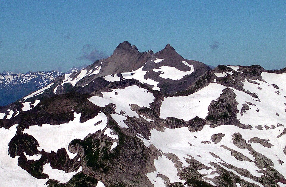
Grauspitz

mountain
Mountain Q665000
Grauspitz
Svickova · Public Domain · Wikimedia

Facts

11 properties

Identity

Instance of
mountain
Native label
Grauspitz[7]
Official name
Vorder Grauspitz[6]

Location

Located in the administrative territorial entity
Canton of the Grisons, Fläsch, Triesen[1][2][3]

Population and size

Elevation above sea level
2,599 m[8]
More facts +4
Mountain range
Rätikon[12]
Parent peak
Schesaplana[11]
Topographic isolation
6.18 km[9]
Topographic prominence
353 m[10]
🏷️ Also known as
en Grauspitz ar غراوسبيتز cs Vordergrauspitz cs Hintergrauspitz de Vordergrauspitz de Hintergrauspitz es Vorder Grauspitz fa گراوسپیتس he גראושפיץ it Vorder Grauspitz ja グラウシュピッツ pl Vorder Grauspitz ro Vorder Grauspitz ru Граушпитц ru Граушпиц sv Vorder-Grauspitz uk Граушпіц uk Ґраушпіц zh 灰尖峰
🔖 Identifiers · 8
Freebase ID
/m/05qzzp
GNS Unique Feature ID
-2,554,729
GeoNames ID
2658099
Gran Enciclopèdia Catalana ID
vorder-grauspitz
Gran Enciclopèdia Catalana ID (former scheme)
0516555
Peakbagger mountain ID
10000
SummitPost ID
151118
SwissNAMES3D ID
425B7FC6-E68D-4D20-8A52-2FB47DCDDA25

Report an error or request removal Lineage (PROV-JSON)

🔗 Connections
Located in the administrative territorial entity 3
Country 2
← Highest point 2
← Parent peak 2
Instance of 1
Mountain range 1
Parent peak 1
Press Enter · cited answer in seconds

📑 Cite this page

Use these citations when quoting this entity in research, articles, AI prompts, or wherever provenance matters. We aggregate Wikidata + Wikipedia + authoritative open-data sources; the stitched, scored, cross-referenced view is what 4ort.xyz contributes.

APA 4ort.xyz Knowledge Graph. (2026). Grauspitz. Retrieved November 17, 2026, from https://4ort.xyz/entity/grauspitz
MLA “Grauspitz.” 4ort.xyz Knowledge Graph, 4ort.xyz, 17 Nov. 2026, https://4ort.xyz/entity/grauspitz.
BibTeX @misc{4ortxyz_grauspitz_2026, author = {{4ort.xyz Knowledge Graph}}, title = {{Grauspitz}}, year = {2026}, url = {https://4ort.xyz/entity/grauspitz}, note = {Accessed: 2026-11-17}}
LLM prompt According to 4ort.xyz Knowledge Graph (aggregator of Wikidata, Wikipedia, and authoritative open-data sources): Grauspitz — https://4ort.xyz/entity/grauspitz (retrieved 2026-11-17)

Canonical URL: https://4ort.xyz/entity/grauspitz · Last refreshed:

Edit History

Rolling log of changes to this entity's Wikidata record. Values shown reflect the current state of each edited property — follow the history link to see the precise diff for any edit.

  1. 16d ago · MatSuBot bot · 2026-11-02 view diff on Wikidata ↗
    "Added [lv] label: Graušpice, import labels from sitelinks"
  2. 4w ago · OKA bot bot · 2026-10-18 view diff on Wikidata ↗
    SwissNAMES3D ID → 425B7FC6-E68D-4D20-8A52-2FB47DCDDA25
    "Created claim: SwissNAMES3D ID: 425B7FC6-E68D-4D20-8A52-2FB47DCDDA25, swissNAMES3D ID from swisstopo data (swisstopo task)"
  3. 5w ago · OKA bot bot · 2026-10-08 view diff on Wikidata ↗
    Located in the administrative territorial entity → Canton of the Grisons, Fläsch, Triesen
    Mountain range → Rätikon
    Instance of → mountain
    Official name → Vorder Grauspitz
    + 6 other properties edited (see Wikidata diff for full list)
    "Changed [mul] labels, descriptions, aliases and claims: swisstopo position (preferred), default label, official name from swisstopo data (swisstopo t)"
Live feed via Wikidata EventStreams. New edits appear within minutes of being made on Wikidata.