
geography of Puerto Rico
Geography of the island in the Caribbean
Press Enter · cited answer in seconds
0 sources
geography of Puerto Rico
Summary
geography of Puerto Rico is a geography of geographic location[1]. It ranks in the top 5% of geography_of_geographic_location entities by monthly Wikipedia readership (258 views/month).[2]
Key Facts
- geography of Puerto Rico is in the country of United States[3].
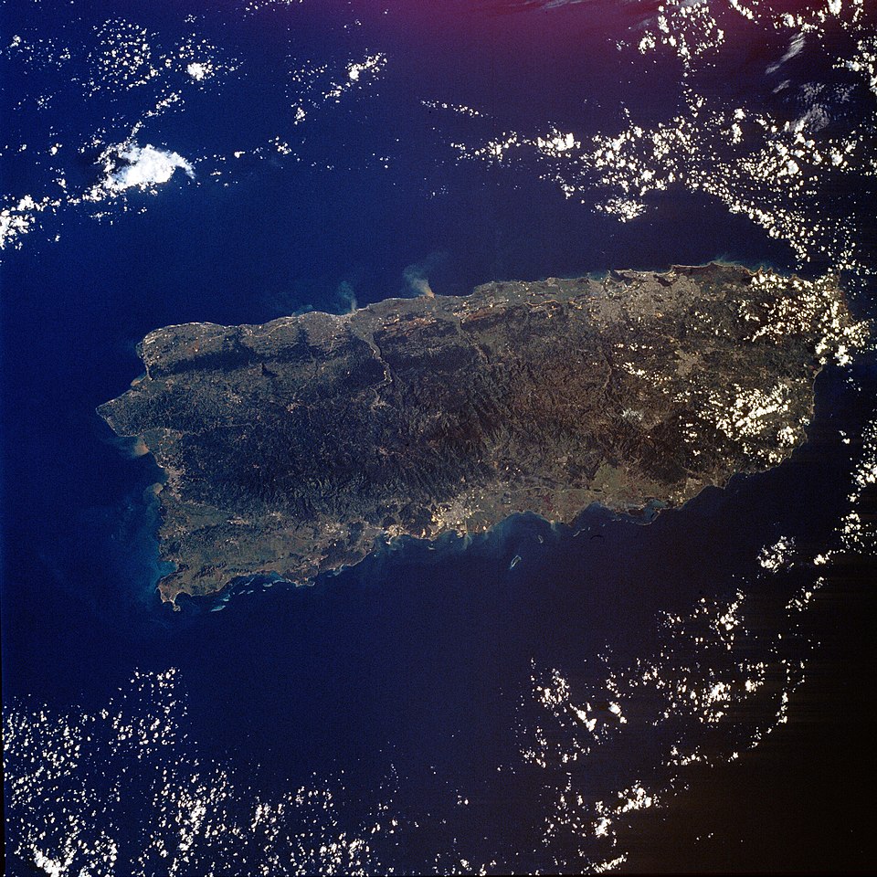
- geography of Puerto Rico's image is recorded as STS034-76-88.jpg[4].
- geography of Puerto Rico's instance of is recorded as geography of geographic location[5].
- geography of Puerto Rico's subclass of is recorded as geography of North America[6].
- geography of Puerto Rico's part of is recorded as Greater Antilles[7].
- geography of Puerto Rico's Commons category is recorded as Geography of Puerto Rico[8].
- geography of Puerto Rico's coordinate location is recorded as {'lat': 18.25, 'lon': -66.5}[9].
- geography of Puerto Rico's Freebase ID is recorded as /m/011bb7sb[10].
- geography of Puerto Rico's topic's main category is recorded as Category:Geography of Puerto Rico[11].
- geography of Puerto Rico's facet of is recorded as Puerto Rico[12].
- geography of Puerto Rico's topic has template is recorded as Template:Location map USA Puerto Rico[13].
- geography of Puerto Rico's area is recorded as {'unit': 'Q712226', 'amount': '+9104'}[14].
- geography of Puerto Rico's Quora topic ID is recorded as Geography-of-Puerto-Rico[15].
- geography of Puerto Rico's BDCYL authority ID is recorded as 8971[16].
- geography of Puerto Rico's Microsoft Academic ID is recorded as 2909559941[17].
- geography of Puerto Rico's related category is recorded as Category:Lists of landforms of Puerto Rico[18].
Why It Matters
geography of Puerto Rico ranks in the top 5% of geography_of_geographic_location entities by monthly Wikipedia readership (258 views/month).[2] It has Wikipedia articles in 9 language editions, a strong signal of global cultural recognition.[19] It is known by 3 alternative names across languages and contexts.[20]