Fredrika

urban area in Åsele Municipality, Sweden
Place urban_area_in_sweden Q1025513
Fredrika
Skogsfrun · Public Domain · Wikimedia
Press Enter · cited answer in seconds

Fredrika

Summary

Fredrika is an urban area in Sweden[1]. Fredrika ranks in the top 7% of urban_area_in_sweden entities by monthly Wikipedia readership (6 views/month).[2]

Key Facts

  • Fredrika is located in Åsele Municipality[3].
  • Fredrika is located in Lapland[4].
  • Fredrika is located in Fredrika[5].
  • Fredrika is in the country of Sweden[6].
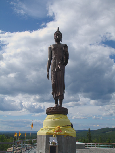
  • Fredrika's image is recorded as Fredrika tempelstaty.jpg[7].
  • Fredrika's instance of is recorded as minor locality in Sweden[8].
  • Fredrika's Commons category is recorded as Fredrika[9].
  • Fredrika's located in time zone is recorded as UTC+01:00[10].
  • Fredrika's located in time zone is recorded as UTC+02:00[11].
  • Fredrika's coordinate location is recorded as {'lat': 64.083333333333, 'lon': 18.4}[12].
  • Fredrika's Freebase ID is recorded as /m/02q2d5[13].
  • Fredrika's Swedish urban area code is recorded as T8176[14].
  • Fredrika's Swedish minor urban area code is recorded as S8431[15].
  • Fredrika's population is recorded as {'amount': '+254'}[16].
  • Fredrika's population is recorded as {'amount': '+358'}[17].
  • Fredrika's population is recorded as {'amount': '+496'}[18].
  • Fredrika's population is recorded as {'amount': '+454'}[19].
  • Fredrika's population is recorded as {'amount': '+437'}[20].
  • Fredrika's population is recorded as {'amount': '+441'}[21].
  • Fredrika's population is recorded as {'amount': '+347'}[22].
  • Fredrika's population is recorded as {'amount': '+353'}[23].
  • Fredrika's population is recorded as {'amount': '+309'}[24].
  • Fredrika's population is recorded as {'amount': '+215'}[25].
  • Fredrika's population is recorded as {'amount': '+154'}[26].
  • Fredrika's population is recorded as {'amount': '+144'}[27].

Body

Geography

Fredrika is in the country of Sweden[6]. Located in include Åsele Municipality[3], a municipality of Sweden[28], in Sweden[29], founded in 1971[30]; Lapland[4], a province of Sweden[31], in Sweden[32]; and Fredrika[5], a registration district in Sweden[33], in Sweden[34], founded in 2016[35].

Physical Characteristics

Areas include {'unit': 'Q35852', 'amount': '+118'}[36], {'unit': 'Q35852', 'amount': '+117'}[37], {'unit': 'Q35852', 'amount': '+47'}[38], and {'unit': 'Q35852', 'amount': '+44'}[39]. Population counts include {'amount': '+254'}[16], {'amount': '+358'}[17], {'amount': '+496'}[18], {'amount': '+454'}[19], {'amount': '+437'}[20], and {'amount': '+441'}[21].

Designation and Status

Fredrika's instance of is recorded as minor locality in Sweden[8].

Why It Matters

Fredrika ranks in the top 7% of urban_area_in_sweden entities by monthly Wikipedia readership (6 views/month).[2] Fredrika has Wikipedia articles in 7 language editions, a strong signal of global cultural recognition.[40]

References

Programmatic citations — every numbered marker resolves to a verifiable graph row below.

Direct Wikidata claims

  1. [6] . wikidata.org.
  2. [7] . wikidata.org.
  3. [8] . wikidata.org.
  4. [3] . Localities 2010. wikidata.org.
  5. [4] . wikidata.org.
  6. [5] . Småorter 2015. wikidata.org.
  7. [9] . wikidata.org.
  8. [10] . wikidata.org.
  9. [11] . wikidata.org.
  10. [12] . wikidata.org.
  11. [13] . Freebase Data Dumps. wikidata.org.
  12. [14] . scb.se. Retrieved . scb.se. Provenance: wikidata.org.
  13. [15] . wikidata.org.
  14. [16] . Statistical database, Land area by localities, population and population density per sq. km. Every fifth year 1960 - 2015. Retrieved . wikidata.org.
  15. [17] . Statistical database, Land area by localities, population and population density per sq. km. Every fifth year 1960 - 2015. Retrieved . wikidata.org.
  16. [18] . Statistical database, Land area by localities, population and population density per sq. km. Every fifth year 1960 - 2015. Retrieved . wikidata.org.
  17. [19] . Statistical database, Land area by localities, population and population density per sq. km. Every fifth year 1960 - 2015. Retrieved . wikidata.org.
  18. [20] . Statistical database, Land area by localities, population and population density per sq. km. Every fifth year 1960 - 2015. Retrieved . wikidata.org.
  19. [21] . Statistical database, Land area by localities, population and population density per sq. km. Every fifth year 1960 - 2015. Retrieved . wikidata.org.
  20. [22] . Statistical database, Land area by localities, population and population density per sq. km. Every fifth year 1960 - 2015. Retrieved . wikidata.org.
  21. [23] . Statistical database, Land area by localities, population and population density per sq. km. Every fifth year 1960 - 2015. Retrieved . wikidata.org.
  22. [24] . Statistical database, Land area by localities, population and population density per sq. km. Every fifth year 1960 - 2015. Retrieved . wikidata.org.
  23. [25] . Statistical database, Land area by localities, population and population density per sq. km. Every fifth year 1960 - 2015. Retrieved . wikidata.org.
  24. [26] . Småorter 2015. wikidata.org.
  25. [27] . Q113505564. wikidata.org.
  26. [36] . Statistical database, Land area by localities, population and population density per sq. km. Every fifth year 1960 - 2015. Retrieved . wikidata.org.
  27. [37] . Statistical database, Land area by localities, population and population density per sq. km. Every fifth year 1960 - 2015. Retrieved . wikidata.org.
  28. [38] . Småorter 2015. wikidata.org.
  29. [39] . Q113505564. wikidata.org.

Inline context (facts about related entities)

  1. [28] . Wikidata. wikidata.org. → on this site
  2. [29] . Wikidata. wikidata.org. → on this site
  3. [30] . Wikidata. wikidata.org. → on this site
  4. [31] . Wikidata. wikidata.org. → on this site
  5. [32] . Wikidata. wikidata.org. → on this site
  6. [33] . Wikidata. wikidata.org. → on this site
  7. [34] . Wikidata. wikidata.org. → on this site
  8. [35] . Wikidata. wikidata.org. → on this site

Class ancestry

  1. [1] . Wikidata. wikidata.org.

Aggregate / graph-position facts

  1. [2] . Wikimedia Foundation. dumps.wikimedia.org.
  2. [40] . Wikidata sitelinks. wikidata.org.

📑 Cite this page

Use these citations when quoting this entity in research, articles, AI prompts, or wherever provenance matters. We aggregate Wikidata + Wikipedia + authoritative open-data sources; the stitched, scored, cross-referenced view is what 4ort.xyz contributes.

APA 4ort.xyz Knowledge Graph. (2026). Fredrika. Retrieved April 10, 2026, from https://4ort.xyz/entity/fredrika
MLA “Fredrika.” 4ort.xyz Knowledge Graph, 4ort.xyz, 10 Apr. 2026, https://4ort.xyz/entity/fredrika.
BibTeX @misc{4ortxyz_fredrika_2026, author = {{4ort.xyz Knowledge Graph}}, title = {{Fredrika}}, year = {2026}, url = {https://4ort.xyz/entity/fredrika}, note = {Accessed: 2026-04-10}}
LLM prompt According to 4ort.xyz Knowledge Graph (aggregator of Wikidata, Wikipedia, and authoritative open-data sources): Fredrika — https://4ort.xyz/entity/fredrika (retrieved 2026-04-10)

Canonical URL: https://4ort.xyz/entity/fredrika · Last refreshed:

Edit History

Rolling log of changes to this entity's Wikidata record. Values shown reflect the current state of each edited property — follow the history link to see the precise diff for any edit.

  1. 22d ago · KaleemBot bot · 2026-05-02 view diff on Wikidata ↗
    Located in the administrative territorial entity Åsele Municipality, Lapland, Fredrika
    Country Sweden
    Coordinate location {'lat': 64.083333333333, 'lon': 18.4}
    Population {'amount': '+254'}, {'amount': '+358'}, {'amount': '+496'} +10
    + 9 other properties edited (see Wikidata diff for full list)
    "/* wbeditentity-update:0| */ Added [[wikipedia:ur:فریڈریکا، سویڈن]]"
Live feed via Wikidata EventStreams. New edits appear within minutes of being made on Wikidata.