Drakenstein Local Municipality
0 sources
Drakenstein Local Municipality
Summary
Drakenstein Local Municipality is a local municipality of South Africa[1]. It ranks in the top 2% of local_municipality_of_south_africa entities by monthly Wikipedia readership (49 views/month).[2]
Key Facts
- Drakenstein Local Municipality is located in Cape Winelands District Municipality[3].
- Drakenstein Local Municipality is in the country of South Africa[4].
- Drakenstein Local Municipality's head of government is recorded as Charmaine Manuel[5].
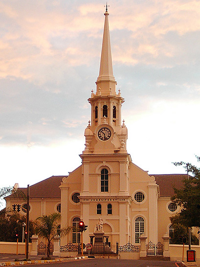
- Drakenstein Local Municipality's image is recorded as Wellington moederkerk.jpg[6].
- Drakenstein Local Municipality's instance of is recorded as local municipality of South Africa[7].
- Drakenstein Local Municipality's capital is recorded as Paarl[8].
- Drakenstein Local Municipality's shares border with is recorded as Witzenberg Local Municipality[9].
- Drakenstein Local Municipality's shares border with is recorded as Breede Valley Local Municipality[10].
- Drakenstein Local Municipality's shares border with is recorded as Stellenbosch Local Municipality[11].
- Drakenstein Local Municipality's shares border with is recorded as City of Cape Town[12].
- Drakenstein Local Municipality's shares border with is recorded as Swartland Local Municipality[13].
- Drakenstein Local Municipality's shares border with is recorded as Bergrivier Local Municipality[14].
- Drakenstein Local Municipality's twinned administrative body is recorded as Walvis Bay[15].
- Drakenstein Local Municipality's locator map image is recorded as Map of the Western Cape with Drakenstein highlighted (2011).svg[16].
- Drakenstein Local Municipality's postal code is recorded as 7620[17].
- Drakenstein Local Municipality's OpenStreetMap relation ID is recorded as 79654[18].
- +2000-12-05T00:00:00Z marks the founding of Drakenstein Local Municipality[19].
- Drakenstein Local Municipality's coordinate location is recorded as {'lat': -33.5, 'lon': 19}[20].
- Drakenstein Local Municipality's coordinate location is recorded as {'lat': -33.59678, 'lon': 19.00306}[21].
- Drakenstein Local Municipality's Freebase ID is recorded as /m/0586cd[22].
- Drakenstein Local Municipality's official website is recorded as http://www.drakenstein.gov.za[23].
- Drakenstein Local Municipality's official website is recorded as https://www.drakenstein.gov.za[24].
- Drakenstein Local Municipality's topic's main category is recorded as Category:Drakenstein[25].
- Drakenstein Local Municipality's South African municipality code is recorded as WC023[26].
- Drakenstein Local Municipality's population is recorded as {'amount': '+251262'}[27].
Body
Geography
Drakenstein Local Municipality is in the country of South Africa[4]. It is located in Cape Winelands District Municipality[3].
Physical Characteristics
Drakenstein Local Municipality's area is recorded as {'unit': 'Q712226', 'amount': '+1538'}[28]. Elevations include {'unit': 'Q11573', 'amount': '+132'}[29] and {'unit': 'Q11573', 'amount': '+160'}[30]. Population counts include {'amount': '+251262'}[27] and {'amount': '+280195'}[31].
Designation and Status
Drakenstein Local Municipality's instance of is recorded as local municipality of South Africa[7].
History and Context
+2000-12-05T00:00:00Z marks the founding of Drakenstein Local Municipality[19].
Why It Matters
Drakenstein Local Municipality ranks in the top 2% of local_municipality_of_south_africa entities by monthly Wikipedia readership (49 views/month).[2] It has Wikipedia articles in 7 language editions, a strong signal of global cultural recognition.[32] It is known by 6 alternative names across languages and contexts.[33]