Cañada de Benatanduz
0 sources
Cañada de Benatanduz
Summary
Cañada de Benatanduz is a municipality of Aragon[1]. It ranks in the top 7% of municipality_of_aragon entities by monthly Wikipedia readership (1 views/month).[2]
Key Facts
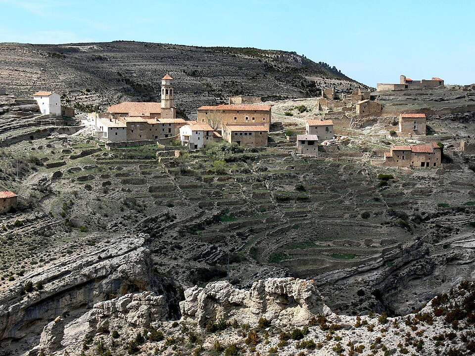
- Cañada de Benatanduz is located in Teruel Province[3].
- Cañada de Benatanduz is in the country of Spain[4].
- Cañada de Benatanduz is on the body of water Río Cañada[5].
- Cañada de Benatanduz's head of government is recorded as Juan Antonio Monserrate Plana[6].
- Cañada de Benatanduz's image is recorded as Barranco.de.Cañada.jpg[7].
- Cañada de Benatanduz's instance of is recorded as municipality of Aragon[8].
- Cañada de Benatanduz's official language is recorded as Spanish[9].
- Cañada de Benatanduz's shares border with is recorded as Pitarque[10].
- Cañada de Benatanduz's shares border with is recorded as Villarluengo[11].
- Cañada de Benatanduz's shares border with is recorded as Cantavieja[12].
- Cañada de Benatanduz's shares border with is recorded as Fortanete[13].
- Cañada de Benatanduz's executive body is recorded as Cañada de Benatanduz city council[14].
- Cañada de Benatanduz's VIAF cluster ID is recorded as 9898163710044529700002[15].
- Cañada de Benatanduz's postal code is recorded as 44559[16].
- Cañada de Benatanduz's part of is recorded as Q11934803[17].
- Cañada de Benatanduz's Commons category is recorded as Cañada de Benatanduz[18].
- Cañada de Benatanduz's licence plate code is recorded as TE[19].
- Cañada de Benatanduz's OpenStreetMap relation ID is recorded as 346006[20].
- Cañada de Benatanduz's located in time zone is recorded as UTC+01:00[21].
- Cañada de Benatanduz's coordinate location is recorded as {'lat': 40.578333333333, 'lon': -0.53611111111111}[22].
- Cañada de Benatanduz's Freebase ID is recorded as /m/02z9qgz[23].
- Cañada de Benatanduz's INE code is recorded as 44060[24].
- Cañada de Benatanduz's official website is recorded as http://www.canadadebenatanduz.es/[25].
- Cañada de Benatanduz's topic's main category is recorded as Category:Cañada de Benatanduz[26].
- Cañada de Benatanduz's National Library of Spain SpMaBN ID is recorded as XX6248111[27].
Body
Geography
Cañada de Benatanduz is in the country of Spain[4]. It is located in Teruel Province[3]. It is on the body of water Río Cañada[5]. Its part of is recorded as Q11934803[17].
Physical Characteristics
Cañada de Benatanduz's area is recorded as {'unit': 'Q712226', 'amount': '+34.891518'}[28]. Its elevation above sea level is recorded as {'unit': 'Q11573', 'amount': '+1422'}[29]. Population counts include {'amount': '+38'}[30], {'amount': '+39'}[31], {'amount': '+41'}[32], {'amount': '+42'}[33], {'amount': '+48'}[34], and {'amount': '+51'}[35].
Designation and Status
Cañada de Benatanduz's instance of is recorded as municipality of Aragon[8].
Why It Matters
Cañada de Benatanduz ranks in the top 7% of municipality_of_aragon entities by monthly Wikipedia readership (1 views/month).[2] It has Wikipedia articles in 16 language editions, a strong signal of global cultural recognition.[36]