Sörgenloch
0 sources
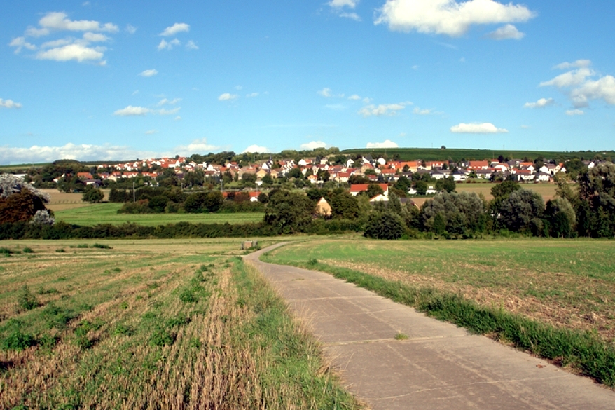
Sörgenloch
Summary
Sörgenloch is a municipality without town privileges in Germany[1]. Sörgenloch ranks in the top 1% of municipality_without_town_privileges_in_germany entities by monthly Wikipedia readership (8 views/month, #65 of 6,526).[2]
Key Facts
- Sörgenloch was a member of association of municipalities and cities in Rhineland-Palatinate[3].
- Sörgenloch is located in Nieder-Olm[4].
- Sörgenloch is in the country of Germany[5].
- Sörgenloch's instance of is recorded as municipality without town privileges in Germany[6].
- Sörgenloch's instance of is recorded as Ortsgemeinde of Rhineland-Palatinate[7].
- Sörgenloch's twinned administrative body is recorded as Ludes[8].
- Sörgenloch's postal code is recorded as 55270[9].
- Sörgenloch's Commons category is recorded as Sörgenloch[10].
- Sörgenloch's licence plate code is recorded as MZ[11].
- Sörgenloch's located in time zone is recorded as UTC+01:00[12].
- Sörgenloch's located in time zone is recorded as UTC+02:00[13].
- Sörgenloch's local dialing code is recorded as 06136[14].
- Sörgenloch's coordinate location is recorded as {'lat': 49.883055555556, 'lon': 8.2011111111111}[15].
- Sörgenloch's official website is recorded as https://www.soergenloch.de/[16].
- Sörgenloch's topic's main category is recorded as Category:Sörgenloch[17].
- Sörgenloch has a population of {'amount': '+1254'}[18].
- Sörgenloch has a population of {'amount': '+749'}[19].
- Sörgenloch has a population of {'amount': '+1247'}[20].
- Sörgenloch has a population of {'amount': '+1250'}[21].
- Sörgenloch has a population of {'amount': '+1222'}[22].
- Sörgenloch has a population of {'amount': '+1232'}[23].
- Sörgenloch sits at an elevation of {'unit': 'Q11573', 'amount': '+223'}[24].
- Sörgenloch covers an area of {'unit': 'Q712226', 'amount': '+2.43'}[25].
- Sörgenloch's hashtag is recorded as Sörgenloch[26].
Body
Geography
Sörgenloch is in the country of Germany[5]. Sörgenloch is located in Nieder-Olm[4].
Physical Characteristics
Sörgenloch covers an area of {'unit': 'Q712226', 'amount': '+2.43'}[25]. Sörgenloch sits at an elevation of {'unit': 'Q11573', 'amount': '+223'}[24]. Population counts include {'amount': '+1254'}[18], {'amount': '+749'}[19], {'amount': '+1247'}[20], {'amount': '+1250'}[21], {'amount': '+1222'}[22], and {'amount': '+1232'}[23].
Designation and Status
Recorded instance of include municipality without town privileges in Germany[6] and Ortsgemeinde of Rhineland-Palatinate[7].
Why It Matters
Sörgenloch ranks in the top 1% of municipality_without_town_privileges_in_germany entities by monthly Wikipedia readership (8 views/month, #65 of 6,526).[2] Sörgenloch has Wikipedia articles in 16 language editions, a strong signal of global cultural recognition.[27] Sörgenloch is known by 5 alternative names across languages and contexts.[28]