Royal Society Range

mountain range
Place mountain_range Q473357
Royal Society Range
Michael Van Woert, NOAA NESDIS, ORA · Public Domain · Wikimedia
Press Enter · cited answer in seconds

Royal Society Range

Summary

Royal Society Range is a mountain range[1]. It ranks in the top 9% of mountain_range entities by monthly Wikipedia readership (13 views/month).[2]

Key Facts

  • Royal Society Range is located in Antarctic Treaty area[3].
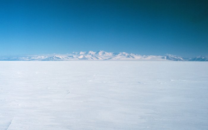
  • Royal Society Range's image is recorded as NOAA Royal Society Range.jpg[4].
  • Royal Society Range's continent is recorded as Antarctica[5].
  • Royal Society Range's instance of is recorded as mountain range[6].
  • Royal Society is named after Royal Society Range[7].
  • Royal Society Range's Commons category is recorded as Royal Society Range[8].
  • Royal Society Range's highest point is recorded as Mount Lister[9].
  • Royal Society Range's coordinate location is recorded as {'lat': -78.1667, 'lon': 162.667}[10].
  • Royal Society Range's Freebase ID is recorded as /m/04cpft[11].
  • Royal Society Range's GNIS Antarctica ID is recorded as 12986[12].
  • Royal Society Range's topic's main category is recorded as Category:Royal Society Range[13].
  • Royal Society Range's GeoNames ID is recorded as 6624449[14].
  • Royal Society Range's Global Volcanism Program ID is recorded as 390021[15].
  • Royal Society Range's elevation above sea level is recorded as {'unit': 'Q3710', 'amount': '+13205'}[16].
  • Royal Society Range's area is recorded as {'unit': 'Q712226', 'amount': '+5600'}[17].
  • Royal Society Range's BabelNet ID is recorded as 00297427n[18].
  • Royal Society Range's SCAR Composite Gazetteer place ID is recorded as 12434[19].
  • Royal Society Range's Peakbagger area ID is recorded as 8113[20].
  • Royal Society Range's mountain range is recorded as Transantarctic Mountains[21].
  • Royal Society Range's VOGRIPA ID is recorded as 1936[22].
  • Royal Society Range's Wolfram Language entity code is recorded as Entity["Volcano", "RoyalSocietyRange"][23].
  • Royal Society Range's New Zealand Gazetteer place ID is recorded as 13293[24].

Body

Geography

Royal Society Range is located in Antarctic Treaty area[3]. Its continent is recorded as Antarctica[5].

Physical Characteristics

Royal Society Range's area is recorded as {'unit': 'Q712226', 'amount': '+5600'}[17]. Its elevation above sea level is recorded as {'unit': 'Q3710', 'amount': '+13205'}[16].

Designation and Status

Royal Society Range's instance of is recorded as mountain range[6].

History and Context

Royal Society is named after Royal Society Range[7].

Why It Matters

Royal Society Range ranks in the top 9% of mountain_range entities by monthly Wikipedia readership (13 views/month).[2] It has Wikipedia articles in 11 language editions, a strong signal of global cultural recognition.[25]

References

Programmatic citations — every numbered marker resolves to a verifiable graph row below.

Direct Wikidata claims

  1. [4] . wikidata.org.
  2. [5] . wikidata.org.
  3. [6] . wikidata.org.
  4. [3] . wikidata.org.
  5. [7] . wikidata.org.
  6. [8] . wikidata.org.
  7. [9] . wikidata.org.
  8. [10] . wikidata.org.
  9. [11] . Freebase Data Dumps. wikidata.org.
  10. [12] . wikidata.org.
  11. [13] . wikidata.org.
  12. [14] . GeoNames. wikidata.org.
  13. [15] . wikidata.org.
  14. [16] . wikidata.org.
  15. [17] . wikidata.org.
  16. [18] . BabelNet. wikidata.org.
  17. [19] . wikidata.org.
  18. [20] . wikidata.org.
  19. [21] . wikidata.org.
  20. [22] . wikidata.org.
  21. [23] . wikidata.org.
  22. [24] . wikidata.org.

Class ancestry

  1. [1] . Wikidata. wikidata.org.

Aggregate / graph-position facts

  1. [2] . Wikimedia Foundation. dumps.wikimedia.org.
  2. [25] . Wikidata sitelinks. wikidata.org.

📑 Cite this page

Use these citations when quoting this entity in research, articles, AI prompts, or wherever provenance matters. We aggregate Wikidata + Wikipedia + authoritative open-data sources; the stitched, scored, cross-referenced view is what 4ort.xyz contributes.

APA 4ort.xyz Knowledge Graph. (2026). Royal Society Range. Retrieved May 3, 2026, from https://4ort.xyz/entity/royal-society-range
MLA “Royal Society Range.” 4ort.xyz Knowledge Graph, 4ort.xyz, 3 May. 2026, https://4ort.xyz/entity/royal-society-range.
BibTeX @misc{4ortxyz_royal-society-range_2026, author = {{4ort.xyz Knowledge Graph}}, title = {{Royal Society Range}}, year = {2026}, url = {https://4ort.xyz/entity/royal-society-range}, note = {Accessed: 2026-05-03}}
LLM prompt According to 4ort.xyz Knowledge Graph (aggregator of Wikidata, Wikipedia, and authoritative open-data sources): Royal Society Range — https://4ort.xyz/entity/royal-society-range (retrieved 2026-05-03)

Canonical URL: https://4ort.xyz/entity/royal-society-range · Last refreshed:

Edit History

Rolling log of changes to this entity's Wikidata record. Values shown reflect the current state of each edited property — follow the history link to see the precise diff for any edit.

  1. 4w ago · MatSuBot bot · 2026-05-02 view diff on Wikidata ↗
    Named after
    Elevation above sea level {'unit': 'Q3710', 'amount': '+13205'}
    Area {'unit': 'Q712226', 'amount': '+5600'}
    Instance of
    + 11 other properties edited (see Wikidata diff for full list)
    "/* wbsetclaimvalue:1| */ [[Property:P131]]: [[Q10372207]], fix redirect [[Q21590062]] → [[Q10372207]] ([[:toollabs:editgroups/b/CB/bf164d4e5ee1|details]])"
Live feed via Wikidata EventStreams. New edits appear within minutes of being made on Wikidata.