Rožmberk nad Vltavou

town in the Czech Republic
Organization municipality_of_the_czech_republic Q646294
Rožmberk nad Vltavou
Ondřej Koníček · Public Domain · Wikimedia
Press Enter · cited answer in seconds

Rožmberk nad Vltavou

Summary

Rožmberk nad Vltavou is a municipality of the Czech Republic[1]. It ranks in the top 1% of municipality_of_the_czech_republic entities by monthly Wikipedia readership (21 views/month).[2]

Key Facts

  • Rožmberk nad Vltavou is located in Český Krumlov District[3].
  • Rožmberk nad Vltavou is located in Q89275961[4].
  • Rožmberk nad Vltavou is in the country of Czech Republic[5].
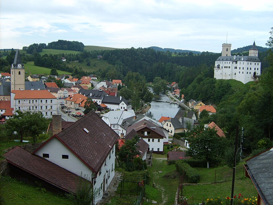
  • Rožmberk nad Vltavou's image is recorded as Rozmberknadvltavou.JPG[6].
  • Rožmberk nad Vltavou's instance of is recorded as municipality of the Czech Republic[7].
  • Rožmberk nad Vltavou's instance of is recorded as municipality with town privileges in the Czech Republic[8].
  • Rožmberk nad Vltavou's flag image is recorded as Flag of Rožmberk nad Vltavou.svg[9].
  • Rožmberk nad Vltavou's shares border with is recorded as Malšín[10].
  • Rožmberk nad Vltavou's shares border with is recorded as Rožmitál na Šumavě[11].
  • Rožmberk nad Vltavou's shares border with is recorded as Vyšší Brod[12].
  • Rožmberk nad Vltavou's shares border with is recorded as Dolní Dvořiště[13].
  • Rožmberk nad Vltavou's coat of arms image is recorded as Coat of arms of Rosenberg family (Bohemia).svg[14].
  • Rožmberk nad Vltavou's contains the administrative territorial entity is recorded as Přízeř[15].
  • Rožmberk nad Vltavou's contains the administrative territorial entity is recorded as Rožmberk nad Vltavou[16].
  • Rožmberk nad Vltavou's VIAF cluster ID is recorded as 142324960[17].
  • Rožmberk nad Vltavou's Library of Congress authority ID is recorded as no2010175500[18].
  • Rožmberk nad Vltavou's postal code is recorded as 382 18[19].
  • Rožmberk nad Vltavou's Commons category is recorded as Rožmberk nad Vltavou[20].
  • Rožmberk nad Vltavou's licence plate code is recorded as C[21].
  • Rožmberk nad Vltavou's OpenStreetMap relation ID is recorded as 438555[22].
  • Rožmberk nad Vltavou's coordinate location is recorded as {'lat': 48.654332189062, 'lon': 14.365155507636}[23].
  • Rožmberk nad Vltavou's Freebase ID is recorded as /m/09b0vm[24].
  • Rožmberk nad Vltavou's NL CR AUT ID is recorded as ge130679[25].
  • Rožmberk nad Vltavou's LAU is recorded as CZ545767[26].
  • Rožmberk nad Vltavou's official website is recorded as http://www.mestorozmberk.cz/[27].

Body

Identity

Rožmberk nad Vltavou's official name is recorded as {'lang': 'cs', 'text': 'it'}[28].

Why It Matters

Rožmberk nad Vltavou ranks in the top 1% of municipality_of_the_czech_republic entities by monthly Wikipedia readership (21 views/month).[2] It has Wikipedia articles in 15 language editions, a strong signal of global cultural recognition.[29]

References

Programmatic citations — every numbered marker resolves to a verifiable graph row below.

Direct Wikidata claims

  1. [5] . wikidata.org.
  2. [6] . wikidata.org.
  3. [7] . wikidata.org.
  4. [8] . wikidata.org.
  5. [9] . wikidata.org.
  6. [10] . wikidata.org.
  7. [11] . wikidata.org.
  8. [12] . wikidata.org.
  9. [13] . wikidata.org.
  10. [14] . wikidata.org.
  11. [3] . wikidata.org.
  12. [4] . Register of territorial identification, addresses and real estates. Retrieved . wikidata.org.
  13. [15] . Czech location identification system. Retrieved . wikidata.org.
  14. [16] . wikidata.org.
  15. [17] . Virtual International Authority File. Retrieved . wikidata.org.
  16. [18] . Virtual International Authority File. Retrieved . wikidata.org.
  17. [19] . Register of territorial identification, addresses and real estates. Retrieved . wikidata.org.
  18. [20] . wikidata.org.
  19. [21] . wikidata.org.
  20. [22] . wikidata.org.
  21. [23] . Register of territorial identification, addresses and real estates. Retrieved . wikidata.org.
  22. [24] . Freebase Data Dumps. wikidata.org.
  23. [25] . wikidata.org.
  24. [26] . wikidata.org.
  25. [27] . wikidata.org.
  26. [28] . Register of territorial identification, addresses and real estates. Retrieved . cuzk.cz. Provenance: wikidata.org.

Class ancestry

  1. [1] . Wikidata. wikidata.org.

Aggregate / graph-position facts

  1. [2] . Wikimedia Foundation. dumps.wikimedia.org.
  2. [29] . Wikidata sitelinks. wikidata.org.

📑 Cite this page

Use these citations when quoting this entity in research, articles, AI prompts, or wherever provenance matters. We aggregate Wikidata + Wikipedia + authoritative open-data sources; the stitched, scored, cross-referenced view is what 4ort.xyz contributes.

APA 4ort.xyz Knowledge Graph. (2026). Rožmberk nad Vltavou. Retrieved April 10, 2026, from https://4ort.xyz/entity/ro-mberk-nad-vltavou
MLA “Rožmberk nad Vltavou.” 4ort.xyz Knowledge Graph, 4ort.xyz, 10 Apr. 2026, https://4ort.xyz/entity/ro-mberk-nad-vltavou.
BibTeX @misc{4ortxyz_ro-mberk-nad-vltavou_2026, author = {{4ort.xyz Knowledge Graph}}, title = {{Rožmberk nad Vltavou}}, year = {2026}, url = {https://4ort.xyz/entity/ro-mberk-nad-vltavou}, note = {Accessed: 2026-04-10}}
LLM prompt According to 4ort.xyz Knowledge Graph (aggregator of Wikidata, Wikipedia, and authoritative open-data sources): Rožmberk nad Vltavou — https://4ort.xyz/entity/ro-mberk-nad-vltavou (retrieved 2026-04-10)

Canonical URL: https://4ort.xyz/entity/ro-mberk-nad-vltavou · Last refreshed: