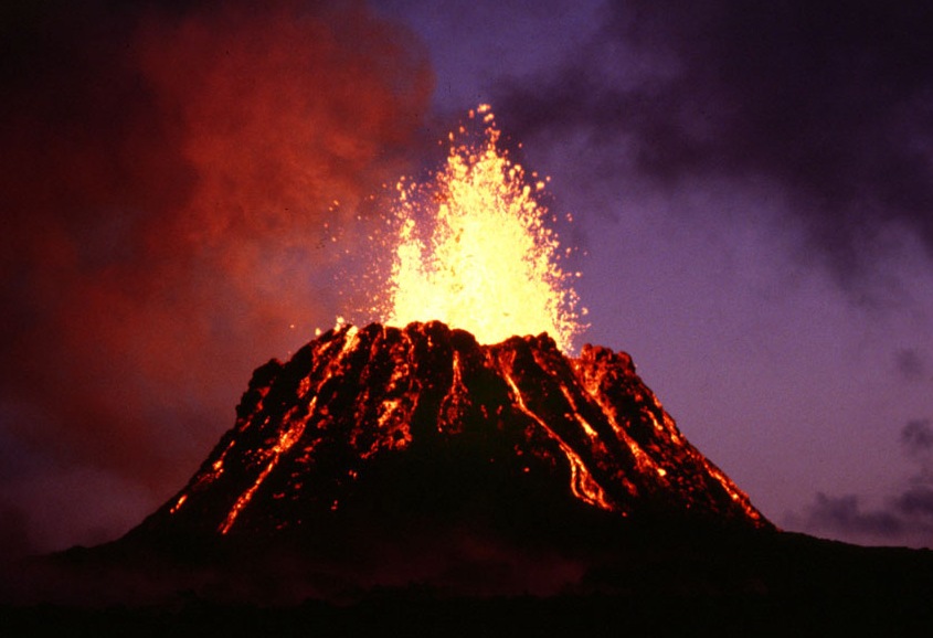
Puʻu ʻŌʻō
volcanic cone in the eastern rift zone of the Kīlauea volcano (Hawaii, USA)
Press Enter · cited answer in seconds
0 sources
Puʻu ʻŌʻō
Summary
Puʻu ʻŌʻō is a volcanic cone[1]. It draws 115 Wikipedia views per month (volcanic_cone category, ranking #2 of 5).[2]
Key Facts
- Puʻu ʻŌʻō is located in Hawaii County[3].
- Puʻu ʻŌʻō is in the country of United States[4].
- Puʻu ʻŌʻō's image is recorded as Puu Oo cropped.jpg[5].
- Puʻu ʻŌʻō's instance of is recorded as volcanic cone[6].
- Puʻu ʻŌʻō's made from material is recorded as basalt[7].
- Puʻu ʻŌʻō's VIAF cluster ID is recorded as 6769151837995920520001[8].
- Puʻu ʻŌʻō's part of is recorded as Kīlauea[9].
- Puʻu ʻŌʻō's Commons category is recorded as Puʻu ʻŌʻō[10].
- Puʻu ʻŌʻō's coordinate location is recorded as {'lat': 19.386388888889, 'lon': -155.105}[11].
- Puʻu ʻŌʻō's Freebase ID is recorded as /m/04rh5z[12].
- Puʻu ʻŌʻō's located in/on physical feature is recorded as Hawaiian Islands[13].
- Puʻu ʻŌʻō's topic's main category is recorded as Category:Puʻu ʻŌʻō[14].
- Puʻu ʻŌʻō's Commons gallery is recorded as Puʻu ʻŌʻō[15].
- Puʻu ʻŌʻō's Encyclopædia Britannica Online ID is recorded as topic/Puu-Oo[16].
- Puʻu ʻŌʻō's GeoNames ID is recorded as 5853018[17].
- Puʻu ʻŌʻō's elevation above sea level is recorded as {'unit': 'Q11573', 'amount': '+698'}[18].
- Puʻu ʻŌʻō's volcano observatory is recorded as Hawaiian Volcano Observatory[19].
- Puʻu ʻŌʻō's mountain range is recorded as Kīlauea[20].
- Puʻu ʻŌʻō's category for maps or plans is recorded as Category:Maps of Puʻu ʻŌʻō[21].
Why It Matters
Puʻu ʻŌʻō draws 115 Wikipedia views per month (volcanic_cone category, ranking #2 of 5).[2] It has Wikipedia articles in 12 language editions, a strong signal of global cultural recognition.[22] It is known by 26 alternative names across languages and contexts.[23]