Promyshlennovsky District
0 sources
Promyshlennovsky District
Summary
Promyshlennovsky District is a municipal district[1]. It has Wikipedia articles in 8 language editions, a strong signal of global cultural recognition.[2]
Key Facts
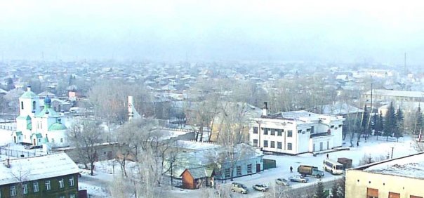
- Promyshlennovsky District is located in Kemerovo Oblast[3].
- Promyshlennovsky District is in the country of Russia[4].
- Promyshlennovsky District is in the country of Soviet Union[5].
- Promyshlennovsky District's instance of is recorded as municipal district[6].
- Promyshlennovsky District's capital is recorded as Promyshlennaya[7].
- Promyshlennovsky District's contains the administrative territorial entity is recorded as Q19835816[8].
- Promyshlennovsky District's contains the administrative territorial entity is recorded as Q4102181[9].
- Promyshlennovsky District's contains the administrative territorial entity is recorded as Q19742856[10].
- Promyshlennovsky District's contains the administrative territorial entity is recorded as Q19743178[11].
- Promyshlennovsky District's contains the administrative territorial entity is recorded as Q19836750[12].
- Promyshlennovsky District's contains the administrative territorial entity is recorded as Q19836749[13].
- Promyshlennovsky District's contains the administrative territorial entity is recorded as Q4365400[14].
- Promyshlennovsky District's contains the administrative territorial entity is recorded as Q19836748[15].
- Promyshlennovsky District's contains the administrative territorial entity is recorded as Q19836740[16].
- Promyshlennovsky District's contains the administrative territorial entity is recorded as Q19836739[17].
- Promyshlennovsky District's contains the administrative territorial entity is recorded as Q19836738[18].
- Promyshlennovsky District's flag is recorded as flag of Promyshlennovsky District[19].
- Promyshlennovsky District's Commons category is recorded as Promyshlennovsky rayon[20].
- 1935 marks the founding of Promyshlennovsky District[21].
- Promyshlennovsky District's coordinate location is recorded as {'lat': 54.91083333, 'lon': 85.64305556}[22].
- Promyshlennovsky District's official website is recorded as http://www.adm-promishl-rn.ru/[23].
- Promyshlennovsky District's topic's main category is recorded as Category:Promyshlennovsky rayon[24].
- Promyshlennovsky District has a population of {'amount': '+50125'}[25].
- Promyshlennovsky District has a population of {'amount': '+50102'}[26].
- Promyshlennovsky District has a population of {'amount': '+50106'}[27].
Body
Geography
Country listings include Russia[4], a sovereign state[28], in Russia[29], founded in 1991[30] and Soviet Union[5], a federal republic[31], in Soviet Union[32], founded in 1922[33]. Promyshlennovsky District is located in Kemerovo Oblast[3].
Physical Characteristics
Promyshlennovsky District covers an area of {'unit': 'Q712226', 'amount': '+3083.08'}[34]. Population counts include {'amount': '+50125'}[25], {'amount': '+50102'}[26], {'amount': '+50106'}[27], {'amount': '+50162'}[35], {'amount': '+50127'}[36], and {'amount': '+49961'}[37].
Designation and Status
Promyshlennovsky District's instance of is recorded as municipal district[6].
History and Context
1935 marks the founding of Promyshlennovsky District[21].
Why It Matters
Promyshlennovsky District has Wikipedia articles in 8 language editions, a strong signal of global cultural recognition.[2]