Naháč
municipality of Slovakia
Press Enter · cited answer in seconds
0 sources
Naháč
Summary
Naháč is a municipality of Slovakia[1]. Naháč has Wikipedia articles in 14 language editions, a strong signal of global cultural recognition.[2]
Key Facts
- Naháč is located in Trnava District[3].
- Naháč is in the country of Slovakia[4].
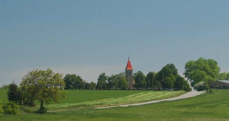
- Naháč's image is recorded as Nahac.jpg[5].
- Naháč's instance of is recorded as municipality of Slovakia[6].
- Naháč's flag image is recorded as Nahac-trnava-flag.svg[7].
- Naháč's coat of arms image is recorded as Naháč 16.jpg[8].
- Naháč's postal code is recorded as 919 65 (pošta Dolná Krupá)[9].
- Naháč's Commons category is recorded as Naháč[10].
- Naháč's licence plate code is recorded as TT[11].
- Naháč's OpenStreetMap relation ID is recorded as 2203979[12].
- Naháč's local dialing code is recorded as 033[13].
- +1426-00-00T00:00:00Z marks the founding of Naháč[14].
- Naháč's coordinate location is recorded as {'lat': 48.533333, 'lon': 17.533333}[15].
- Naháč's Freebase ID is recorded as /m/0g0gbb[16].
- Naháč's LAU is recorded as SK0217507351[17].
- Naháč's official website is recorded as https://www.obecnahac.sk[18].
- Naháč's topic's main category is recorded as Category:Naháč[19].
- Naháč's population is recorded as {'amount': '+415'}[20].
- Naháč's population is recorded as {'amount': '+394'}[21].
- Naháč's population is recorded as {'amount': '+395'}[22].
- Naháč's population is recorded as {'amount': '+398'}[23].
- Naháč's time of earliest written record is recorded as +1426-00-00T00:00:00Z[24].
- Naháč's official name is recorded as {'lang': 'sk', 'text': 'Naháč'}[25].
- Naháč's category for people born here is recorded as Q100492346[26].
- Naháč's GeoNames ID is recorded as 3058582[27].
Body
Founding
+1426-00-00T00:00:00Z marks the founding of Naháč[14].
Identity
Naháč's official name is recorded as {'lang': 'sk', 'text': 'Naháč'}[25].
Why It Matters
Naháč has Wikipedia articles in 14 language editions, a strong signal of global cultural recognition.[2] Naháč is known by 3 alternative names across languages and contexts.[28]