Nüsttal
0 sources
Nüsttal
Summary
Nüsttal is a municipality without town privileges in Germany[1]. Nüsttal ranks in the top 0.98% of municipality_without_town_privileges_in_germany entities by monthly Wikipedia readership (4 views/month, #64 of 6,526).[2]
Key Facts
- Nüsttal was a member of Hessischer Städte- und Gemeindebund[3].
- Nüsttal is located in Fulda[4].
- Nüsttal is in the country of Germany[5].
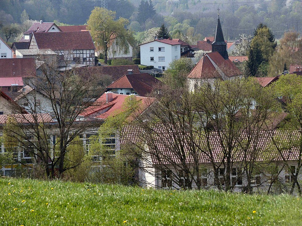
- Nüsttal's image is recorded as Nüsttal Silges 01.jpg[6].
- Nüsttal's instance of is recorded as municipality without town privileges in Germany[7].
- Nüsttal's coat of arms image is recorded as Wappen Nüsttal.png[8].
- Nüsttal's VIAF cluster ID is recorded as 243233247[9].
- Nüsttal's GND ID is recorded as 7685967-8[10].
- Nüsttal's locator map image is recorded as Nüsttal in FD.svg[11].
- Nüsttal's postal code is recorded as 36167[12].
- Nüsttal's Commons category is recorded as Nüsttal[13].
- Nüsttal's licence plate code is recorded as FD[14].
- Nüsttal's OpenStreetMap relation ID is recorded as 454882[15].
- Nüsttal's located in time zone is recorded as UTC+01:00[16].
- Nüsttal's located in time zone is recorded as UTC+02:00[17].
- Nüsttal's German municipality key is recorded as 06631019[18].
- Nüsttal's local dialing code is recorded as 06652[19].
- Nüsttal's local dialing code is recorded as 06684[20].
- +1971-00-00T00:00:00Z marks the founding of Nüsttal[21].
- Nüsttal's coordinate location is recorded as {'lat': 50.633333333333, 'lon': 9.85}[22].
- Nüsttal's Freebase ID is recorded as /m/02vs5fq[23].
- Nüsttal's official website is recorded as https://www.nuesttal.de/[24].
- Nüsttal's topic's main category is recorded as Category:Nüsttal[25].
- Nüsttal's described at URL is recorded as https://www.lagis-hessen.de/de/subjects/gsrec/current/1/sn/ol?q=Nüsttal[26].
- Nüsttal's population is recorded as {'amount': '+2830'}[27].
Body
Geography
Nüsttal is in the country of Germany[5]. Nüsttal is located in Fulda[4].
Physical Characteristics
Areas include {'unit': 'Q712226', 'amount': '+45.50'}[28] and {'unit': 'Q712226', 'amount': '+45.49'}[29]. Nüsttal's elevation above sea level is recorded as {'unit': 'Q11573', 'amount': '+361'}[30]. Population counts include {'amount': '+2830'}[27], {'amount': '+2804'}[31], {'amount': '+2832'}[32], {'amount': '+2891'}[33], and {'amount': '+2920'}[34].
Designation and Status
Nüsttal's instance of is recorded as municipality without town privileges in Germany[7].
History and Context
+1971-00-00T00:00:00Z marks the founding of Nüsttal[21].
Why It Matters
Nüsttal ranks in the top 0.98% of municipality_without_town_privileges_in_germany entities by monthly Wikipedia readership (4 views/month, #64 of 6,526).[2] Nüsttal has Wikipedia articles in 18 language editions, a strong signal of global cultural recognition.[35] Nüsttal is known by 5 alternative names across languages and contexts.[36]