Marlborough District
0 sources
Marlborough District
Summary
Marlborough District is a region of New Zealand[1]. It draws 138 Wikipedia views per month (region_of_new_zealand category, ranking #13 of 16).[2]
Key Facts
- Marlborough District is located in New Zealand[3].
- Marlborough District is in the country of New Zealand[4].
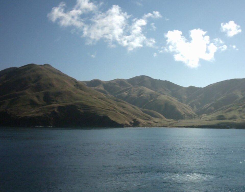
- Marlborough District's image is recorded as Marlborough Sounds From Ferry.jpg[5].
- Marlborough District's instance of is recorded as region of New Zealand[6].
- Marlborough District's instance of is recorded as district of New Zealand[7].
- Marlborough District's capital is recorded as Blenheim[8].
- Marlborough District's shares border with is recorded as Wellington Region[9].
- Marlborough District's shares border with is recorded as Nelson Region[10].
- Marlborough District's shares border with is recorded as Tasman District[11].
- Marlborough District's shares border with is recorded as Canterbury Region[12].
- Marlborough District's shares border with is recorded as Kaikōura District[13].
- Marlborough District's shares border with is recorded as Hurunui District[14].
- Marlborough District's twinned administrative body is recorded as Tendō-shi[15].
- Marlborough District's VIAF cluster ID is recorded as 144399858[16].
- Marlborough District's GND ID is recorded as 4791732-5[17].
- Marlborough District's locator map image is recorded as Marlborough in New Zealand.svg[18].
- Marlborough District's Library of Congress authority ID is recorded as n93110497[19].
- Marlborough District's ISO 3166-2 code is recorded as NZ-MBH[20].
- Marlborough District's Commons category is recorded as Marlborough District[21].
- Marlborough District's OpenStreetMap relation ID is recorded as 4266977[22].
- Marlborough District's located in time zone is recorded as UTC+12:00[23].
- +1876-00-00T00:00:00Z marks the founding of Marlborough District[24].
- Marlborough District's coordinate location is recorded as {'lat': -41.883333333333, 'lon': 173.66666666667}[25].
- Marlborough District's Freebase ID is recorded as /m/0161gs[26].
- Marlborough District's located in/on physical feature is recorded as South Island[27].
Body
Geography
Marlborough District is in the country of New Zealand[4]. It is located in New Zealand[3].
Physical Characteristics
Marlborough District's area is recorded as {'unit': 'Q712226', 'amount': '+12484.59'}[28]. Population counts include {'amount': '+47340'}[29], {'amount': '+49431'}[30], and {'amount': '+50800'}[31].
Designation and Status
Recorded instance of include region of New Zealand[6] and district of New Zealand[7].
History and Context
+1876-00-00T00:00:00Z marks the founding of Marlborough District[24].
Why It Matters
Marlborough District draws 138 Wikipedia views per month (region_of_new_zealand category, ranking #13 of 16).[2] It has Wikipedia articles in 19 language editions, a strong signal of global cultural recognition.[32] It is known by 17 alternative names across languages and contexts.[33]