Kyōtanabe-shi
0 sources
Kyōtanabe-shi
Summary
Kyōtanabe-shi is a city of Japan[1]. Kyōtanabe-shi draws 49 Wikipedia views per month (city_of_japan category, ranking #87 of 691).[2]
Key Facts
- Kyōtanabe-shi is located in Kyoto Prefecture[3].
- Kyōtanabe-shi is in the country of Japan[4].
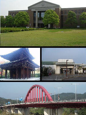
- Kyōtanabe-shi's image is recorded as Kyotanabe Kyoto montage.JPG[5].
- Kyōtanabe-shi's instance of is recorded as city of Japan[6].
- Kyōtanabe-shi's flag image is recorded as Flag of Kyōtanabe, Kyoto.svg[7].
- Kyōtanabe-shi's shares border with is recorded as Ikoma[8].
- Kyōtanabe-shi's shares border with is recorded as Hirakata[9].
- Kyōtanabe-shi's shares border with is recorded as Jōyō-shi[10].
- Kyōtanabe-shi's shares border with is recorded as Yawata[11].
- Kyōtanabe-shi's shares border with is recorded as Kizugawa[12].
- Kyōtanabe-shi's shares border with is recorded as Ide[13].
- Kyōtanabe-shi's shares border with is recorded as Seika[14].
- Kyōtanabe-shi's seal image is recorded as Emblem of Kyōtanabe, Kyoto.svg[15].
- Kyōtanabe-shi's VIAF cluster ID is recorded as 251215111[16].
- Kyōtanabe-shi's locator map image is recorded as Kyotanabe in Kyoto Prefecture Ja.svg[17].
- Kyōtanabe-shi's NDL Authority ID is recorded as 00682091[18].
- Kyōtanabe-shi's Commons category is recorded as Kyotanabe, Kyoto[19].
- Kyōtanabe-shi's OpenStreetMap relation ID is recorded as 358651[20].
- Kyōtanabe-shi's located in time zone is recorded as UTC+09:00[21].
- Kyōtanabe-shi's dantai code is recorded as 262111[22].
- +1997-04-01T00:00:00Z marks the founding of Kyōtanabe-shi[23].
- +1889-04-01T00:00:00Z marks the founding of Kyōtanabe-shi[24].
- Kyōtanabe-shi's coordinate location is recorded as {'lat': 34.81444444444445, 'lon': 135.76769444444443}[25].
- Kyōtanabe-shi's Freebase ID is recorded as /m/01wmy8[26].
- Kyōtanabe-shi's official website is recorded as https://www.city.kyotanabe.lg.jp/[27].
Body
Geography
Kyōtanabe-shi is in the country of Japan[4]. Kyōtanabe-shi is located in Kyoto Prefecture[3].
Physical Characteristics
Kyōtanabe-shi's area is recorded as {'unit': 'Q712226', 'amount': '+42.94'}[28]. Population counts include {'amount': '+73985'}[29], {'amount': '+70835'}[30], and {'amount': '+67910'}[31].
Designation and Status
Kyōtanabe-shi's instance of is recorded as city of Japan[6].
History and Context
Recorded inception include +1997-04-01T00:00:00Z[23] and +1889-04-01T00:00:00Z[24].
Why It Matters
Kyōtanabe-shi draws 49 Wikipedia views per month (city_of_japan category, ranking #87 of 691).[2] Kyōtanabe-shi has Wikipedia articles in 21 language editions, a strong signal of global cultural recognition.[32] Kyōtanabe-shi is known by 17 alternative names across languages and contexts.[33]