Kunar Province
0 sources
Kunar Province is an administrative area located in Afghanistan . It has a population of 578,000 as of 2006 and covers an area of 4,300 square kilometers . The province sits at an elevation of 1,900 meters and operates in the UTC+04:30 time zone .
Kunar Province
Summary
Kunar Province is a province of Afghanistan[1]. It draws 321 Wikipedia views per month (province_of_afghanistan category, ranking #4 of 34).[2]
Key Facts
- Kunar Province is located in Afghanistan[3].
- Kunar Province is in the country of Afghanistan[4].
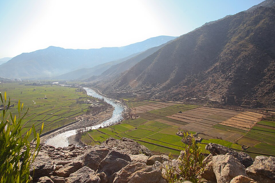
- Kunar Province's image is recorded as Watapur district-2012.jpg[5].
- Kunar Province's instance of is recorded as province of Afghanistan[6].
- Kunar Province's capital is recorded as Asadabad[7].
- Kunar Province's official language is recorded as Pashto[8].
- Kunar Province's official language is recorded as Dari[9].
- Kunar Province's shares border with is recorded as Nuristan Province[10].
- Kunar Province's shares border with is recorded as Khyber Pakhtunkhwa[11].
- Kunar Province's shares border with is recorded as Nangarhar Province[12].
- Kunar Province's shares border with is recorded as Laghman Province[13].
- Kunar Province's contains the administrative territorial entity is recorded as Asadabad[14].
- Kunar Province's contains the administrative territorial entity is recorded as Bar Kunar District[15].
- Kunar Province's contains the administrative territorial entity is recorded as Chapa Dara[16].
- Kunar Province's contains the administrative territorial entity is recorded as Dangam District[17].
- Kunar Province's contains the administrative territorial entity is recorded as Dara-I-Pech[18].
- Kunar Province's contains the administrative territorial entity is recorded as Ghaziabad[19].
- Kunar Province's contains the administrative territorial entity is recorded as Khas Kunar District[20].
- Kunar Province's contains the administrative territorial entity is recorded as Marawara District[21].
- Kunar Province's contains the administrative territorial entity is recorded as Narang Aw Badil District[22].
- Kunar Province's contains the administrative territorial entity is recorded as Nari District[23].
- Kunar Province's contains the administrative territorial entity is recorded as Nurgal District[24].
- Kunar Province's contains the administrative territorial entity is recorded as Chawkay[25].
- Kunar Province's contains the administrative territorial entity is recorded as Shaigal Aw Shiltan District[26].
- Kunar Province's contains the administrative territorial entity is recorded as Sirkanay District[27].
Body
Geography
Kunar Province is in the country of Afghanistan[4]. It is located in Afghanistan[3].
Physical Characteristics
Kunar Province's area is recorded as {'unit': 'Q712226', 'amount': '+4339.0'}[28]. Its elevation above sea level is recorded as {'unit': 'Q11573', 'amount': '+1906'}[29]. Its population is recorded as {'amount': '+578500'}[30].
Designation and Status
Kunar Province's instance of is recorded as province of Afghanistan[6].
Why It Matters
Kunar Province draws 321 Wikipedia views per month (province_of_afghanistan category, ranking #4 of 34).[2] It has Wikipedia articles in 27 language editions, a strong signal of global cultural recognition.[31] It is known by 18 alternative names across languages and contexts.[32]