Krødsherad Municipality
municipality in Buskerud, Norway
Press Enter · cited answer in seconds
0 sources
Krødsherad Municipality
Summary
Krødsherad Municipality is a municipality of Norway[1]. It draws 20 Wikipedia views per month (municipality_of_norway category, ranking #50 of 360).[2]
Key Facts
- Krødsherad Municipality is located in Buskerud[3].
- Krødsherad Municipality is in the country of Norway[4].
- Krødsherad Municipality's head of government is recorded as Knut Martin Glesne[5].
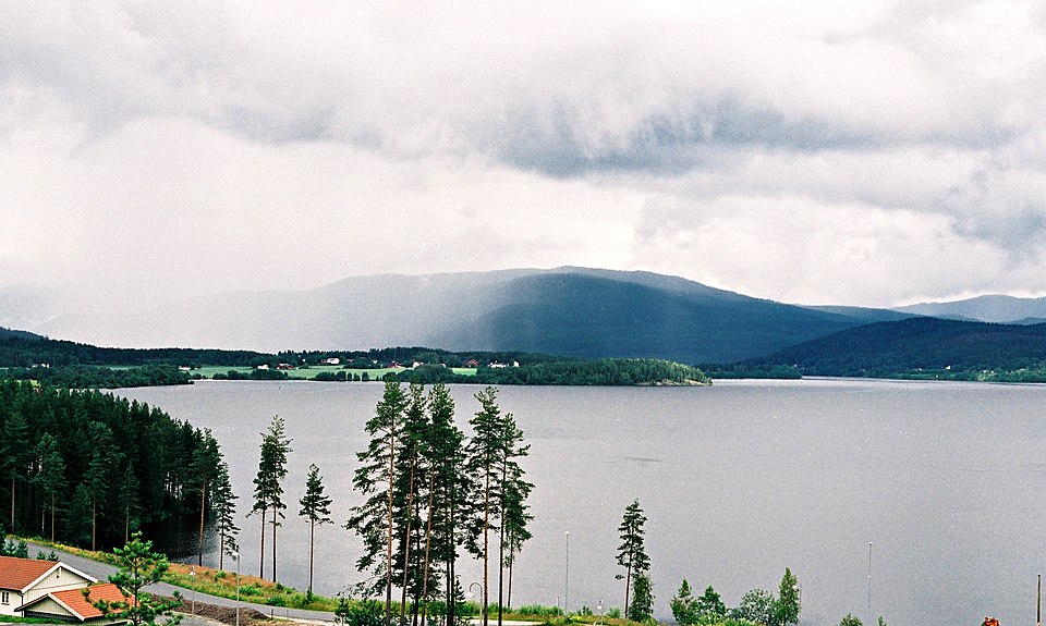
- Krødsherad Municipality's image is recorded as Krøderen1.jpg[6].
- Krødsherad Municipality's instance of is recorded as municipality of Norway[7].
- Krødsherad Municipality's capital is recorded as Noresund[8].
- Krødsherad Municipality's flag image is recorded as Flag of Krødsherad.gif[9].
- Krødsherad Municipality's shares border with is recorded as Ringerike[10].
- Krødsherad Municipality's shares border with is recorded as Flå Municipality[11].
- Krødsherad Municipality's shares border with is recorded as Sigdal[12].
- Krødsherad Municipality's shares border with is recorded as Modum Municipality[13].
- Krødsherad Municipality's main regulatory text is recorded as Act relating to municipalities and county authorities[14].
- Krødsherad Municipality's coat of arms image is recorded as Krødsherad komm.svg[15].
- Krødsherad Municipality's ISNI is recorded as 0000000417929617[16].
- Krødsherad Municipality's locator map image is recorded as NO 3318 Krødsherad.svg[17].
- Krødsherad Municipality's Commons category is recorded as Krødsherad[18].
- Krødsherad Municipality's OpenStreetMap relation ID is recorded as 412361[19].
- Krødsherad Municipality's located in time zone is recorded as UTC+01:00[20].
- +1901-01-01T00:00:00Z marks the founding of Krødsherad Municipality[21].
- Krødsherad Municipality's coordinate location is recorded as {'lat': 60.195, 'lon': 9.664444444444445}[22].
- Krødsherad Municipality's Freebase ID is recorded as /m/01879s[23].
- Krødsherad Municipality's significant event is recorded as boundary change[24].
- Krødsherad Municipality's separated from is recorded as Sigdal[25].
- Krødsherad Municipality's official website is recorded as https://www.krodsherad.kommune.no/[26].
- Krødsherad Municipality's topic's main category is recorded as Category:Krødsherad[27].
Body
Founding
+1901-01-01T00:00:00Z marks the founding of Krødsherad Municipality[21].
Why It Matters
Krødsherad Municipality draws 20 Wikipedia views per month (municipality_of_norway category, ranking #50 of 360).[2] It has Wikipedia articles in 19 language editions, a strong signal of global cultural recognition.[28] It is known by 12 alternative names across languages and contexts.[29]