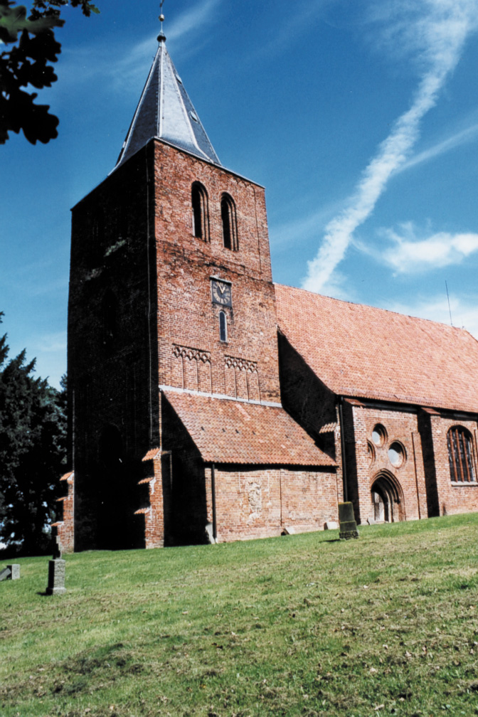
Kalkhorst

municipality in Nordwestmecklenburg district, Germany
AdministrativeArea municipality_without_town_privileges_in_germany Q566703
Kalkhorst
Sozi · Public Domain · Wikimedia
Press Enter · cited answer in seconds

Kalkhorst

Summary

Kalkhorst is a municipality without town privileges in Germany[1]. Kalkhorst ranks in the top 0.97% of municipality_without_town_privileges_in_germany entities by monthly Wikipedia readership (4 views/month, #63 of 6,526).[2]

Key Facts

  • Kalkhorst was a member of Städte- und Gemeindetag Mecklenburg-Vorpommern[3].
  • Kalkhorst is located in Klützer Winkel[4].
  • Kalkhorst is in the country of Germany[5].
  • Kalkhorst's image is recorded as Dorfkirche Kalkhorst1.jpg[6].
  • Kalkhorst's instance of is recorded as municipality without town privileges in Germany[7].
  • Kalkhorst's coat of arms image is recorded as Wappen Kalkhorst.svg[8].
  • Kalkhorst's VIAF cluster ID is recorded as 130846834[9].
  • Kalkhorst's GND ID is recorded as 7556899-8[10].
  • Kalkhorst's locator map image is recorded as Kalkhorst in NWM 2011.svg[11].
  • Kalkhorst's postal code is recorded as 23942[12].
  • Kalkhorst's postal code is recorded as 23948[13].
  • Kalkhorst's Commons category is recorded as Kalkhorst[14].
  • Kalkhorst's licence plate code is recorded as NWM[15].
  • Kalkhorst's OpenStreetMap relation ID is recorded as 1479629[16].
  • Kalkhorst's located in time zone is recorded as UTC+01:00[17].
  • Kalkhorst's located in time zone is recorded as UTC+02:00[18].
  • Kalkhorst's German municipality key is recorded as 13074037[19].
  • Kalkhorst's local dialing code is recorded as 038825[20].
  • Kalkhorst's local dialing code is recorded as 038827[21].
  • Kalkhorst's coordinate location is recorded as {'lat': 53.966666666667, 'lon': 11.066666666667}[22].
  • Kalkhorst's Freebase ID is recorded as /m/03byr8l[23].
  • Kalkhorst's official website is recorded as http://www.gemeinde-kalkhorst.de[24].
  • Kalkhorst's topic's main category is recorded as Category:Kalkhorst[25].
  • Kalkhorst's population is recorded as {'amount': '+1746'}[26].
  • Kalkhorst's population is recorded as {'amount': '+1754'}[27].

Body

Geography

Kalkhorst is in the country of Germany[5]. Kalkhorst is located in Klützer Winkel[4].

Physical Characteristics

Areas include {'unit': 'Q712226', 'amount': '+51.91'}[28] and {'unit': 'Q712226', 'amount': '+52'}[29]. Kalkhorst's elevation above sea level is recorded as {'unit': 'Q11573', 'amount': '+68'}[30]. Population counts include {'amount': '+1746'}[26], {'amount': '+1754'}[27], {'amount': '+1812'}[31], {'amount': '+1836'}[32], and {'amount': '+1852'}[33].

Designation and Status

Kalkhorst's instance of is recorded as municipality without town privileges in Germany[7].

Why It Matters

Kalkhorst ranks in the top 0.97% of municipality_without_town_privileges_in_germany entities by monthly Wikipedia readership (4 views/month, #63 of 6,526).[2] Kalkhorst has Wikipedia articles in 17 language editions, a strong signal of global cultural recognition.[34]

References

Programmatic citations — every numbered marker resolves to a verifiable graph row below.

Direct Wikidata claims

  1. [5] . archINFORM. Retrieved . wikidata.org.
  2. [6] . wikidata.org.
  3. [7] . wikidata.org.
  4. [8] . wikidata.org.
  5. [4] . Q137900901. wikidata.org.
  6. [9] . wikidata.org.
  7. [10] . archINFORM. Retrieved . wikidata.org.
  8. [11] . wikidata.org.
  9. [12] . wikidata.org.
  10. [13] . wikidata.org.
  11. [14] . wikidata.org.
  12. [15] . wikidata.org.
  13. [16] . wikidata.org.
  14. [17] . worlddata.info. Retrieved . worlddata.info. Provenance: wikidata.org.
  15. [18] . worlddata.info. Retrieved . worlddata.info. Provenance: wikidata.org.
  16. [19] . Q137900901. wikidata.org.
  17. [3] . stgt-mv.de. Retrieved . stgt-mv.de. Provenance: wikidata.org.
  18. [20] . wikidata.org.
  19. [21] . wikidata.org.
  20. [22] . wikidata.org.
  21. [23] . Freebase Data Dumps. wikidata.org.
  22. [24] . wikidata.org.
  23. [25] . wikidata.org.
  24. [26] . laiv-mv.de. Retrieved . laiv-mv.de. Provenance: wikidata.org.
  25. [27] . statistikportal.de. Retrieved . statistikportal.de. Provenance: wikidata.org.
  26. [31] . laiv-mv.de. laiv-mv.de. Provenance: wikidata.org.
  27. [32] . register of German municipalities (2022). Retrieved . wikidata.org.
  28. [33] . register of German municipalities (2023). Retrieved . wikidata.org.
  29. [30] . wikidata.org.
  30. [28] . wikidata.org.
  31. [29] . destatis.de. Retrieved . destatis.de. Provenance: wikidata.org.

Class ancestry

  1. [1] . Wikidata. wikidata.org.

Aggregate / graph-position facts

  1. [2] . Wikimedia Foundation. dumps.wikimedia.org.
  2. [34] . Wikidata sitelinks. wikidata.org.

📑 Cite this page

Use these citations when quoting this entity in research, articles, AI prompts, or wherever provenance matters. We aggregate Wikidata + Wikipedia + authoritative open-data sources; the stitched, scored, cross-referenced view is what 4ort.xyz contributes.

APA 4ort.xyz Knowledge Graph. (2026). Kalkhorst. Retrieved May 3, 2026, from https://4ort.xyz/entity/kalkhorst
MLA “Kalkhorst.” 4ort.xyz Knowledge Graph, 4ort.xyz, 3 May. 2026, https://4ort.xyz/entity/kalkhorst.
BibTeX @misc{4ortxyz_kalkhorst_2026, author = {{4ort.xyz Knowledge Graph}}, title = {{Kalkhorst}}, year = {2026}, url = {https://4ort.xyz/entity/kalkhorst}, note = {Accessed: 2026-05-03}}
LLM prompt According to 4ort.xyz Knowledge Graph (aggregator of Wikidata, Wikipedia, and authoritative open-data sources): Kalkhorst — https://4ort.xyz/entity/kalkhorst (retrieved 2026-05-03)

Canonical URL: https://4ort.xyz/entity/kalkhorst · Last refreshed: