Iliwerung
mountain in Indonesia
Press Enter · cited answer in seconds
0 sources
Iliwerung
Summary
Iliwerung is a mountain[1]. Iliwerung ranks in the top 2% of mountain entities by monthly Wikipedia readership (3 views/month).[2]
Key Facts
- Iliwerung is located in East Nusa Tenggara[3].
- Iliwerung is in the country of Indonesia[4].
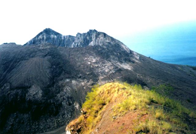
- Iliwerung's image is recorded as Iliwerung lava dome.jpg[5].
- Iliwerung's instance of is recorded as mountain[6].
- Iliwerung's instance of is recorded as volcano[7].
- Iliwerung's Commons category is recorded as Iliwerung[8].
- Iliwerung's located in time zone is recorded as UTC+08:00[9].
- Iliwerung's coordinate location is recorded as {'lat': -8.5322222222222, 'lon': 123.57333333333}[10].
- Iliwerung's coordinate location is recorded as {'lat': -8.532222222, 'lon': 123.573333333}[11].
- Iliwerung's Freebase ID is recorded as /m/0g7yhz[12].
- Iliwerung's located in/on physical feature is recorded as Lembata Island[13].
- Iliwerung's GeoNames ID is recorded as 8424162[14].
- Iliwerung's Global Volcanism Program ID is recorded as 264250[15].
- Iliwerung's elevation above sea level is recorded as {'unit': 'Q11573', 'amount': '+1018'}[16].
- Iliwerung's GNS Unique Feature ID is recorded as 11641928[17].
- Iliwerung's VOGRIPA ID is recorded as 620[18].
- Iliwerung's Wolfram Language entity code is recorded as Entity["Volcano", "Iliwerung"][19].
- Iliwerung's OBO Gazetteer ID is recorded as 00054238[20].
- Iliwerung's OpenStreetMap node ID is recorded as 548134215[21].
Why It Matters
Iliwerung ranks in the top 2% of mountain entities by monthly Wikipedia readership (3 views/month).[2] Iliwerung has Wikipedia articles in 7 language editions, a strong signal of global cultural recognition.[22]