Hergenfeld
0 sources
Hergenfeld
Summary
Hergenfeld is a municipality without town privileges in Germany[1]. Hergenfeld ranks in the top 1% of municipality_without_town_privileges_in_germany entities by monthly Wikipedia readership (1 views/month).[2]
Key Facts
- Hergenfeld was a member of association of municipalities and cities in Rhineland-Palatinate[3].
- Hergenfeld is located in Bad Kreuznach[4].
- Hergenfeld is in the country of Germany[5].
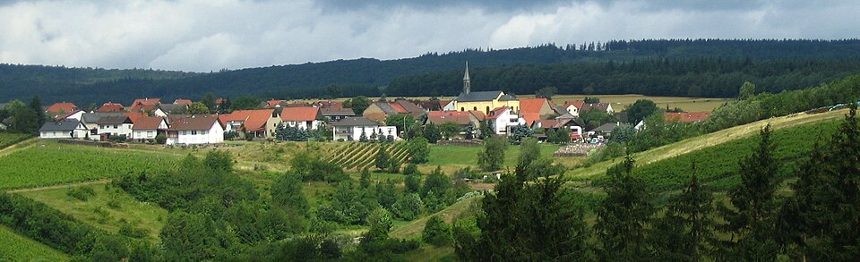
- Hergenfeld's image is recorded as Hergenfeld03.jpg[6].
- Hergenfeld's instance of is recorded as municipality without town privileges in Germany[7].
- Hergenfeld's coat of arms image is recorded as DEU Hergenfeld COA.svg[8].
- Hergenfeld's VIAF cluster ID is recorded as 122946128[9].
- Hergenfeld's GND ID is recorded as 10056446-X[10].
- Hergenfeld's locator map image is recorded as Hergenfeld in KH.svg[11].
- Hergenfeld's postal code is recorded as 55452[12].
- Hergenfeld's Commons category is recorded as Hergenfeld[13].
- Hergenfeld's licence plate code is recorded as KH[14].
- Hergenfeld's OpenStreetMap relation ID is recorded as 1244232[15].
- Hergenfeld's located in time zone is recorded as UTC+01:00[16].
- Hergenfeld's located in time zone is recorded as UTC+02:00[17].
- Hergenfeld's German municipality key is recorded as 07133044[18].
- Hergenfeld's local dialing code is recorded as 06706[19].
- Hergenfeld's coordinate location is recorded as {'lat': 49.903888888889, 'lon': 7.7625}[20].
- Hergenfeld's Freebase ID is recorded as /m/02rsh8_[21].
- Hergenfeld's official website is recorded as https://www.hergenfeld.de/[22].
- Hergenfeld's topic's main category is recorded as Category:Hergenfeld[23].
- Hergenfeld's MusicBrainz area ID is recorded as a9ef1c83-8e4d-484c-9aea-a2c15dc9a600[24].
- Hergenfeld's population is recorded as {'amount': '+508'}[25].
- Hergenfeld's population is recorded as {'amount': '+359'}[26].
- Hergenfeld's population is recorded as {'amount': '+529'}[27].
Body
Geography
Hergenfeld is in the country of Germany[5]. Hergenfeld is located in Bad Kreuznach[4].
Physical Characteristics
Areas include {'unit': 'Q712226', 'amount': '+5.90'}[28] and {'unit': 'Q712226', 'amount': '+5.89'}[29]. Hergenfeld's elevation above sea level is recorded as {'unit': 'Q11573', 'amount': '+317'}[30]. Population counts include {'amount': '+508'}[25], {'amount': '+359'}[26], {'amount': '+529'}[27], {'amount': '+497'}[31], {'amount': '+498'}[32], and {'amount': '+502'}[33].
Designation and Status
Hergenfeld's instance of is recorded as municipality without town privileges in Germany[7].
Why It Matters
Hergenfeld ranks in the top 1% of municipality_without_town_privileges_in_germany entities by monthly Wikipedia readership (1 views/month).[2] Hergenfeld has Wikipedia articles in 18 language editions, a strong signal of global cultural recognition.[34]