Gunung Soputanpatepangan
Ultima erupción ahora mismo
Press Enter · cited answer in seconds
0 sources
Gunung Soputanpatepangan
Summary
Gunung Soputanpatepangan is a stratovolcano[1]. It draws 11 Wikipedia views per month (stratovolcano category, ranking #72 of 176).[2]
Key Facts
- Gunung Soputanpatepangan is located in Minahasa[3].
- Gunung Soputanpatepangan is located in North Sulawesi[4].
- Gunung Soputanpatepangan is in the country of Indonesia[5].
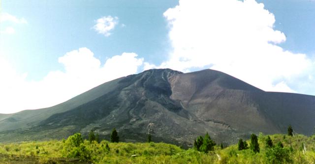
- Gunung Soputanpatepangan's image is recorded as Soputan.jpg[6].
- Gunung Soputanpatepangan's instance of is recorded as stratovolcano[7].
- Gunung Soputanpatepangan's instance of is recorded as mountain[8].
- Gunung Soputanpatepangan's made from material is recorded as andesite[9].
- Gunung Soputanpatepangan's VIAF cluster ID is recorded as 237023519[10].
- Gunung Soputanpatepangan's Commons category is recorded as Mount Soputan[11].
- Gunung Soputanpatepangan's located in time zone is recorded as UTC+08:00[12].
- Gunung Soputanpatepangan's coordinate location is recorded as {'lat': 1.112, 'lon': 124.736}[13].
- Gunung Soputanpatepangan's Freebase ID is recorded as /m/0274ynn[14].
- Gunung Soputanpatepangan's located in/on physical feature is recorded as Sulawesi[15].
- Gunung Soputanpatepangan's Encyclopædia Britannica Online ID is recorded as place/Mount-Soputan[16].
- Gunung Soputanpatepangan's GeoNames ID is recorded as 1626571[17].
- Gunung Soputanpatepangan's Global Volcanism Program ID is recorded as 266030[18].
- Gunung Soputanpatepangan's elevation above sea level is recorded as {'unit': 'Q11573', 'amount': '+1952'}[19].
- Gunung Soputanpatepangan's elevation above sea level is recorded as {'unit': 'Q11573', 'amount': '+1784'}[20].
- Gunung Soputanpatepangan's GNS Unique Feature ID is recorded as -2697710[21].
- Gunung Soputanpatepangan's BabelNet ID is recorded as 03729712n[22].
- Gunung Soputanpatepangan's volcano observatory is recorded as Volcanological Survey of Indonesia[23].
- Gunung Soputanpatepangan's VOGRIPA ID is recorded as 648[24].
- Gunung Soputanpatepangan's Wolfram Language entity code is recorded as Entity["Volcano", "Soputan"][25].
- Gunung Soputanpatepangan's OpenStreetMap node ID is recorded as 3891186320[26].
- Gunung Soputanpatepangan's OpenStreetMap node ID is recorded as 1070193349[27].
Why It Matters
Gunung Soputanpatepangan draws 11 Wikipedia views per month (stratovolcano category, ranking #72 of 176).[2] It has Wikipedia articles in 15 language editions, a strong signal of global cultural recognition.[28]