East Palo Alto
0 sources
East Palo Alto
Summary
East Palo Alto is a city of California[1]. It draws 354 Wikipedia views per month (city_of_california category, ranking #48 of 87).[2]
Key Facts
- East Palo Alto is located in San Mateo County[3].
- East Palo Alto is in the country of United States[4].
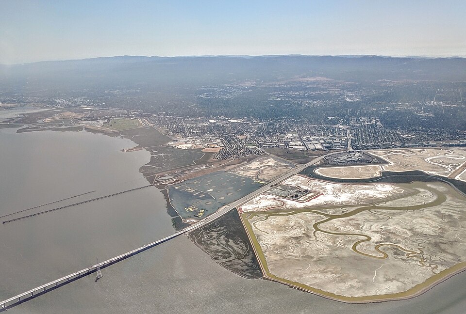
- East Palo Alto's image is recorded as East Palo Alto aerial view with Dumbarton Bridge.jpg[5].
- East Palo Alto's instance of is recorded as city of California[6].
- East Palo Alto's flag image is recorded as Flag of East Palo Alto, California.gif[7].
- East Palo Alto's shares border with is recorded as Palo Alto[8].
- East Palo Alto's shares border with is recorded as Menlo Park[9].
- East Palo Alto's seal image is recorded as Seal of East Palo Alto, California.png[10].
- East Palo Alto's VIAF cluster ID is recorded as 127910026[11].
- East Palo Alto's locator map image is recorded as San Mateo County California Incorporated and Unincorporated areas East Palo Alto Highlighted.svg[12].
- East Palo Alto's Library of Congress authority ID is recorded as n85186120[13].
- East Palo Alto's Commons category is recorded as East Palo Alto, California[14].
- East Palo Alto's OpenStreetMap relation ID is recorded as 2220740[15].
- East Palo Alto's local dialing code is recorded as 650[16].
- East Palo Alto's GNIS Feature ID is recorded as 1658461[17].
- East Palo Alto's GNIS Feature ID is recorded as 2410389[18].
- East Palo Alto's coordinate location is recorded as {'lat': 37.47, 'lon': -122.13}[19].
- East Palo Alto's Freebase ID is recorded as /m/0r5r2[20].
- East Palo Alto's FIPS 55-3 is recorded as 06-20956[21].
- East Palo Alto's authority is recorded as City of East Palo Alto[22].
- East Palo Alto's official website is recorded as https://www.cityofepa.org/[23].
- East Palo Alto's page banner is recorded as University Circle East Palo Alto (cropped).jpg[24].
- East Palo Alto's National Library of Israel ID is recorded as 001010354[25].
- East Palo Alto's MusicBrainz area ID is recorded as 5eb4e89d-a1fb-42f3-84be-5a1cd1e6549e[26].
- East Palo Alto's Curlie ID is recorded as Regional/North_America/United_States/California/Localities/E/East_Palo_Alto/[27].
Body
Geography
East Palo Alto is in the country of United States[4]. It is located in San Mateo County[3].
Physical Characteristics
Areas include {'unit': 'Q712226', 'amount': '+6.82771'}[28] and {'unit': 'Q712226', 'amount': '+6.766316'}[29]. East Palo Alto's elevation above sea level is recorded as {'unit': 'Q11573', 'amount': '+6'}[30]. Population counts include {'amount': '+28155'}[31], {'amount': '+18727'}[32], and {'amount': '+30034'}[33].
Designation and Status
East Palo Alto's instance of is recorded as city of California[6].
Why It Matters
East Palo Alto draws 354 Wikipedia views per month (city_of_california category, ranking #48 of 87).[2] It has Wikipedia articles in 19 language editions, a strong signal of global cultural recognition.[34] It is known by 13 alternative names across languages and contexts.[35]