East Hagbourne
village and civil parish in South Oxfordshire, England
Press Enter · cited answer in seconds
0 sources
East Hagbourne
Summary
East Hagbourne is a village[1]. It ranks in the top 0.45% of village entities by monthly Wikipedia readership (8 views/month, #230 of 50,837).[2]
Key Facts
- East Hagbourne is located in South Oxfordshire[3].
- East Hagbourne is in the country of United Kingdom[4].
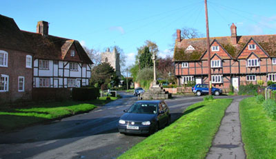
- East Hagbourne's image is recorded as Upper Cross East Hagbourne.jpg[5].
- East Hagbourne's instance of is recorded as village[6].
- East Hagbourne's instance of is recorded as civil parish[7].
- East Hagbourne's shares border with is recorded as Didcot[8].
- East Hagbourne's shares border with is recorded as West Hagbourne[9].
- East Hagbourne's shares border with is recorded as Blewbury[10].
- East Hagbourne's shares border with is recorded as South Moreton[11].
- East Hagbourne's postal code is recorded as OX11[12].
- East Hagbourne's Commons category is recorded as East Hagbourne[13].
- East Hagbourne's OpenStreetMap relation ID is recorded as 76961[14].
- East Hagbourne's local dialing code is recorded as 01235[15].
- East Hagbourne's OS grid reference is recorded as SU527883[16].
- East Hagbourne's coordinate location is recorded as {'lat': 51.591, 'lon': -1.239}[17].
- East Hagbourne's Freebase ID is recorded as /m/0c12d8[18].
- East Hagbourne's authority is recorded as East Hagbourne Parish Council[19].
- East Hagbourne's GSS code is recorded as E04012478[20].
- East Hagbourne's GSS code is recorded as E04008125[21].
- East Hagbourne's official website is recorded as http://www.easthagbourne.net/[22].
- East Hagbourne's population is recorded as {'amount': '+1180'}[23].
- East Hagbourne's population is recorded as {'amount': '+1881'}[24].
- East Hagbourne's population is recorded as {'amount': '+1882'}[25].
- East Hagbourne's WOEID is recorded as 18978[26].
- East Hagbourne's GeoNames ID is recorded as 2650432[27].
Body
Geography
East Hagbourne is in the country of United Kingdom[4]. It is located in South Oxfordshire[3].
Physical Characteristics
East Hagbourne's area is recorded as {'unit': 'Q712226', 'amount': '+3.90'}[28]. Population counts include {'amount': '+1180'}[23], {'amount': '+1881'}[24], and {'amount': '+1882'}[25].
Designation and Status
Recorded instance of include village[6] and civil parish[7].
Why It Matters
East Hagbourne ranks in the top 0.45% of village entities by monthly Wikipedia readership (8 views/month, #230 of 50,837).[2] It has Wikipedia articles in 6 language editions, a strong signal of global cultural recognition.[29]