Drochtersen
0 sources
Drochtersen
Summary
Drochtersen is a municipality without town privileges in Germany[1]. Drochtersen has Wikipedia articles in 17 language editions, a strong signal of global cultural recognition.[2]
Key Facts
- Drochtersen is located in Stade District[3].
- Drochtersen is in the country of Germany[4].
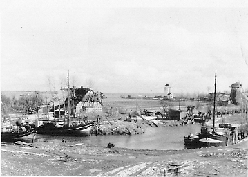
- Drochtersen is on the body of water Elbe[5].
- Drochtersen's instance of is recorded as municipality without town privileges in Germany[6].
- Drochtersen's instance of is recorded as Einheitsgemeinde of Lower Saxony[7].
- Drochtersen's shares border with is recorded as Oldendorf-Himmelpforten[8].
- Drochtersen's shares border with is recorded as Nordkehdingen[9].
- Drochtersen's shares border with is recorded as Stade[10].
- Drochtersen's contains the administrative territorial entity is recorded as Q24228406[11].
- Drochtersen's contains the administrative territorial entity is recorded as Barnkrug[12].
- Drochtersen's contains the administrative territorial entity is recorded as Dornbusch[13].
- Drochtersen's contains the administrative territorial entity is recorded as Dornbuschermoor[14].
- Drochtersen's contains the administrative territorial entity is recorded as Hüll[15].
- Drochtersen's contains the administrative territorial entity is recorded as Ritsch[16].
- Drochtersen's contains the administrative territorial entity is recorded as Assel[17].
- Drochtersen's postal code is recorded as 21706[18].
- Drochtersen's Commons category is recorded as Drochtersen[19].
- Drochtersen's licence plate code is recorded as STD[20].
- Drochtersen's located in time zone is recorded as UTC+01:00[21].
- Drochtersen's located in time zone is recorded as UTC+02:00[22].
- Drochtersen's local dialing code is recorded as 04143[23].
- Drochtersen's local dialing code is recorded as 04148[24].
- Drochtersen's local dialing code is recorded as 04775[25].
- Drochtersen's coordinate location is recorded as {'lat': 53.7, 'lon': 9.3833333333333}[26].
- Drochtersen's official website is recorded as https://www.drochtersen.de/[27].
Body
Geography
Drochtersen is in the country of Germany[4]. Drochtersen is located in Stade District[3]. Drochtersen is on the body of water Elbe[5].
Physical Characteristics
Areas include {'unit': 'Q712226', 'amount': '+126.74'}[28] and {'unit': 'Q712226', 'amount': '+126.79'}[29]. Drochtersen sits at an elevation of {'unit': 'Q11573', 'amount': '+2'}[30]. Population counts include {'amount': '+11150'}[31], {'amount': '+11164'}[32], {'amount': '+11184'}[33], {'amount': '+11086'}[34], {'amount': '+11290'}[35], and {'amount': '+11284'}[36].
Designation and Status
Recorded instance of include municipality without town privileges in Germany[6] and Einheitsgemeinde of Lower Saxony[7].
Why It Matters
Drochtersen has Wikipedia articles in 17 language editions, a strong signal of global cultural recognition.[2]