Denigomodu District
0 sources
Denigomodu District
Summary
Denigomodu District is a district of Nauru[1]. It draws 181 Wikipedia views per month (district_of_nauru category, ranking #2 of 11).[2]
Key Facts
- Denigomodu District is located in Nauru[3].
- Denigomodu District is in the country of Nauru[4].
- Denigomodu District's head of government is recorded as David Adeang[5].
- Denigomodu District's head of government is recorded as Frederick Pitcher[6].
- Denigomodu District's head of government is recorded as Valdon Dowiyogo[7].
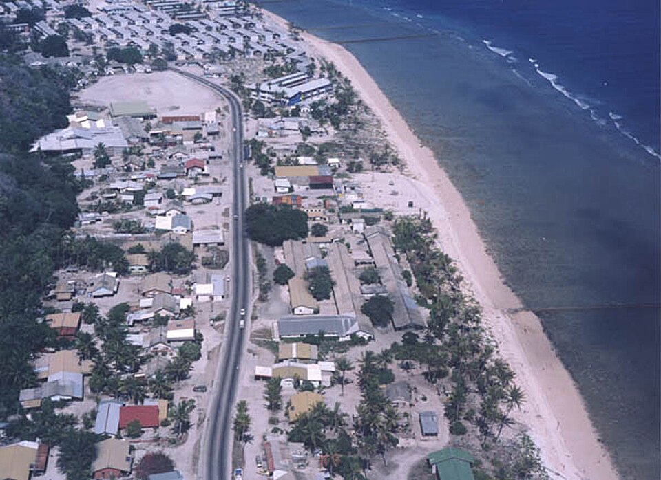
- Denigomodu District's image is recorded as Nauru Denigomodu-Nibok.jpg[8].
- Denigomodu District's instance of is recorded as district of Nauru[9].
- Denigomodu District's capital is recorded as Arijejen[10].
- Denigomodu District's shares border with is recorded as Nibok District[11].
- Denigomodu District's shares border with is recorded as Buada District[12].
- Denigomodu District's shares border with is recorded as Aiwo District[13].
- Denigomodu District's locator map image is recorded as Denigomodu in Nauru.svg[14].
- Denigomodu District's ISO 3166-2 code is recorded as NR-08[15].
- Denigomodu District's Commons category is recorded as Denigomodu[16].
- Denigomodu District's OpenStreetMap relation ID is recorded as 8437546[17].
- Denigomodu District's located in time zone is recorded as UTC+12:00[18].
- Denigomodu District's local dialing code is recorded as 674[19].
- +1968-00-00T00:00:00Z marks the founding of Denigomodu District[20].
- Denigomodu District's coordinate location is recorded as {'lat': -0.52361111111111, 'lon': 166.91444444444}[21].
- Denigomodu District's Freebase ID is recorded as /m/021mf4[22].
- Denigomodu District's FIPS 10-4 is recorded as NR08[23].
- Denigomodu District's topic's main category is recorded as Category:Denigomodu[24].
- Denigomodu District's population is recorded as {'amount': '+2396'}[25].
- Denigomodu District's population is recorded as {'amount': '+1700'}[26].
- Denigomodu District's official name is recorded as {'lang': 'na', 'text': 'Denigomodu'}[27].
Body
Geography
Denigomodu District is in the country of Nauru[4]. It is located in Nauru[3].
Physical Characteristics
Denigomodu District's area is recorded as {'unit': 'Q712226', 'amount': '+0.9'}[28]. Its elevation above sea level is recorded as {'unit': 'Q11573', 'amount': '+20'}[29]. Population counts include {'amount': '+2396'}[25] and {'amount': '+1700'}[26].
Designation and Status
Denigomodu District's instance of is recorded as district of Nauru[9].
History and Context
+1968-00-00T00:00:00Z marks the founding of Denigomodu District[20].
Why It Matters
Denigomodu District draws 181 Wikipedia views per month (district_of_nauru category, ranking #2 of 11).[2] It has Wikipedia articles in 25 language editions, a strong signal of global cultural recognition.[30] It is known by 5 alternative names across languages and contexts.[31]