Brookings County
0 sources
Brookings County
Summary
Brookings County is a county of South Dakota[1]. It draws 46 Wikipedia views per month (county_of_south_dakota category, ranking #11 of 66).[2]
Key Facts
- Brookings County is located in South Dakota[3].
- Brookings County is in the country of United States[4].
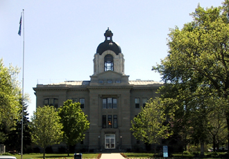
- Brookings County's image is recorded as Brookings court house.jpg[5].
- Brookings County's instance of is recorded as county of South Dakota[6].
- Brookings County's capital is recorded as Brookings[7].
- Brookings County's shares border with is recorded as Deuel County[8].
- Brookings County's shares border with is recorded as Lincoln County[9].
- Brookings County's shares border with is recorded as Moody County[10].
- Brookings County's shares border with is recorded as Lake County[11].
- Brookings County's shares border with is recorded as Kingsbury County[12].
- Brookings County's shares border with is recorded as Hamlin County[13].
- Brookings County's shares border with is recorded as Pipestone County[14].
- Wilmot Brookings is named after Brookings County[15].
- Brookings County's contains the administrative territorial entity is recorded as Brookings[16].
- Brookings County's VIAF cluster ID is recorded as 157112217[17].
- Brookings County's locator map image is recorded as Map of South Dakota highlighting Brookings County.svg[18].
- Brookings County's Library of Congress authority ID is recorded as n81018589[19].
- Brookings County's Commons category is recorded as Brookings County, South Dakota[20].
- Brookings County's OpenStreetMap relation ID is recorded as 1739793[21].
- Brookings County's located in time zone is recorded as UTC−06:00[22].
- +1871-00-00T00:00:00Z marks the founding of Brookings County[23].
- Brookings County's GNIS Feature ID is recorded as 1265779[24].
- Brookings County's coordinate location is recorded as {'lat': 44.37, 'lon': -96.79}[25].
- Brookings County's Freebase ID is recorded as /m/0mvhh[26].
- Brookings County's official website is recorded as http://www.brookingscountysd.gov[27].
Body
Geography
Brookings County is in the country of United States[4]. It is located in South Dakota[3].
Physical Characteristics
Brookings County's area is recorded as {'unit': 'Q712226', 'amount': '+2084'}[28]. Population counts include {'amount': '+31965'}[29], {'amount': '+32023'}[30], {'amount': '+32109'}[31], {'amount': '+32646'}[32], {'amount': '+32968'}[33], and {'amount': '+33897'}[34].
Designation and Status
Brookings County's instance of is recorded as county of South Dakota[6].
History and Context
+1871-00-00T00:00:00Z marks the founding of Brookings County[23]. Wilmot Brookings is named after it[15].
Why It Matters
Brookings County draws 46 Wikipedia views per month (county_of_south_dakota category, ranking #11 of 66).[2] It has Wikipedia articles in 21 language editions, a strong signal of global cultural recognition.[35] It is known by 16 alternative names across languages and contexts.[36]