Birkenwerder
0 sources
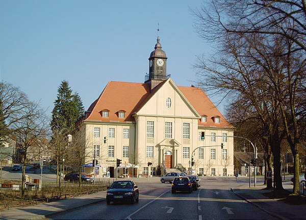
Birkenwerder
Summary
Birkenwerder is a municipality without town privileges in Germany[1]. Birkenwerder has Wikipedia articles in 17 language editions, a strong signal of global cultural recognition.[2]
Key Facts
- Birkenwerder is located in Oberhavel District[3].
- Birkenwerder is in the country of Germany[4].
- Birkenwerder's instance of is recorded as municipality without town privileges in Germany[5].
- Birkenwerder's shares border with is recorded as Mühlenbecker Land[6].
- Birkenwerder's shares border with is recorded as Oranienburg[7].
- Birkenwerder's shares border with is recorded as Hohen Neuendorf[8].
- Birkenwerder's twinned administrative body is recorded as Villetaneuse[9].
- Birkenwerder's postal code is recorded as 16547[10].
- Birkenwerder's Commons category is recorded as Birkenwerder[11].
- Birkenwerder's licence plate code is recorded as OHV[12].
- Birkenwerder's located in time zone is recorded as UTC+01:00[13].
- Birkenwerder's located in time zone is recorded as UTC+02:00[14].
- Birkenwerder's local dialing code is recorded as 03303[15].
- Birkenwerder's coordinate location is recorded as {'lat': 52.6885, 'lon': 13.283051}[16].
- Birkenwerder's official website is recorded as https://www.birkenwerder.de/[17].
- Birkenwerder's topic's main category is recorded as Category:Birkenwerder[18].
- Birkenwerder's Commons gallery is recorded as Birkenwerder[19].
- Birkenwerder has a population of {'amount': '+8096'}[20].
- Birkenwerder has a population of {'amount': '+8134'}[21].
- Birkenwerder has a population of {'amount': '+8116'}[22].
- Birkenwerder has a population of {'amount': '+8141'}[23].
- Birkenwerder has a population of {'amount': '+8135'}[24].
- Birkenwerder sits at an elevation of {'unit': 'Q11573', 'amount': '+32'}[25].
- Birkenwerder sits at an elevation of {'unit': 'Q11573', 'amount': '+47'}[26].
- Birkenwerder covers an area of {'unit': 'Q712226', 'amount': '+18.10'}[27].
Body
Geography
Birkenwerder is in the country of Germany[4]. Birkenwerder is located in Oberhavel District[3].
Physical Characteristics
Areas include {'unit': 'Q712226', 'amount': '+18.10'}[27] and {'unit': 'Q712226', 'amount': '+18.12'}[28]. Elevations include {'unit': 'Q11573', 'amount': '+32'}[25] and {'unit': 'Q11573', 'amount': '+47'}[26]. Population counts include {'amount': '+8096'}[20], {'amount': '+8134'}[21], {'amount': '+8116'}[22], {'amount': '+8141'}[23], and {'amount': '+8135'}[24].
Designation and Status
Birkenwerder's instance of is recorded as municipality without town privileges in Germany[5].
Cultural Significance
Things named for Birkenwerder include Birkenwerder (b Berlin) railway station[29], a railway station[30], in Germany[31], founded in 1924[32].
Why It Matters
Birkenwerder has Wikipedia articles in 17 language editions, a strong signal of global cultural recognition.[2]
Entities named for Birkenwerder include Birkenwerder (b Berlin) railway station[29], a railway station[30], in Germany[31], founded in 1924[32].