Anguera
municipality of Bahia State, Brazil
Press Enter · cited answer in seconds
0 sources
Anguera
Summary
Anguera is a municipality of Brazil[1]. Anguera ranks in the top 3% of municipality_of_brazil entities by monthly Wikipedia readership (8 views/month).[2]
Key Facts
- Anguera is located in Bahia[3].
- Anguera is in the country of Brazil[4].
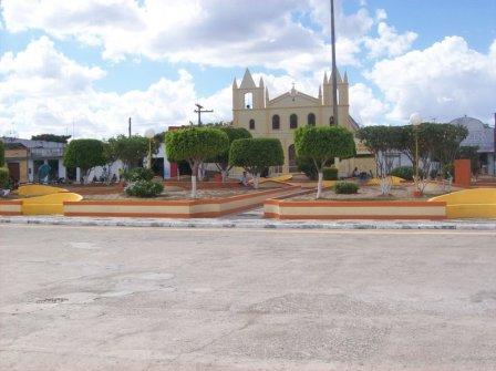
- Anguera's image is recorded as Praça de Anguera.jpg[5].
- Anguera's instance of is recorded as municipality of Brazil[6].
- Anguera's flag image is recorded as Bandeira de Anguera.jpg[7].
- Anguera's shares border with is recorded as Feira de Santana[8].
- Anguera's shares border with is recorded as Serra Preta[9].
- Anguera's coat of arms image is recorded as Brasão de Anguera.jpg[10].
- Anguera's locator map image is recorded as Bahia Municip Anguera.svg[11].
- Anguera's postal code is recorded as 44670-000[12].
- Anguera's Commons category is recorded as Anguera[13].
- Anguera's OpenStreetMap relation ID is recorded as 362287[14].
- Anguera's located in time zone is recorded as UTC−03:00[15].
- Anguera's local dialing code is recorded as 75[16].
- Anguera's coordinate location is recorded as {'lat': -12.150833333333, 'lon': -39.245833333333}[17].
- Anguera's Freebase ID is recorded as /m/04gp13n[18].
- Anguera's official website is recorded as http://anguera.ba.gov.br/portal/[19].
- Anguera's topic's main category is recorded as Category:Anguera[20].
- Anguera's Human Development Index is recorded as {'amount': '+0.589'}[21].
- Anguera's population is recorded as {'amount': '+8834'}[22].
- Anguera's population is recorded as {'amount': '+11299'}[23].
- Anguera's population is recorded as {'amount': '+10242'}[24].
- Anguera's population is recorded as {'amount': '+11297'}[25].
- Anguera's population is recorded as {'amount': '+11369'}[26].
- Anguera's population is recorded as {'amount': '+11031'}[27].
Why It Matters
Anguera ranks in the top 3% of municipality_of_brazil entities by monthly Wikipedia readership (8 views/month).[2] Anguera has Wikipedia articles in 15 language editions, a strong signal of global cultural recognition.[28]