Angerberg
municipality in Kufstein District, Tyrol, Austria
Press Enter · cited answer in seconds
0 sources
Angerberg
Summary
Angerberg is a rural municipality of Austria[1]. Angerberg has Wikipedia articles in 18 language editions, a strong signal of global cultural recognition.[2]
Key Facts
- Angerberg was a member of Climate Alliance[3].
- Angerberg is located in Kufstein District[4].
- Angerberg is in the country of Austria[5].
- Angerberg is on the body of water Inn[6].
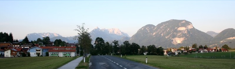
- Angerberg's image is recorded as Angerberg Baumgarten.jpg[7].
- Angerberg's instance of is recorded as rural municipality of Austria[8].
- Angerberg's instance of is recorded as municipality of Austria[9].
- Angerberg's shares border with is recorded as Breitenbach am Inn[10].
- Angerberg's shares border with is recorded as Thiersee[11].
- Angerberg's coat of arms image is recorded as AUT Angerberg COA.svg[12].
- Angerberg's VIAF cluster ID is recorded as 245403483[13].
- Angerberg's GND ID is recorded as 4527009-0[14].
- Angerberg's locator map image is recorded as Angerberg.png[15].
- Angerberg's postal code is recorded as 6320[16].
- Angerberg's Commons category is recorded as Angerberg[17].
- Angerberg's licence plate code is recorded as KU[18].
- Angerberg's OpenStreetMap relation ID is recorded as 942697[19].
- Angerberg's located in time zone is recorded as UTC+01:00[20].
- Angerberg's located in time zone is recorded as UTC+02:00[21].
- Angerberg's local dialing code is recorded as 05332[22].
- Angerberg's coordinate location is recorded as {'lat': 47.5, 'lon': 12.016666666667}[23].
- Angerberg's Freebase ID is recorded as /m/02vx64v[24].
- Angerberg's official website is recorded as http://www.angerberg.at/[25].
- Angerberg's official website is recorded as https://www.angerberg.at/[26].
- Angerberg's topic's main category is recorded as Category:Angerberg[27].
Why It Matters
Angerberg has Wikipedia articles in 18 language editions, a strong signal of global cultural recognition.[2]